Tourist routes in the Urals by car. Traveling through the Urals by car, on a bike, on quad bikes: photos, routes
The article gives an overview of 1-4 weeks of the Urals and Siberia, give recommendations on the choice of travel, it is described how to use sources during self-development of routes, a "hit parade" and route threads are given. Some of the described campaigns are in.
Once in a hike in the Katunsky Range on (Altai), I met a group of schoolchildren from Kurgan and talked to their leader. We asked each other where we visited. It turned out that we have about the same list of advanced travel. It brought me to the idea of \u200b\u200bmaking my "hit parade" of travel routes in the Urals and Siberia, bring places in which you need to visit. And although not yet past routes are enough for ten years, I already have something to recommend from the twenty expeditions after me.
Why precisely the Urals and Siberia? Imagine that you are a tourist with an experience of 2-4 day trips from the night in a classic sense - love to travel with a backpack, live in a tent, cook food on a fire. You already understand that the greatest satisfaction brings such a vacation. On earth is full beautiful placesWhere can be reached by bus or fly by helicopter, climb to the vertex on the cable car. And views will be no less beautiful than if you go there on foot. Why not such satisfaction? Because people traveled for thousands of years on foot or horses. And we have a need to sometimes be in the role of a "primitive person", the discoverer, hoping only for the power of our muscles and loyal friends. It is the Urals and Siberia with their wild endless expanses who can give us these feelings. There are still beautiful mountains - the Caucasus and Tien Shan. But traveling along them, we understand that there we are guests. What is the land of other nations and you need to know the specifics of relationships with local residents. Traveling in the Urals and Siberia, we get acquainted with ours. Is there any sense to "go to visit" when we are not fully familiar with "our apartment"? That is why in the summer I travel through the Urals, Siberia, the surroundings of Baikal. I want to talk about these mountains.
There are three incorrect stereotypes about Siberia in residents of European Russia, and from the Urals too.
1) "Siberia is an endless flat swamp". But if we look at the map, we will see that at least a quarter of the square is occupied by the mountains.
2) "In the summer there are a lot of bloodsowing insects." But only in two of my 20 travels, the tag was obligatory. We were honesting in July in the Northern Urals. After my lecture on the Siberian Old-timelous Councils, participants in the morning from the tent were interested in, how is it outside - nasty or comaren? There is no mosquito in Altai at all (the larvae is not matured due to negative night temperatures), and there are flies only on horseback routes.
3) "Summer in the Urals and Siberia may not be." As in the anecdote: Uraltsa or Siberian who came to the Black Sea are asked: "Why are you so white? Doesn't you have? " "Why, it was, only I worked on this day." Summer in Siberia is short, but the present: sunny and roast. If you go to a sufficiently long hike (for three weeks), then it will certainly be installed. I had only one completely rainy three-week campaign - on the subtybesty teeth. Summer travel season lasts from mid-June to the end of August (on Polar Urals And in the north of Baikal - from mid-July, the south of Baikal is the best time - August, up to this rainy, monsoon winds blowing with Lake Baikal).
In the article, I focus exclusively on summer hiking and mountain travel, although some hiking is better to do in winter. For example, on Munka-Sardyk (Eastern Sayan) it is easier to get in winter on skiing along the frozen rivers than in the summer it is to get along Burno and Stluna. And on Baikal interesting winter travel on skates.
Types of travel. To begin with, we will define the terms used. Traveling around the mountainous area. Western, if you do not use climbing and ice-dining equipment. Journey mountain, if ropes are used, including - to organize a crossing through rivers. Mountain tourism From the mountaineering in Altai and Siberia is characterized by goals. A mountain tourist tends to travel a few valleys, moving between the passes and making climbing some vertices along the simplest routes. The climber is "throws" on one valley in the base camp as much as possible way (for example, on horseback), then acclimatization walks and makes climbs on tops. And for him is the way to climb. He can rise to the same vertex several times more complex routes. Climbing and descent can take up to 24 hours, but the climber will definitely go down to sleep in the base camp. The mountain tourist more complies with the day of the day. It will spend the night where it is safe to put a tent, for example, on a small platform on the pass. For the climbers, the main view from the top, for the mountain tourist attractions are also lakes, waterfalls, canyons. In general, the climber more athlete, and a mountain tourist more researcher, he learns to live in the territory on which it goes.
Recently, another term has appeared - trekking. it hiking According to the mountain paths, although separate obstacles in the form of Kurum (the Ural-Siberian Word, meaning the stony Ospar) and even a simple glacier can occur. As a rule, trekking routes pass through the villages and the turbases, so there is no need to carry food and tents. I am happy to travel as a tracker in the Himalayas, but I hope that in Siberia, all this infrastructure will not be developed for a long time. There should be a place for us, where we can only hope for yourself and our team to feel the completeness of life.
So, focus on summer autonomous hiking or mountain travel, that is, hiking with a complete margin from civilization. What duration of the hike to choose? The classic option is two weeks that include an occupancy in the first valley of the river, the arrangement of the camp, radials (walking light) to the sights, the day, the transition through the passage to the second valley, radials in the second valley, a spare day, exit. Radios can be and ascending on tops. I prefer three-week hiking (on average, it turns out to visit as many valleys, how many weeks in the campaign). For three weeks, it is better to "bother" into the area and thoroughly bypass the whole range, whereas in two weeks you can have time to see only the main sights. Light I consider traveling lasting in two weeks without the use of mining (climbing or ice-visual) equipment. Middle severity travel lasts two weeks with special equipment or three weeks without special equipment. Heavy journey lasts four weeks or three weeks with special equipment. Great gravity at the current level of technology will be able to carry only permanent athletes. Therefore, it is better to break the routes for a long time on two or three "rings" with the "Bookmarks" device, that is, to hide the products on the following "rings". In fact, we are talking about several journey donations.
Most tourists can afford only one journey over the summer. If you are a professional traveler, then it is quite realistic to make 2-4. Need not to forget about the rest. At least once a week you need to arrange a day, because it is the usual mode of life of a working person. Some executives recommend doing a day on the fourth day, because newcomers go on the first three days on enthusiasm, and then the strength ends, and further promotion is the result of the calculated forces. If we are talking about "joining" travels, then I advise you to rest between parts in as many days as many parts in the campaign. For example, if you comb together two ten-day campaigns, then take two days between them, and if three ten days, then rest for three days. If we are talking about several travels over the summer at different areas, then, from my point of view, the most harmonious after the trip is resting to relax as many days as the journey lasted. In this mode, five years traveled and I: spent a two-week campaign in Altai last week June - the first week of July, then rested two weeks and spent a three-week trip on Siberia.
What sources to use when developing a route? We will not consider the "highest pilot" when you need to pave new routePerhaps with first-graders, and when the source is only a map and snapshots from the Space of the Google Planet Earth. We assume that on the Internet you can find descriptions.
Technical reports on sports campaigns. They most objectively describe geography, route thread, timing and obstacles. If you are going to do sports "career" in tourism, then such reports are the main source of information. If for you, as for me, certificates, titles and regalia is not important, and you are primarily interested in sights and that the campaign in general is interesting, then the technical reports need to know the following:
1) Most likely, you will be suitable for campaign reports 1-3 categories of complexity, hikes 4 and 5 of the categories of difficulties will be too complicated. Pay attention to the main obstacles. Passing of the first category of complexity means that you can pass them in one day without the use of special equipment (Pass 1B means that it may be necessary to accomplish one rope), the passes of the second category will require the use of special equipment and training of participants with necessary skills, even more complex obstacles - systematic Training. There is a method of calculating the category of complexity of the campaign in general. If you do a rough travel assessment in the Urals and Siberia, then the campaign is a normal tempo (20-30 km in the Urals, 15-20 km in Siberia, 10-15 km per day in Altai) and with the passage of the first category passages will have such a category as Weeks lashes a trip.
2) In the reports you can encounter scam. For example, if the last or first day is a mileage of 40-50 km, then you need to think whether the group really went on foot or brought it. If there are photos of participants on the passes, but there are no photos on some pass (it is written that there was bad weather and the photo did not work) and this pass is located away from the main route (that is, its passage does not necessarily and does not affect the passage of the total travel ), then you should think, did the group really pass this pass?
3) Sometimes the route contains excessive "winding" of the pass to increase the category of the hike complexity, for example, the route passes around the mountain with the passage of three passages. You need to think if you should pass this ring with backpacks for three days, is there really interesting sights around the mountain, or maybe it is worth equipping camp and make two radials?
Programs of commercial routes. As a rule, they pass along truly beautiful places and are described in terms of beauty sights. The conscientiously designed commercial route is designed for people with an average training level and, most likely, will suit you. It should be compared with the report on sports passage to think about how to pass the route for a shorter time than is described in the commercial program. As a rule, commercial campaigns are limited in time by two weeks, so they may not include attractions that you should look at. Therefore, you need to carefully look at the sights near the route and think about increasing the duration. For example, the most famous campaign in Altai "Kuchered - Pass Karatyrek - Akkem" in commercial programs may include 1-2 radials in the Cover Valley, although there should be at least 4 radials. Often, commercial firms offer an unrealistic campaign on some "branded" vertex, knowing that the group participants will refuse to go away when they see in place that they have to go. For example, we have seen how groups going to the highest peak of Altai and the whole Siberia - Beluhu, unfolded and left before the Poted Delon. Therefore, if the commercial program stated a technical climb or a high category of complexity, it is worth thinking if the program itself is realistic.
Informal descriptions. These are descriptions of impressions from the campaign made by its participants, as a rule, with photos. Of these, you can learn information about what is worth viewing on the route. Reading the description, you need to pay attention, is the group look like yours. And to take into account that the opinion of the narrator about the terrain can be very subjective. For example, in the descriptions I read about the terrible swamps under the Manaraga, if you go to the foot of the classic route from the car car. In my opinion, these swamps do not represent a serious obstacle. In any case, our speed was at least 4 km / h.
When reading reports, you need to pay attention to the dates of travel and crossing the rivers. Focusing on tops and passes, tourists often do not pay attention to the river, although in the mountainous tourism most of the states are happening just on crossings. And if B. sports campaign Tourists switched to the knee river, this is not a guarantee that you will not plunge on the belt. Commercial routes are good, which will simply do not go through risky crossings. Although no guarantees are also. So, in Altai with Kuchera, one of the most common radials on Lake Darashkol. Everyone is moving Kuchecher Lod. In 2010, I could not decide for a few days to go to Darashkol because of the high water in Kucherle, replacing this walk with other radialists. When there is no time left, we made the High Cross. And not mistaken. With us, a tourist, who passed the River River, killed a river (he knocked down and tightened under the body from the logs).
Geography of campaigns and strategies for a long schedule for several years.
The Urals stretched from the north to the south and in a broad sense includes mountains of the New Earth, Pai-Hoi, Polar, Polar, North, Middle and South Urals and Muurgary (Kazakh Urals).
Interesting from the point of view of traveling, the mountain plot of Siberia begins with Altai (except Russian Altai there is also Kazakh, Mongolian and Gobi Altai). North of Altai - Kuznetsky Alatau, east - first Western Sayan, then Eastern Sayan. South of Sayan - Tuva Mountains.
To the east of Sayan there are mountains around Lake Baikal. To the west and northwest of the bakala - Baikal Ridge, south of Hamar-Dabah, on the eastern shore - Barguzinsky Ridge. Next to the northeast - becoming Highlands.
Siberia includes still hard-to-reach areas of the Pouotnian plateau and the mountain of Yakutia, the number of which is equal to the previous one. I think that over the next ten years we will observe the growth of tourist interest in these areas. In the meantime, focus on the mountains before Zabaikalia for another reason. Rocking in Yakutia is long and perhaps the journey will be more expensive than, for example, in Iceland.
So, we have a huge mountainous country. Where to go first of all, what to leave for later? I offer three strategies:
1) one 2-3 weekly expedition for the summer
2) Two travels for the summer: two weeks in Altai and three weeks in Siberia
3) 2-4 interrelated travels for the summer.
Travel details I will describe in the third strategy. When describing the first two - only listing the ridge.
Strategy №1. Suppose you want to spend 2-3 weeks of summer holidays on one journey through the Urals and Siberia, extinguish every year in another mountain region. This strategy is suitable for most tourists.
I offer five "hit" campaigns, from the discharge "you need to visit":
1) Porpolar Urals. Natural park Yughyda. Mountains People's, Manaraga
2) Kuznetsky Alatau. Tigirtish Ridge (Crossbested Teeth)
3) Altai. Katun ridge. Kuchered River, Akkem, Kara-Treesure
4) Western Sayan. Ridge Ergaki
5) Baikal ridge. River Kurkun, Molokon, Peak Bird
These trips introduce you to key areas of different mountain systems. The order for residents of European Russia is just such as is associated with gradual progress to the East. For residents of the Urals (Perm, Yekaterinburg, Ufa, Chelyabinsk), it is easier to get to Altai and Kuznetsky Alatau than to the Polar Urals. Siberians are easier to start hiking from the places that are closer to them, as shown in the following table:
Table of mountain systems, cities and stations
| Region | Middle Mountain System | Railway station or major settlement |
|---|---|---|
| European Russia | Porcelary Urals | Int. |
| Chelyabinsk Oblast, Bashkiria, Orenburg region | Mountains of the Southern Urals | Zlatoust, Yuryuzan, Beloretsk, Magnitogorsk |
| Perm and Sverdlovsk region | Northern Ural | Ivdel, Severouralsk, Krasnoturinsk, Serov |
| Omsk, Novosibirsk, Tomsk Region, Altai Territory | Altai | Biisk |
| Kemerovo Region | Kuznetsky Alatau | Novokuznetsk |
| Khakassia, Krasnoyarsk Territory | Western Sayan, Western Tofalaria (Eastern Sayan) | Abakan, Minusinsk |
| Tuva | Mountains Tuva | Abakan, then by bus in Kyzyl |
| Irkutsk region, West Buryatia | Eastern Sayan: Tofalaria Tunkinsky Goltsy and Hamar Danab | Nizhneudinsk Slyudyanka |
| Buryatia | Baikal Transbaikal | Severobaikalsk Barguzin, Bama Station |
You can restrict ourselves to these campaigns, if you think that the land is big, and our country is also big. And you need to visit the Crimea, in the Caucasus, on the Kola Peninsula, Tien Shan, Yakutia, Kamchatka and Kuril Islands. Another argument in favor of these places is to visit them until they finally "pecks." We who are accustomed to the wild expanses of our Motherland, hardly want to see equipped trails, cafes, cable roadsHotels and motels on our route.
Each hike in the vicinity of Baikal can be finished on the shore of Baikal. In particular, who rides the train to Irkutsk or Slyudyanki, can arrange a weekly rest on Olkhon Island.
For residents of European Russia, there may be another beginning of long trips:
0a) Southern Urals. Taganai Natural Park, Lake Turgoyak or Natural Park Zyuratkul, Nurgush and Jespal.
Southern Urals is close, available, there are many cities at the foot of the ridges - perfect place To start tourism. The inhabitants of the Urals make no sense to spend vacation for these places where you can go on a weekend for several routes. But they, before switching to Siberia, it is worth committing following these trips:
0b) Northern Urals. The main Ural ridge.
And hike on the manpoupler, which opens the second cycle of travel:
6) Northern Urals. Manpoupler.
I have a tourist encyclopedia, on the cover of which the photos of Paris, Easter Islands, Kamchatka Volcanoes and the cliffs of Manpupunyre are shown. Very clearly, where it is worth visiting the calculation of travel throughout the land.
7) Altai. Ridges of the IOLO and Uymansky, Lake Teletskoy. 77 Altai Mining Taiga route. This is the very beginning of Altai with affordable mountains, but on the horizon you will be planted with pointed peaks with snowballs, and you will dream of further campaigns in Altai.
8) Tuva. Mongun Taiga. Feature of hikes on Tuva: It is necessary to take into account the criminogenic situation.
9) Eastern Sayan. Tunkinsky goltsy
Third Travel Cycle:
10) Porpolar Urals. Saber Ridge
11) Altai. North-Chuy Range. Shavlin lakes.
12) Western Sayan. Ridge Arandan.
13) Eastern Sayan. Tofalaria.
14) Transbaikalia. Barguzinsky ridge.
Fourth travel cycle.
15) Altai. South Chuy Range.
17) Tuva. Shapshal ridge.
18) Eastern Sayan. Valley extinct volcanoes. Peak topographers
19) South coast Bakala. Hamar Danaba.
Fifth travel cycle.
20) Altai. Plogradle dock, Mount Tavan-Bogdo-Ula
21) Western Sayan. Abakan ridge.
22) Transbaikalia. Kodar.
23) Transbaikalia. North Mai Range.
Sixth travel cycle.
24) Altai. Katun ridge. Multician lakes
25) Eastern Sayan. Tofalaria. West Side
26) Transbaikalia. South Musa Range.
27) Altai. Terektinsky ridge.
It turns out that you need 27 years to get around the interest ridges to Transbaikalia, and then, probably, the same thing to bypass Yakutia and the Far East? If you fell in love with the Urals and Siberia, you will fit the second strategy.
Strategy №2.
Walking in two travels for the summer: one - two weeks in June-July in Altai, the second is three weeks in July-August in Siberia and the Urals. I can say that Altai charm all who visited him. Many tourists consider Altai themselves beautiful mountains. I was told that he was beautiful Tian Shan and Himalayas. I tend to agree with this. Altai is very diverse. During a walking day, you can change some climatic belts and see many attractions. I know tourists who go to Altai every year, and they do not need anything else. According to this strategy, the hike plan looks like this:
| Year | Expedition 1. | Expedition 2. |
|---|---|---|
| 1 | 77 Altai Mining Taiga route (3 weeks) | Northern Urals. Manpoupooner (2 weeks) |
| 2 | Kuznetsky Alatau. Bridal teeth | Altai. Katun ridge. Kuchecher-Akkem. |
| 3 | Altai. North-Chuy Range. Shavlin lakes, Maasha | |
| 4 | Western Sayan. Ergaki | Polar Urals. People's and Manaraga |
| 5 | Altai. South Chuy Range | Eastern Sayan. Tunkinsky goltsy |
| 6 | Altai. Ukok, Tavan-Bogdo-Ula | Transbaikalia. Barguzinsky Ridge |
| 7 | Western Sayan. Aradan | Eastern Sayan. Tofalaria |
| 8 | Altai. Katun ridge. Multician lakes | Polar Urals. Saber |
| 9 | Altai. Terektinsky Ridge | Eastern Sayan. Valley extinct volcanoes |
| 10 | Western Sayan. Abakan ridge. | Tuva. Mongun Taiga |
| 11 | Altai. The source of Katuni. | South Baikal Coast. Hamar Daba |
| 12 | Altai. Katun ridge. Jewygem, Suluaire | Transbaikalia. Kodar |
| 13 | Tuva. Shapshalsky Ridge | Transbaikalia. North Mai Range |
| 14 | Transbaikalia. South Mai Range |
Strategy number 3. Designed for those who are engaged in tourism professionally or so passionate about tourism, which is ready to travel all summer. This strategy is suitable for Turklubes that can organize three or four campaigns in close areas so that tourists after the end of one expedition can go to the next one. According to Turklubus "New Nomads" I can say that we have a lot of tourists who are willing to go three hikes in a row. And if you think, it is not fanaticism, but quite. In full compliance with the name of our Turklub ("New nomads") some of our tourists go hiking with the onset of summer and return home when in the mountains of winter. This planning method requires strategic thinking from the leadership of the club and the coordinated work of campaign managers.
 Big trip to the South Urals
The feature of the hike is that there are local settlements on the route, so there is no need to carry all products. Travel includes the following trips:
1) Taganai Natural Park (1 week). Start in Karabash, Finish in Zlatoust.
2) Ubraiga (3 days). Start in Zlatoust, Finish in Zyuratkul village.
3) Zyuratkul Natural Park (1 week). Ridge Zyuratkul, Uvan, Nurguish. Start in the village Zyuratkul, Finish in Tyutuk.
4) Zigalga (4 days). Start in Tyutuk, Finish in Aleksandrovka, Return to Tylyuk.
5) Irenel, Avalyak (4 days). Start in Tyutuk, Finish in Nikolaevka, Go to Verkhnearshinsky.
6) Kuamardak, Inzer gear, Yalangas (1 week). Start in Verkhnearskis, Finish in Beloretsk.

Big journey through the Northern Urals
 The difference from the Southern Urals is that the forest border passes much lower, so the mountains at the same height seem to be impressive. In July, many bloodsowing insects. The climate is much cooler. Includes the routes of the most popular hiking in the Northern Urals:
1) Mountains near Konzhakinsky Stone (1 week): Serebryansky, Korzhakovsky, Tyrali, Kozvinsky Stones, Three Bugggra, Seagovychka, Sukhogorsky (Kazan) Stones.
2) the main one Ural Ridge, Quarks Ridge with Gigalansk waterfalls (1 week).
3) To the cliffs of Manpoupongore and Torporreyiz (3 weeks, if without torrshiz, then 2 weeks). Dyatlov's pass - Holyovhl - Seaned with Lunchuusapetur Lake and Porotyssori Waterfalls - Motorechl - Yanyghachchachl - Yanyvondudsshachl - Pechorashahlhahl (Sainchors) - Manpupongor - Torporreiz.
Big trip to the Supolar Ural
 This is the heart of the Urals. Despite the fact that I was on Baikal, Altai, Sayanov, Himalayas, Kamchatka, view from the highest top of the Urals, Mountains of the people, I consider the best view in my life. Traditionally, tourists go to the indoor Urals for a week from the geological base desired with the ascent on folk and manaragu (some are then melted from Manaragi on the River Kosya).
I drove a group in a three-week hike, which was the ring: desired - the foot of the folk, climbing the folk - Pass Car-Car - the foot of the manaraghi, climbing the small tooth of Manaragi - the foot of the bell tower, climbing the bell tower - the reindeer recovery, ascent on protection and peak Komsomol - Pass of reindeer breeders - Hob-West Pass - Pass Blue Lakes - Climbing on Karpinsky peak - the base is desired. The conceived climbing on Blucher, Mansing and Ugra did not take place due to bad weather. I believe that the campaign was successful, since we visited five vertices in good weather, which is often rainy on the Supolar Urals. Since in July there are white nights there, it is possible to "catch" good weather during the day and start the path at least 2 o'clock in the morning.
 The long journey offered by me along the Supillary Urals consists of the following parts:
1) The auxiliary part is the transfer of products from the base of the base through the car car in the valley of the Manaraga River. With good weather - climbing folk.
2) Ring around the mountains of People's, Blucher, Ugra, Mansiner, Protection with a Parnuk Plateau for collecting amethysts. If you do not carry out auxiliary part, then return to the base is desired for the products for the next part. It will take about 2 weeks.
3) Transition through Car-Car in the Maragona Valley. Climbing the folk and manaragu, the transition to the bell tower and climbing it. Go to the saber and climbing the saber, output. Duration - 3 weeks.
Large trip to Kuznetsky Alatau and West Sayan
Sayan is an infinite sea of \u200b\u200btaiga with round golts railing towers over it. There are in the west of Siberia and the ridges, towering over the taiga pointed peaks. And they have the appropriate names: Tigirtish (Podneby Teeth) and Ergaki (fingers) with the Ardan ridge adjacent to him, incoming (along with Ergacles) into the Natural Park of the same name. Mountain rivers fall into the blue lakes (especially there are many of them in the Golden Valley of the Middle Best Teeth). There are elegant waterfalls. On Kuznetsk Alatau there are small glaciers.
The hike consists of three parts:
 1) Aradan (two weeks). River Nistorovka - Creek Smooth - Valley of Nine Lakes - Radially On Pass of Minusinsk Tourists and Peak Aradansky - Passage Pass - Lake Emerald Guitar - Creek Waterfall - Radially On Polytechnic Pass - Pass Unexpected - Complete Pass - Mirror Lake - Lake 1627 - River Mall Nizhny Small Casir-Sug - Outloan Pass - Aradan Lakes - Bear Passage - Lake Plateau - Passage Pass of Youth - Red Lake - Baklaniha Pass - Lake Promethere - Turbaz Tuskanchik. This most common route passes through the eastern part of the Aradan Range. The ridge itself is much longer and includes a still intact Central and Western part with the same sharp peaks and lakes.
 2) Ergaki (two weeks). Ring via ERGAC passes with radials. Turbase "Tushkanchik" - Lake Marble - Pass of the Swaddes of Western - Lake Artists, Radiane on the Mountain Spirit Lake and Pass Starry - Lake Malachita Bath - Parking Arrow, Radiane on Colored Lakes and Pass Puckat, Radiane To Lake Icery - Taigishonok Lake - Taigišonok Lake - Pass Misty-1 - Lake Fairy Tale, Radiate to Waterfalls Bogatyr and Grace, Radiane on Kamenny Castle - Pass Tale - Lake Azure, Radine on Peak Mother Sayan - Pass Taigish-1 - Lake Small Buubinskoe - Tarmatovsky Bridge. From the arrows you can go to the lake Big Bubyinskoe and climb the ridge of Metugul Taiga. Lake the interest of the lake south of Ergac: Big and Small Unbendable, Golden and Light. In this case, it takes 3 weeks to pass the route.
 3) Kuznetsky Alatau (two weeks). Route "Big Ring on the Middle Kingdom": Luzhba - Shelter Glukharic - Amzas - Maruha Pass (900m) - Cutlery, Inspection of Waterfalls, Bathing in Radonova "Bath", Radiane to Lake graduates, Climbing a large tooth (2046m) - Bess - Pass the running (1110m) - the valley of the Turalyg River - Kozkoy Gate Pass (1806m) - Lake Hratas. With the pass of walks, the old fortress (2211m) and the top tooth (2178m) and the upper tooth (2178m). Locking on the Golden Valley, inspection of lakes and waterfalls, climbing Silver peak (2063m). Oz. Hratas - Oz. Huunukhuzuh (Golden Valley) - Per. Karatash - r. Small cazame - mouth of the high-mountain stream. Radine in the valley of the streams of high mountain and waterfall. Climbing number 2 on a large tooth or a small tooth. Kuprianovskaya Polyana - Per. Kazyarsky - Alugu - Amzas - Luzhba. From the sources of Bels, you can make an additional week trip along the rocky mountains.
Big trip to Tuva
Traveling along Tuva is a continuation of the travel around Kuznetsk Alatau and Western Sayan and can be committed with him in one year. Unfortunately, the criminogenic situation strongly limits the tourist capabilities of this beautiful land. Recently, ecotourism began to develop in Tuva. It is worth visiting the yurts with ethnic concerts (Gorl singing) and the only shaman clinic in Kyzyl in the world.

Truck routes on Tuva:
1) Shapshalsky Ridge (two-week journey). Bay-tal - r. Chemchik - mouth of Chingga-Hem - r. Chingge Hem - the mouth of the river with Ak-Oyuk - Ak-Oyuk (3613 m. Radially) - Pass to the Valley of Chon-Hem - Wild Lakes, Per. Rocky (radial) - Pyramid (3477 m.) - r. AK-OYUK - Merge Ak-Oyuk and Shuya - Per. Shapshal, 3349 m. (Radially) - r. Shui - pos. Shui.
2) Mongun Taiga is the highest peak of Tuva (3976m.) - a two-week journey. Climbing to the top is simple, but because the vertex is covered with a glacier, it is necessary to go in bundles and cats for climbing. In the journey you can visit the Valleys of the Tolat River with waterfalls, Lake Uzong-Hol and Hindi-Hol.
Large Altai Journey
Altai is probably the most colorful mining system. Practically with any glade on the route you can admire all the colors of nature: green forest, blue lake or waterfall, multi-colored rocky oids, white snowflakes and glaciers. This is one of the reasons why you can ride on Altai every year.

 Camping in Altai:
 1) Fragments of the legendary 77 route: Teletsk Lake, Ridge IoLo and Karakol Lakes, Uymansky Range (2-3 weeks). it northern part Russian Altai. Here the mountains are low and affordable for ascents, but the vertices already overlooks the pointed snow-covered peaks.
 2) Katun ridge, the valleys of Kuchered rivers and the accum, Pass Kara-Treare, perhaps ascent on Belukha (2-3 weeks). Start and finish in Tunong and Kuchecher. This is the very heart of Altai. On the highest peak of Altai - Beluhu - they are climbing by commercial firms, but it must be borne in mind that the mountain of cowar is, on the weather conditions, half of the ascent cancels. To climb, you need to have endurance and climbing skills. But with the passage of Kara-Treare, a fabulous view of Belukhu and other Altai Mountains opens.
 3) North-Chuy Range (2-3 weeks). Start and finish in front of Chibit. Valleys of the rivers Shavl, Maasha, Aktra. Pass Nizhnezavlinsky. Shavlin lakes surrounded by walls with snow-white peaks - one of the best types in Altai.
4) South Chuy Range (2-3 weeks). Start and finish in the village of Beltir. Valley of the rivers Elangash, Karaoyuk, Taldura. Pass of Rublevsky, successful, Leningradsky. Climbing the highest peak - Peak Irbist (3967m, 2a) - requires climbing preparation. This is an unusual ridge, on which there is little forest, but the vertices are visible from everywhere. Locals are divorced by yaks, which can be found in almost any part of the ridge, and camels at Lake Karakol.
 5) Plateau Ukok (2 weeks). Start and finish in a jacator. This is the southernmost Russian Altai. Steppe SO scythian Kurgans and lakes and pointed peaks. Climbing sacred Mount Tan-Bogdo-Ula requires the use of climbing equipment.
6) Terektinsky Ridge (2 weeks). Last-transmitted, but promising from the point of view of tourism ridge. Commercial firms offer there for the most part horse hikes.
Traveling around Katunsky Range in Altai
I allocated a trip to the Katunsky ridge in a separate Altai travel expedition, because if you visit all the valleys of this ridge, it will take almost the entire summer season and the time to other Altai ridges may not be enough. And Katun ridge really deserves the whole summer to walk on it! A variety of valleys with lakes and waterfalls on streams-tributaries and sparkling snow-covered peaks will not leave indifferent. In the environment of esotericists with feeding Roerich, this place is considered to be Shambal. A typical two-week route looks like an approach of one river, parking on the lake, radials, transition through the passage of 1 category of complexity in the second valley, radials from there, output down the river to the village. If you combine three valleys or more, it is logical to make the throwing products on horseback in the valleys in the middle of the campaign. I only give rivers current from the northern slopes of the ridge, with the exception of Katun. There are also the Kazakh river Berel and the Southern Rivers, current on the plateau of ocke (hikes there logically combine with hikes on ukock).

1) the source of Katun. Lake Quiet and Talmen. Start and finish in the village of Kaitanak. Through the passing a strong way out to the Multician lakes, through Khaziniinsky - to the Valley of the Kuragan.
 2) Moute. Raising from the Malctic Maocair. Radios for travel cartoon, strong, cartoon, kuiguka. Through the Kuiguksky pass, you can go to the valley of the Akchan and make climbing the sacred Mount Colban, having kurumny slopes and not requiring special equipment. Routes include a visit to the beautiful lakes. Through the passing pass, you can go on the quiet river, and from there to the lake Talmen and to the origins of Katun. From Akchan - the transition to Lake Kyrgyz and the Valley of the Kuragan.
3) Kuragan, Ioldo. Raising from the village of Katanda ( ferry crossing Through Katun). Through Lake Kyrgyz, exit to the Cuiguka Valley, then to the Multician lakes, through the Khaznikhinsky Pass - access to the lake Talmen and the origins of Katun.
 4) Kuchered. Start in Tingur and Kucheral villages. Radies for color lakes, Kuldur-Oyuku, Darashkula, Mustera, Coniary. In my opinion, this is the central Altai Lake, on which you can safely stand for a week and make radials that are not bored. Camps on other Altai lakes are limited to 2-3 radialists. Through Darashkol and Passwords, Ioladaire Western and Ioldo, the transition to the Valley of the Kuragan. Through the passage of Kara-Trearen - in the valley of the Akkema.
 5) accum. Start in Tingur and Kucheral villages. Radies in the Valley Ak-Oyuk, the crown, to the lake of the spirits, Tomsk parking at the Rodevich (Akkem) glacier. From Tomsk streets begins the route of ascent on the highest peak of Altai and all Siberia - Beluhu (requires the use of climbing equipment). Through the Kara-Taire pass to the Cachecher's valley, through Sarybel's pass - to the Valley of Temale, then through Telece's pass - to the Suluyir Valley.
6) The valleys of the rivers Suluyir, Mensu, Jedyguem, Kuhablesh. Exit to the village jazzor on the plateau of ocke. According to these valleys, esnomal tours are held.
Large trip to East Sayan
Eastern Sayan is less familiar to tourists than Western Sayan or Mountains of Baikal. However, there is something to see. These are high mountains, including extinct volcanoes, wild mountain lakes, Hot and mineral springs, deep gorges.

Hiking on Eastern Sayan:
 1) Tunkinsky goltsy. Best time For travel - August, at this time the smallest rainfall. Routes require two weeks for passing, but it is better to highlight three weeks to stand at the Shumak mineral springs and make radials. In esoteric medium, this area is another candidate for the role of Shambhala. There are warm radon baths and about 150 outputs. mineral water from a variety of diseases. In the Tunkinsky Valley at the foot of the Tunkin Goltsov are located resort settlements With mineral sources - Nilova Desert and Arshan. Three routes are popular on hype:
1A) Village Nilova Desert - Schumak Pass - Valley Shumaka - Kita River - Pass Arshansky - Arshan. This is the easiest route by which you can pass in case of bad weather.
1B) Village Nilova Desert - Schumak Pass - Valley Schumaka - River Narin-Goal - River Yaman-Goal - River Ara-Khubyta - Pass Khubitinsky - Nilova Pustun village. I recommend this route in the case of a stable good weather and low water in rivers. It includes passing the gorges of River Narin-Goal and Yaman-goals, which require about 40 crossings and places go straight along the river. This is a unique place for Siberia, where you can admire the sheer cliffs of gorges and waterfalls. The hike is compatible with the journey along Hamar Daban, as you need to get to the same station - Slyudyanka.
1B) Village Nilova Desert - Schumak Pass - Schumaka Valley - Windy Passage - Bilyuta River - Bepkan Pass - Dinosaur Pass - Arshan Village. The route is recommended when high water makes version 1b impassable, but at the same time the precipitates do not lead to the formation of snow cover on the passes.
2) Valley of extinct volcanoes, peak of topographers (climbing requires experience and availability of ice equipment), hot springs of the hutu-goal and mineral springs Zholgan (3 weeks). The route introduces participants with a variety of relief form of East Sayan. The nearest settlement is Orlik, it requires transport of increased passability.
3) Tofalaria. Mountain Country C. wildlife In East Sayan - Country of Topov. It is quite possible to make three travels for a duration of 2-3 weeks: from the west of the Krasnoyarsk region to the peak of the grandiose, from the northeast from the lakes of Agul and Bear to the peak of the grandiose, from the east to the peaks of triangulators, the transcendent and consecient.
Large trip to Baikal
Baikal is a unique place for outdoor activities. Surrounded by mountains from all sides, it allows you to combine the hike in the mountains with a holiday on the sea (as the Baikal is called everything local residents), Attend the scene of the birth of Shamanism - Olkhon Island. There are on Baikal and hot springs - huckles and sources on the hot river.

 Hiking in the vicinity of Baikal:
 1) The Baikal Range (2 weeks) is located on the West Bank of Baikal. You need to get to Severobaykalsk. Visiting the valleys of the river rivers and Molokon, inspection of waterfalls on the Molokon, the Glacier at the foot of the Mountain Mountain, climbing the bird's peak (the bird is the extension of the largest top of the ridge - Mountain Mountains. Climbing in Cherka requires the use of climbing equipment).
 2) Hamar-Daban (3 weeks). The best time for travel - August, when clouds are almost never come from Baikal. Stone cutlery mountains in the West are replaced by sharp peaks in the east. The hike is a protracted, designed for rolling tourists (per day you need to pass about 20 km with a total set of height 1200 m). Start in Slyudyanka, Finish in Vydrino. Route: Slyudyanka - Picksky Peak (climbing, inspection of Lake Chertov and Lake Heart and Waterfalls on a subcompact) - Bosan - Margassan Nutka - Margassan - Tumbus Dulga - Utulikskaya Horseshoe - Lakes Transfer, Pate, Galichie - Khan-Ula - Nukhne Danaba Pass Langtai gate - Talzinsky Pic - Lake Warm - Lake Sobolin - Vyritico. Reducing the route will require mounted crossing through stormy rivers. An alternative shape of the campaign is an approach from any railway station, radials, then moving to another station, etc.
3) Barguzinsky Ridge is the most powerful of the surrounding Baikal ridges with a variety of sharp peaks and high mountain lakes. It is quite possible to organize several campaigns for 2-4 weeks. The routes can be started from the valley of the Barguzin (the eastern sole of the ridge) and through the passes to go to the eastern shore of the Baikal or start and finish on the shore of Baikal at the mouth of different rivers. Often, routes pass through hot springs Hakui, Lake Frolich and Ukrange and in the upper reaches of the Tompleud River.
 4) Olkhon Island. Rest on the island logically finishing a journey through Baikal. You can stay in the largest village of Islands - Khuzhir, from where it is easy to order transport for trips on the island, boat, or in the Nuregan Gup - Bay with sandy beach In the larch forest (from there it is convenient to perform hiking along the northern part of the island). Weekly vacation on the island is enough to visit all of its sights: the place of the birth of the shamanism - the rock Shamann, the northern tip of the island - Cape Hoea and Pad Uzura, Bay eastern Bank Hathu, Idyba and Tashknya, Lake with healing muds of Shara-Nur, the highest top of the island - Rise, Southeast Bay and Lake Hongkhoy, Muku-Nur, Nursky, Archaeological Monument - the Kuryan Wall.
4B) An alternative to the camp on Olkhon can be a camp on the Holy Nose Peninsula with a visit to the hot sources of the huckles and a boat at the Ushkanya Islands.
Big Travel in Transbaikali
I allocated these trips on a trip, separate from a big journey in Baikal, because in one summer all these trips do not have time to spend. Various combinations of hiking travets are possible on Baikal and Transbaikali, ending with the rest on Baikal.
I have not yet been in transbaital campaigns and did not work on these routes, so I will make descriptions of these campaigns in the future:
1) Kodar with desert Char Sands
2) North Mai Range
3) South Musa Range
4) Verkhne-Angar Range
Conclusion
In the review article on the Urals and Siberia routes, I wanted to say that we have a huge mountainous country, which is quite enough for summer holiday For many years. On many routes, you can find commercial tours, but they only allow you to look inside these ridges. A full-fledged campaign is possible in a coherent and developing team of hiking friends. System, from year to year, bypassing Siberia ridges requires the organization of the tourist club. And this is quite justified: you will grow together with your hiking friends, your team will develop, and the Urals and Siberia will give you all new beautiful species, becoming your homeland. In Turkluba "New nomads" there is a project "
Multi-kilometer race on a heavy truck, exhausting transitions, dangerous molds and powdered rapid rivers ... If you are ready to overcome obstacles, a long-way, changeable weather, in order to penetrate, in the orders hidden from idle eyes, the reserves, then hike - This is your adventure. If you want, 20 minutes after leaving the train to be in a fabulous park, where gems lie under the legs, it is almost impossible to get lost, there are trails who are on the shoulder and children and adults, then the journey to the Urals is your active vacation.
This amazing region, a length of 2.5 thousand km, connects the Northern Arctic Ocean and the steppe of Kazakhstan. It is a deserted and densely populated, frosty and hot, Asian and European - with amazing multifaceted natural landscapes, climatic zones, artifacts of various eras.
Porcelary Ural: Hike to the highest peaks
Porpolar Ural One of the most interesting places The region, which began to master by travelers in the 30s. This harsh land is far from the most visited due to huge distances, which gives him the potential for high categories of complexity. Nelaskov here and climate.
 Most tourist routes in the Supilla Urals go through the int station. From here, private owners on the machines Ural-Vakhtovka are racing into mountain areas, for example, to the shelter "desired" (located 136 km from the railway station). You can reach the local off-road to it in 8 hours.
From "desired," where mountain quartz is mined, trails go to highest tops Ural Mountains - People's Mountains (1894), Karpinsky (1878), Manarage (1820). Around them there are many routes with amazing mountain landscapes, ridges and passes, stormy rivers with many ducts. Mandrels try themselves in climbing these peaks, as well as for a large number of less high mountains and ridges - saber, protection, impregnable.
Despite the fact that the passes and vertices have categories no higher than 2a, the combination of obstacles and the length of the route determine its 5 category of complexity.
After all, to inspect this northern merciless beauty, you need not less than 3 weeks. During this time, trappers are walking or skiing more than 300 km.
Rain, fogs, broken roads, swampy rusties, wide river spills, where even in Brod - in the middle of the thigh, and even in the belt, are serious summer tests even for well-trained tourists. In winter, it is easier to go here, unless of course, skiers are ready for a platoon, which in some areas of their campaign to the Ural reaches 80 cm, crackle frosts (up to - 45 degrees) and gusty winds.
The most favorable period for summer trekking is the second half of July - the first half of August. But even in the height of the summer, the weather change of weather: the air temperature can range from 0 to +20 degrees, the drizzling rain is replaced by shower, hail, and even a blizzard. Often there are snowfields and glaciers. In summer, up to 1000 mm of precipitation dropping, which reduces the passability of the tourist trail.
Pass, as a rule, in March and April. In this period, substantial temperature differences are also noticeable - from 0 to - 45.
On the territory of the National Park "Yugyd Va", where these natural attractions are located, travelers can wait for bad weather in shelters, beams, sings that are sometimes found on the way. The cost of the night - 200-250 rubles. With a person, although quite recently, these facilities were free shelters for tourists who make hiking in the Urals.
 The way out of the route is usually carried out through Aranets Pass and the village of Aranets, from where on foot or by boat (having agreed with the locals) you can reach the village of the ending. Here 2-3 times a week walks public transport (Bus) to the city of Pechora or you can catch a fellow. Time is on the way about 2.5 hours.
There is another "entry point" on the tourist route at the Supilla Urals - Vuktyl, popular with vodnikov tourists.
Keep in mind! Despite the fact that on the official website of the Yighd Va Park tourists call for a special permit and pay every day of their stay on its territory, such an intercourse was repeatedly recognized by an illegal court and prosecutor's office. The last decision of the Vuktyl City Court of the Republic of Komi entered into force on August 6, 2012 and published on 10/24/2012 in the "Shine of the North" newspaper.
The activities of the National Park "Yugyd Va" every year more actively commercializes. And today, his directorate offers services for the organization of the abandonment of auto-, water and air transport (helicopter), publishes and distributes printed and souvenir products, charges for the use of shelters, etc. NP offices are located in the cities of Inta, Pechora, Vuktyl.
Useful articles:
Traveling through the Northern Urals: Through Dyatlov Passing to Dumplings Mansi
 A hike to the Northern Urals is interesting not only to those who attract hard-to-reach places away from civilization, the absence of nearby cities and towns, in general, game and wilderness.
Here is the legendary pass, where in 1959, with unexplained and mysterious circumstances, tragically died tourist group Dyatlova. Today it is called Dyatlov's pass. And the highlight of the local places is the mysterious Plateau Manpupununer with its majestic powders of Mansi, the height of which is from 30 to 42 meters.
Many tourist routes in the Northern Urals are also laid in the area. Get here both from Europe and from Asia. After all, the Urals is the boundary of the continents.
In the summer, the most convenient (but not budget - approx. 18 thousand rubles. For the boat for 6 people) River on the Pechora River, usually delivered organized groups. This route offers the Directorate of the Pechoro Ilych Reserve, in which the plateau is located. It is designed for 6 days, starts from Troitsko-Pechersk, from where the participants are made for individual money to the pier (60 km). This journey through the Northern Urals includes, except for 200 km. Waterway, also 66 km. Hidden before and from Manpupuner. Its most occupied by a fairly tiring road.
The one who wants to make a full-fledged hiking or skiing campaign to the Northern Urals, chooses the path that lies from the railway station Ivdel, where the train Moscow-Priobye is walking.
 From Ivela, there is a throwing to the Auspiana River. Further go skiing or walking up the river to Dyatlov's pass, which is located on the ridge of the belt stone. On the pass - memorable plates, reminiscent of the tragic events of the 59th year.
From here, you can go down to the source of the Great Pechora River, which in these places there is still a stream, hitting in the Taiga Forest, and make a radial on the Manpupauer plateau.
If you return the same way - it will be the shortest hike to these sacred places. But he will take 10 days due to long distances - about 200 km. And the routes here can be paved for every taste and almost any category of complexity from 2 to 5.
 Keep in mind! Even before the start of your trip, the Urals need to issue a pass to the Pechoro Ilych Reserve. It is necessary to do this in advance, sending an application by fax or e-mail to a minimum directorate for two weeks before the campaign. The cost of 1 day of stay on its territory in the summer of 2012 was 650 rubles. You can pay for the skip by listed money to the reserve.
Although, many tourists prefer an alternative option - a fine of 1000 rubles. On the spot. After all, the number of passes is limited, and in the date of stay in the reserve, specified in the application, can be elementary "not to get", for example, due to bad weather.
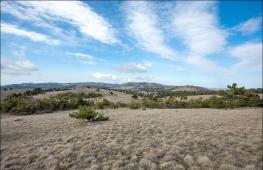
Southern Urals: Taganya National Park
Taganay - mountain ridges and national Park Near the Zlatoust, which compared to wild spaces of the Supolar and Northern Urals seems to be chamber. Nevertheless, its area is 568 square meters. km, allows you to master interesting tourist routes in the Urals.
The central entrance to the Taganai Park is located, literally, a 10-minute bus ride or half an hour walk from the railway station, in Pushkinsky village.
You can also go to its territory from Miass, Magnitics or Karabash. If there is a GPS navigator or you read a card well, then you can go to Taganay without conductors. In winter, it is much easier to do what summer. No swamps. Brooks and lakes frozen. Many running brown roads.
Taganay is a few mountain ranges of which the highest - Big Taganay and its dominant, the most high Point Park - Kruglitsa (1112). Strong wind Creates amazing forms of snow here.
 Fancy rocks in the valley of fairy tales, a response comb, vertical walls of which repeated echo reflect every word said, a weather station at the top of the Long Taganay Ridge (1114), which opens an unprecedented review - these and other picturesque landscapes can be seen by moving or skiing.
In NP "Taganay" many category routes 1B-3A for experienced touristswhich can put tents on specially designated places equipped with firewood.
 For lovers of "walking" recreation, families with children, 60 km of labeled trail and 6 have been laid out of the shelters located apart from 7 to 24 km. So hiking in the South Urals can be performed with unprecedented amenities.
Overnight in houses paid, from 400 rubles. per person per day depending on the season and the degree of comfort (although it is very conditional). Also, the money is charged for the production of their tent, the use of equipped paths and picnic sites with mangals, etc. In general, the degree of commercialization is rather big, although the entrance to the territory and finding in the national park "Taganay" is free.
 Severance to the trail, a large number of guests in winter and summer, can scare away lovers of deaf angles and deserted outdoor. But for those who are not ready for complicated autonomous distances for hundreds of kilometers or in whose team there are small tourists, this is an excellent version - a trip to the southern Urals with a minimum risk and load.
The idea to visit the Ural arose literally a month before the trip. I decided to take a short vacation - 1 week - and somewhere ride. After a brief search, I stopped in the Urals.
10 days in sum. Of these, 4 days on the road there and back and 6 days there. Such a preliminary alignment. I'm going to lead the logbook and write everything is not too lazy. (Kilometers on odometer and time Moscow everywhere).
I take a tent and sleeping bags, but it's just in case. Live going in motels and inexpensive hotels.
May 19, 2010 23:59, Wednesday.
Start the logbook of the car. Saturday is appointed departure in the direction of the Urals. I have to defeat several thousand kilometers in Russia, visit the large and not very cities of the Urals and see different attractions. Today, many necessary things were purchased. It remains only to purchase an ax, sunglasses and engine oil. Filled a full tank of the 95th on British Petroleum.
List of things I'm going to take with me:
For auto:
1. Torch keys
2. Pasalti
3. Hammer
4. Isol
5. Cold welding
6. Motor oil Shell Helix 5W40
7. Washer fluid
8. Scotch
9. Ragges for wiring glass
10. Water (6 liter baccake)
11. Rubber on gaskets
12. Topor.
13. Reflector under the glass
14. Hose clamps
15. Navigator
16. Maps
17. Board (Support under the jack)
18. Lantern
19. Batteries for alarm key chain, lamp and a camera.
Other things:
1. Termos
2. Tableware
3. Boiler
4. Swiss knife
5. Tent
6. Bedrooms, pillow
7. Penozyrik
8. Polyethylene to cover the tent
9. Camera + Charger
10. Raincoat
11. Sunglasses
12. Means from mosquitoes
13. Tanning remedy
May 21, 2010 23:15, Friday.
All necessary equipment (if you can call it) purchased, including ax and sunglasses. It remains to pack everything, put in the trunk and can be touched on the road. But before shipment, it is necessary to make an important thing - sleep. This is what I will do now.
By the way, I was suggested at the forum that it was worth visiting the Lake and Park "Zyuratkul" instead of Taganay Park, as there is a road to the lake itself. I decided to take advantage of the Council, and there will be visible.
May 22, 2010 10:45, Saturday. Moscow. 54231 km.
Finally came the day of departure. Things are packed and laid. The machine is verified. Everything is normal - you can touch!
12:38 54305km. Somewhere after Noginsk.
Finally left the chain hugs of Moscow. 70 km in 2 hours is cool. Further seems free.
15:50 54571km. Mechkovo

16:50 54639km. Nizhny Novgorod
I decided to go through the city, and not around. On Saturday, the city is free, so that there were no problems with the passage. Filled on LUKOIL 30 liters of gasoline.
Cork in Chuvashia. There you have been doing five years old, but there is no progress.
Reduced: 80% of [800 to 449] - Click to view the full image

On the roads of Chuvashia at sunset:
Reduced: 80% of [800 to 449] - Click to view the full image

Reduced: 80% of [800 to 449] - Click to view the full image

23:50 55131km. Motel between Kazan and Elabuga.
So completed the first day of travel. Passed exactly 900 km. Roads came across different - both wide, and narrow, and smooth, and broken. But I can safely declare that there are not so many broken. Everything is in order with the car. I stopped at some wretched motel. 780 rubles came out money, and the conditions for 300 do not pull. I am unpretentious man, but somehow sorry for money.
May 23, 2010 8:48.
Having charged and breakfast, I go to the road again. Beyond +17, partly cloudy. Today I have to get to Kungur Ice Cave and, perhaps, have time to inspect it. My path lies through Izhevsk and Perm. There is little gasoline, and when there will be the next LUKOIL - it is not clear, so I decide to plunge on 300 rubles "Shemordannefteprodukt". I hope not to stall ...
9:55 55206km.
They stopped on some KPM in Tatarstan and recorded me in a magazine. With terrorists, probably fight. BD!
Reduced: 80% of [800 to 449] - Click to view the full image

13:19 55464km Udmurtia
He stopped relaxing into the fishing line, but the mosquitoes are chibantly evil, so long on the street is not working.
Reduced: 80% of [800 to 449] - Click to view the full image

14:35 55529km game
Could not pass by the modern LUKOIL refueling. I drove, refuel, went further.
19:39 55790km Perm. Cafe "City cafe".
I drove to Perm. I sit in a cafe, waiting for the order. He looked like a little on Perm, picked the Kamu, the center, saw one club traveler - with a sticker, but without the rear bumper.
Reduced: 80% of [800 to 449] - Click to view the full image

Reduced: 80% of [800 to 449] - Click to view the full image

Reduced: 80% of [800 to 449] - Click to view the full image

22:36 55856km Kungur.
Stopped at the Stalagmitis Hotel. Relic hotel of the middle scoop period. Money fights decent, but conditions like in a hostel. Well, okay, we do not get used to us, the main thing is that the bed was.
Today I drove a little more than 700 kilometers. The theme of the day is the road. Roads are terrible here. If good roads are dominated in Tatarstan, fifty-fifty fifty, then in the Perm region of good roads only small spraces. It looks like this:
Reduced: 80% of [800 to 449] - Click to view the full image

Reduced: 80% of [800 to 449] - Click to view the full image

Reduced: 80% of [800 to 449] - Click to view the full image

Perm Road - Yekaterinburg, at least to Kungur, disgusting. And not only with its most advanced bruise, but also throughput. Such roads are associated with neighboring villages, not two major cities. GAI continues to sit in the bushes ...
At the departure from Perm, they stopped and checked all database documents. To their regret and my pleasure with them everything is in order.
Nature is beautiful here. Wooded hills and small rivers. I liked Udmurtia more, although Kama is also impressive in Perm.
Izhevsk traveled safely, but Perm drove through the center. I did not find anything surprising there. All regional centers of Russia are similar to each other. Where can I eat immediately found. A pair of sushi bars do not count. Having left away, led to the "City Cafe", cheap and tasty.
Given the quality of roads and the Nevaznets, the speed of movement, you have to block the original route and cancel Tyumen with Tobolsky. It hurts for a long time. This is not from Moscow to Voronezh to catch up, 500 km in 5 o'clock. Here is the average speed of two less. Tomorrow Cave and move further towards Nizhny Tagil on secondary roads.
May 24, 2010 11:10 Monday. Kungur.
Breed in a hotel. Standard scrambled eggs and tea. I visited Kungur Ice Cave. For 300 rubles a guide, the hour drove on the grotto and told the bike.
Reduced: 80% of [800 to 449] - Click to view the full image

Reduced: 80% of [800 to 449] - Click to view the full image

14:18 55989km. Chusovoy city
Pofotographed the Chusovaya River in the city of Chusovoy from the bridge over this river. Summaged in the cafe "Pass". Going on.
Reduced: 80% of [800 to 449] - Click to view the full image

Reduced: 80% of [800 to 449] - Click to view the full image

Reduced: 80% of [800 to 449] - Click to view the full image

Reduced: 80% of [800 to 449] - Click to view the full image

14:44 55998km
Exceeded the speed per 100 rubles (in the photo is not me).
Reduced: 80% of [800 to 449] - Click to view the full image

16:13 56094km. Border of Europe and Asia.
Crossed the border. One pair of wheels in Europe, the other in Asia ... 


20:39 56237km. Upbeat.
Received to the city of Verkhoturier, examined the Kremlin and the Cathedral.
Reduced: 80% of [800 to 449] - Click to view the full image


Reduced: 80% of [800 to 449] - Click to view the full image

Reduced: 80% of [800 to 449] - Click to view the full image

I discovered that there is a hotel, or rather I suggested the navigator. I decided to stop here and do not go further. Not very nice
ride in unfamiliar country roads to eats. In general, the third day of my auto operating was not bad. In the morning I visited Kutgur Ice Cave. It took about one and a half hours.
Then he went well to Verkhoturia. Nobody, because there are no roads in the Perm region. What was my surprise, drove in Sverdlovsk Oblast, Find out what the roads are here. So I want to say that as if I got into Europe, but no!
Everything is just the opposite - today I crossed the border of Europe and Asia. The border passes almost along the border of the areas. In general, Asia pleased.
Verkhoturia at the entrance is not impressive. It seems the next same type of village, but then you notice the dome, another dome. On the high bank of the river Tours there is a monastery and the Kremlin. And an excellent view of the other side. Some kind of peace
hanging over the river. Sunset there is just wonderful! Tomorrow morning the early rise and the way. Lower Sinychikha, Alapaevsk, Nizhny Tagil, Nevyansk and in the evening to get to Yekaterinburg.
May 25, 2010 8:37. 56237km. Upbeat.
Breakfast and I go to the bottom buscier.
10:00
Refueling for some kind of gas station with some gasoline. I hope somehow I will do.
10:55 56404km. Nizhny Tagil
Lukoil refueling.
Pictures of Nizhny Tagil:
Reduced: 80% of [800 to 449] - Click to view the full image

Reduced: 80% of [800 to 449] - Click to view the full image

13:48 56527km. Lower bruise.
We are proceeding to inspect the museum.
Reduced: 80% of [800 to 449] - Click to view the full image

14:40
The museum is examined. Move further towards Nevyansk.
17:20 56693km. Nevyansk.
Examined the turret. Unfortunately I did not get inside - the museum was already closed.
Reduced: 80% of [800 to 449] - Click to view the full image

18:10 56769km. Yekaterinburg.
He stopped at relatives. So today I looked at the museum of architecture in the lower Sinyachah and the Nevyansk inclined tower. A country road to the bruise was, to put it mildly, not very.
Reduced: 80% of [800 to 449] - Click to view the full image

Reduced: 80% of [800 to 449] - Click to view the full image

The gravel and dirt road, according to which, probably, the ore was taken from the Shaitan mine to the bottom or the upper night. By the way, in any self-respecting village there is a urban pond, which in the old days used for
drive water wheels Combine. Well, the metallurgical plants are fully. The road and we were heroically overcome and reached the bruises. The museum consists of several log houses, turrets and churches. Looks like
not bad, especially at a high-tender slope of the river Sinychikha. Nevyansk is famous for the oblique tower of Demidov. She really turned out to be tilted that it was necessary to prove.
It is worth saying a few words about Lower Tagil. I drove only around the edge, and I was struck by the number of plants and a decrepid view of the city. Do plants do not bring profit? Or do not pay taxes? Or the government does not want to repair roads and buildings?
In general, there was a strange circumstance today. Between settlements Roads are good and excellent, in the populated points are completely broken. It is not clear why such a skew.
I also noticed one chip. If you see such a shield and on it, LLC "Magistral" - boldly go through this road, she good quality, only without marking.
Reduced: 80% of [800 to 449] - Click to view the full image

10:14 56889km. Natural park "Oleni streams".
Reduced: 80% of [800 to 449] - Click to view the full image

14:49 56889km. Natural park "Oleni streams".
Protopal kilometers 15. Feet buzz.
17:21 57006km. Yekaterinburg. Cafe "True" on Karl Liebknecht Street.
Finally, I sit and eat, before that I was standing on my feet and was hungry. Today, the day began with traffic jam, feeling the density of the movement of Yekaterinburg. Well, not long.
Park "Oleni stream" is 120 kilometers from Yekaterinburg. 120 rubles from the nose + 50 rubles for parking and walk to yourself how much will fit. There are two routes - 6 km and 15 km. I chose the second.
Sun, sky, forest, river, rocks, birds sing, insects buzz ... Lyapota! The most it is to distract from the city bustle. But I was decent. Feet sobat, corners buzz. I do not know how three more park I will visit.
I returned to Yekaterinburg, looked at the temple, urban pond and I sit in a cafe I write this opus. I respect the institutions that can cook Befsteks.
May 27, 2010 08:49 Thursday. 57018km. Yekaterinburg.
I stand in line for washing. We must wash insects from the face of the car's face. Another place was added to the route - "Ganina Yama." There now go.
Reduced: 80% of [800 to 449] - Click to view the full image

Reduced: 80% of [800 to 449] - Click to view the full image

14:00 57072km. On the road from Yekaterinburg towards Chelyabinsk.
Stop at refueling
14:45 57096km.
The driver also reins itself in the Café "Mainer".
16:55 57238km. Lake Uvildy.
The weather confused all the plans. Pours heavy rain and nothing can be seen. In such conditions, it will not work out natural attractions. I do not know what to do next.
19:33 57351km. Zlatoust.
I examined the lake Turgoyak. Rain ran out, but still very wet. Now I will look for a hotel in Zlatoust.
21:45 57357km. Zlatoust. Hotel "Taganay".
Located in a good hotel. Room with shower and TV for 900 rubles.
In the morning I visited the monastery "Ganin Yama". The feeling of fresh-bearing is pretty clearly present. Some kind of political order. Although it looks pretty organic. Breeding churches and houses in a pine forest.
After moving in the direction of Chelyabinsk to see the lake and, maybe Taganay. He stopped photographed some kind of lake, clouds have already hung heavy, but the rain has not yet walked. It was worth going off a couple of kilometers and a wall of water fell on the ground.
The number of lakes amazes, but they failed to evaluate their beauty, only Turgoyak pleased. One strange place is Karabash. I look - like a mountain, but, driving up closer, I saw that the mountains seem to be artificial. Mountains of some slag. And the earth around as if
scorched. And on the real hills, very rare trees are growing. There are no herbs and bushes. Martian landscapes. I later learned about the dirtiest city on Earth ...
Looking Lakes Udlud and Turgoyak and arrived in Zlatoust. It remains to find out if you can see anything in Tagana in one day and call on Zyuratkul.
That's where I discovered one more kind thing - a tick was sitting on my back. Looks like a day. I went to the traumapunk, there I was removed and said what kind of medicine to drink.
I do not know what the consequences will be, but the sightseeing program is placed. I go home. I do not want to get to the hospital away from home.
16:07 57800km. Somewhere after Ufa.
I was attempted and refueling.
22:40 58347km. Chuvashia. Kanash.
He stopped at relatives. Today I defeated 990km.
May 29, 2010 13:30 Saturday. 58357km. Chuvashia.
Refueling before the last jerk. In the evening I hope to be in Moscow.
22:45 59092km. Moscow.
I'm at home.
Conclusion.
Travel, I think it was generally possible (if you do not count the tick). The route turned out to be:
Moscow - Kazan - Izhevsk - Perm - Kungur - Verkhoturia - Nizhny Tagil - Alapaevsk - Yekaterinburg - Miass - Zlatoust - Ufa - Naberezhnye Chelny - Kazan - Moscow.
Passed 4861km. Absorbing gasoline 350 liters. The average consumption is 7.2 l / 100km.
Filled mainly in Lukoil. In the Urals liter 95th costs 23.10-23.15, in the European part - 24.50-25.00
Until the summer remained less than a month, and ahead of the long-awaited season of vacation. If you decide to spend your vacation in Russia, the South Urals is wonderful place For recreation and travel. Interestingly, to most natural or historical attractions of the Southern Urals can be reached by car. By the number of places engaged for tourists, South Urals can be compared with the Altai or Caucasus. I'll tell you about several such ideas for traveling in this article.
Arkim
On South Chelyabinsk region At the beginning of the eighties, archaeologists have discovered ancient city, older than Troy. And in closest to him, the mountains called him arcam. After visiting this place, Tamara Globa Arkim began to call the place of the Urals.
Today, Arkim is not only Ilmensky state Reserve, Scientific base of the Chelyabinsk State University, but also an excellent tourist complex with a dozen museum objects and its traditions. In Arcaim you are waiting for not only excursions to historical sights, but also landscapes of the pristine steppe and an unusual atmosphere of friendliness and openness.

Arkaim can be reached by car. Most often, tourists stop in a tent camp, or live in a small hotel complex.
Shaitan-stone and stone tents Allaki
Southern Ural region legends and myths. If you are interested in history, archaeology or are looking for interesting ideas For travel, go along the route: Lake Itkul-Lake Large Allaki.
On Lake Yukul right in the middle of the water there is a Shaitan-stone, which Pavel Bazhov wrote about and tell Bashkir legends. Rock is one of the most beautiful places of utkul. Moreover, the stone looks unusual from any points: both near and from afar. Before the Shaitan-stone it is easy to reach and even drive by car, if not afraid of forest roads.

The age of the village of Yukul, which is built on the shores of the lake, more than 300 years. Here you can find a monument to Bashkiram-Tereykov who participated in the war of 1812. The shores of Lake Yelkul stony. There are caves here. At the Etkule there is an island consisting of piles of stones and boulders. In general, the place is satisfied kinda. In addition, there are several approaches to the lake on the West Bank, where you can fish and swim. On the lake you can find two campsites.
About 70 kilometers from Lake Itkul Lake Lake Large Allaki.
The lake is noteworthy the fact that on the shore there are granite rocks, which are called stone tents. Several thousand years ago, this place was the sanctuary of ancient people. Here are the rites of the sacrifice. On some rocks, scholars were found rocky pictures. In total, there are 14 rocks in Allak stone tents. The shape of the rocks is pretty fancy. You can see faces of people and animals.

In the summer on the lake, large allaki has a lot of ticks. If you decide to go here, remember this. Reach Stone tents You can by car.
Bazhovka
In June, the Bazhov festival of folk art is held in the Southern Urals. Creative teams and workshops of decorative and applied creativity are involved in the festival. Collects the junction of up to 20 thousand people.

In different years, the festival was held on the shores of the lakes of the Southern Urals. Since 2016, the Bazhov Festival has been carried out on the territory of the Sunny Valley GLK under Miass.
What do you find here for yourself? If you are interested in the history of the peoples of Russia and folk creativity, then there will live a lot of bright emotions on the junction. Listen to the singing of the Cossacks, visit the Yurts, buy souvenirs and you can even participate in the contest of costumes ...
Sugomak Cave and Slyudnik
If you are interested in the caves of the Southern Urals, you can go to the cave of Sugomak and in Slyudnik. Sugomak cave is located 10 kilometers from the city of Kyshtyma. And about 12 kilometers from the cave is the village of Slyoudnik, in which there are a couple of interesting things for inspection of abandoned gallery.
Sugomak cave is easy for inspection. True, it is necessary to crawl through a narrow passage. Consists of 3 halls. But in the third room you can get only with climbing equipment. Next to the cave will find Maryin Creek with clean drinking water. Here you can put tents. The place is quite quiet. Only in the afternoon about the cave many tourists, and in the evening and night there is almost no one.

After visiting the Sugomak cave, go to the micoooo, a small worker village, built near the mining factory. By the way, the mica is in the micoooodnik everywhere.
Currently, a sports-leisure center "Province" is functioning in the Slyoudnik, where you can stay for the night, relax, rent bicycles, walk along the tourist trail and, of course, to examine abandoned gallery. Stands in summer are often filled with water, so it is better to take rubber boots with you.

A visit to the cave of Sugomak and Slyudohadnik can be an excellent idea for summer journey through the South Urals.
Shikhans and Lake Aracul
One of the most beautiful species of the Southern Urals will be found in the Araculian Shhaans. In recent years, this place has become very popular among tourists. Arachaul Shikhana is a rocky array to the west of Lake Aracul, which is close to the top Ufale.
Arachaul Shikhans are notable for stretched from north to south to more than 2 kilometers, as well as the fact that 11 lakes can be seen from one of the vertices of the array. Also Shikhan is one of the places of trainings of climbers and climbers in the South Urals.

You can only get to the cliffs by car only in dry weather. After rains to Arachaul Shikhanov will get only on the SUV. Hiking routes The Araculian Shikhanov begins with the village of Salcha or the village of Aracul. In the village of Salach, you can leave the car. Local residents take about 100 rubles per day.
Araculian Shikhanov has Lake Aracul. You can drive up to the shore of the lake only in several places. One of these places is at the entrance to the village of Aracul, if you are going from Vishnevogorsk. Lake is beautiful. From the shore there is a wonderful view of the Araculian Shikhans. On the shore you can smash a tent camp. You can swim on Aracle. But on weekends on the lake, we will meet a lot of people. It is worth considering when planning your journey through the Urals.

Neighborhood Miassa
The city of Miass and its surroundings are just a paradise for autotourists and several dozen travel ideas. What can be viewed in Miass and its surroundings?
From the most famous I note: Park of giant stationery figures, Lake Turgoyak, Old Town, Ilmenskoye Lake, Chashkovsky Ridge, Ustinovsky Canyon, Lake Inshko, Mountain famous in GLK "Sunny Valley", Firmatan, Carler of Turgoak Rudioction and a lot more.


You can reach all attractions by car. Miass has a couple of hotels and a "Polykarp" hostel, or you can rent accommodation.
Miass - perfect place For traveling lovers of photography, outdoor activities and history.
National Park "Zyuratkul"
Another ideas for traveling in the South Urals on the car can be the National Park "Zyuratkul". The main tourist facilities of the park are the ridges Zyuratkul, Nurgush, Big Wawn, Bitch, Lukash, Moskal, Naked Skalk, Fountain, Zyuratkul Poles and Lake Zyuratkul. Also on the territory of the Zyuratkul National Park, "Ecopark Zyuratkul", Forelevoy economy and a mini-zoo are located.
A part of the park objects can be reached by car, for example, to Lake Zyuratkul or Fountain. But, mostly, you have to walk. Tourist routes The ridges of the park begin with the villages of Siberian, Zyuratkul or the cattle.


Lake Zyuratkul knows what is the most alpine lake Southern Urals. The ridges of the National Park "Zyuratkul" are interesting, many of whom are Kurumniki on tops. And, of course, excellent panoramas of the Ural Nature opens from the vertices of the ridges.
Stop national Park "Zyuratkul" can be in guest houses in the villages of Siberian or Zyuratkul. Visit to the National Park "Zyuratkul" - pay!
To learn more information About the National Park "Zyuratkul" read my articles on this topic, as well as information from the official Park site.
Ilmenka
In the second weekend, the Ilmensky authorship festival has been held at the Southern Urals for more than 30 years. Until 2015, the festival was held on the shore of Ilmen Lake. Currently, Ilmenka takes place on the territory of the GLC "Solar Valley" under Miass.
The Ilmensky festival is one of the largest events of the Chelyabinsk region, on which famous bards and fans of the author's song. All participants and guests of the festival live in a tent camp. The scene is in the open sky. And Ilmenka is famous for its atmosphere, where they sing not only on stage, but also at the tents and bonfire guests of the festival.

If you adore bard songs, Ilmenka is your holiday!
The neighborhood of Zlatousta
Zlatoust is one of the highest cities of the Urals. Located at an altitude of 400-600 meters above sea level. Next to the city passes the border of Europe and Asia. Zlatoust surrounds the Ural-Tau, Ubeng, Taganya and Nazimine. The city is included in the list of historical cities of Russia.
As you already understood, for tourists in Zlatoust there are several tens of places of sightseeing. You can visit the Zlatoust weapon factory, the bell tower with the chapel of St. John Zlatoust, mountain Park them. Bazzova, local history museum, Arsenal, Taganya bird park and Europe-Asia Stella.


And of course, Zlatoust is natural sights. Among the tourists are popular black rocks on Taganay, Alexander Sopka, Ubeng Ridge, Akhmatovskaya Mineral Spear, Kosotur Mountain and Great Tagany Ratches. These objects are located in the nearest surroundings of the city.
Black cliff can be reached by car. To other natural attractions of Zlatoust, you need to walk or go on all-terrain vehicles.
And in the city rides the most high-altitude tram in the world.
To inspect all the sights of Zlatoust, you will need several days. And it can be one of the most beautiful travels in the southern Urals.
Nurali Range and Lake Aushl
In the participation district of Bashkiria, there is such a wonderful place as the Nurali Range. Here is the origins of the Miass River, and somewhere in these places Pugachev hid his treasure. And the natural landscape of the ridge is completely unlike the South Urals. Nurally is noteworthy that there is almost nothing growing on the rocks. And how beautiful flowers are beautifully looking, growing through the stones ... At the foot of the mountain grows a huge amount of herbs.

Even an unprepared person can climb nurally. From the top of the ridge, delightful views of ubony, goremel and a clock open.
You can drive up by car. We have to go through a couple of kilometers to the foot.
In the vicinity of Nurali will find another beautiful lake and Mount Aushkul. For me, Lake Aushkul produced a fabulous impression. And the spring source with healing water flows from Mount Aushkul, which is a holy place in Bashkiria.

Lake and Mount Aushkul can be reached by car.
In general, these places are full of legends and magical beauties.
Lake Turgoyak
If you want to see one of the main attractions of the Southern Urals, then travel to Lake Turgoyak, which is located in the city of Miass, Chelyabinsk region.
Lake Turgoyak is called Baikal's younger brother due to the transparency of the water depth. Somewhere in the middle of the lake mysterious Island Faith, which is considered one of the Power Places of the Urals. The shores of the lake are surrounded by the beautiful forest and the Ural Mountains. Landscapes on Lake Turgoyak are amazing!
The climate here is considered therapeutic, so there are several dozen boarding houses and sanatoriums on the shores of the lake, where you can relax and improve. There is also a couple of campgrounds, where you can stay with a tent.

On the Lake Turgoyak you can ride the yacht, to do the wind surfing and water skiing, as well as ride along the shore on the bike!
You can reach Turgoyak by car. Along the shore of the lake there is an excellent asphalt road!
Cape Cave and Schulgan-Tash Reserve
In the Burzian district of Bashkiria, the Schulgan-Tash reserve is functioning. The main feature of the reserve is the Capov of the cave and Borthernsky, one of the types of beekeeping. In addition to the cave cave, known in their rock paintings, visit the Bortreast Museum on the territory of the Schulgan-Tash reserve, walk through the forest and rest on the banks of the River Belaya.


On the territory of the reserve you can stay in a tent camp or in hotel complex. You can get here by car!
National Park "Taganay"
To understand the Southern Urals, you need to visit Taganay. Taganay is a whole world with its history, structure and even weather. Under Tagana, they understand the territory of the National Park "Taganay". The park is located on the outskirts of the city of Zlatoust. You can navigate through the territory of the National Park, you can walk, on bicycles or on quad bikes. The entry of vehicles is prohibited.


Most often, tourists reach the central forest area, leave there cars on the car park and go to the objects of the National Park. Either you can get to the Black Rock, and from there admire the panorama of the large tagana ridges.
What can I see in the National Park "Taganay"? Among the attractions, we note the ridges double-headed hill, the calf comb, the Kruglitsa, Izyl, Mont Blanc, Jurma, the Saddle of the Valley of the fairy tales, a big log, and the remains of the clodder, three brothers, Kialyim Rocks, damn gates, Mitykins Rocks and a large stone and Kurumny River.
To inspect all the objects of Tagana, there is not enough month!
Salted lakes of the Etkulsky district
The Etkulsky district of the Chelyabinsk region is famous for his salted lakes. They note two lakes among them: Big Chalntropia and Gorky (Selezian). These lakes are considered healing due to their mineral mud and alkaline water.

Unfortunately, on the shores of the lakes there are no databases and sanatoriums that could take people for treatment and recovery. Rest in these places "Wild". Tourists live in tent camps that lakes are broken along the shores. The lake is especially popular thanks to the pine-birch forest along the shores and convenient access to water.
You can get to Big Tattrey and Lake Gorky by car.
Neighborhood Kyshtyuma
In 90 kilometers from Chelyabinsk, there is a city of Kyshtym, in the vicinity of which there are several dozen natural and historical attractions. Near the city there are Sugomak Cave, Mount Sugomak, Lake Sugomak, Kaolin Quarry, Gallery Slyooodnik, the ruins of an abandoned powder plant, rocks of the dragon and the damn tooth, raspberry rocks, Stella "Europe-Asia", Cherry Mountains and Azyas-Ufa Plant.


Interesting and the city itself is kyshtym. Here you can see a system of hydraulic structures. Times, ancient mansion of Demidov and city churches, cozy fit into the landscape of industrial ural city. And within a radius of 50 kilometers from Kyshtym there are the legendary Mendarkin Peninsula, Castle, Araculian Shhahans and Allaki.
In general, the neighborhood of the Ural city is Kyshtym can make your trip to the southern Urals unforgettable!
I note that this is only a small part of what can open the Southern Urals for travelers. Want to be aware of new ideas for traveling to the southern Urals by car? Subscribe to group
Why do I like travels in the Urals
Among my friends are many people who prefer to relax far from their native places - in Turkey, Egypt, in Europe ... where everything goes. Probably, they believe that everything else can be seen only in distant edges and countries. Tourists fly and go thousands of kilometers, spend big money, while they have a lot of wonderful opportunities for recreation, and most importantly, it is its own, native. Of course, there are a lot of beautiful, interesting and exotic places in the world, in which you want to visit. But it seems to me that you certainly need to know and love your land, especially since any foreigner will tell you - there is no amazing and richer nature, extensive spaces than in Russia.
And in the Urals no less unique places - There are objects listed on the World List of Nature Monuments - for example, the Chusovaya River, Kungur Ice Cave, there are monuments of history: the Nevyanskaya "Falling" Tower, the burial place of the royal family on the Ganina pit, fabulous Bazhovsky seats near Sysert and Polevsky ... And completely uncomplicated lands - for example, in the North and Supolar Urals, where the locals live in the last century, where clean rivers and forests, full beasts. Total to list is impossible. Traveling through the Urals I am interesting to me, his nature and history are curious. Therefore, I always try to spend more time in my life in the forest, better time.
The Ural is at the junction of Europe and Asia, it extends from the coast of the Arctic Ocean in the north to the semi-desert areas of Kazakhstan in the south. To the stone belt of the Mountains of the Urals is adjacent to the sublime plains of the Viurala and Zauralye, here are located Perm region, Sverdlovskaya, Chelyabinsk, Kurgan, Orenburg region, Udmurtia and Bashkortostan, the eastern parts of the Republic of Komi and the Arkhangelsk region and the western part of the Tyumen region.
Given that the Urals extended 2500 km, its nature is distinguished by an amazing variety - both landscapes, and climatic features, and flora, and fauna, so traveling through the Urals always carry new impressions. In this area there are deserted wild places, and big cities With historical sights, and densely populated areas with many villages. The fact that the Ural is rich in minerals, for a traveler it is interesting for a large number of quarries, mines, picturesque fericon dumps, flooded ore developments.
Ural Mountains Consist of low ridges and arrays. The highest of them are located in the Podpolar (Mountain People's 1895 m.), North (Mount Telposis - 1617 m.) And South (Mount Yamantau - 1640 m.) Urals. In the mountains and rock outlets, caves and karst failures are often found.
In the Urals and in the Ural, there are many rivers, including quite large, which belong to the pools of the Northern Ocean (on the western slope - Pechora with a mustache, on East - Tobol, Iset, Tura, Lozva, Northern Soche, belonging to the Ob system) and the Caspian Sea (Kama with Chusovoy and White; Ural River). Beautiful view of the active recreation - traveling through the Ural rivers, then spinning and stormy, like mountain, then wide and calm as the plain.
The animal world is also very diverse - in the north you can meet the inhabitants of the tundra - nordic deer, and in the south of typical inhabitants of the steppes - Surkov-Baybakov, earthling, snakes and lizards. Forests are populated by predators: brown bears, wolves, wolverines, foxes, sables, ermine, lysy. Unlocks are found in them (moose, deer, roe, etc.) and birds of various species. On the river valleys there are ondatra, otter and beaver, and in the reservoirs - Pike, Harius, Som, Chebak, Bream and many others.
Years fifty back the animal world was even more diverse, but cutting down forests, pollution of rivers and the landscape of the lands completely displaced some species from the Urals. Wild animals have become so easy to see. But, despite this, one day I met with the salsen's family in the vicinity of Degtyarsk, and when we traveled along the river Sochev, came running to us on the shore and jumped right on the boat a small border. On the rivers in general a lot of living creatures - we saw Bobrov in our travels, and Herbal, and ducks with horses, and of course, a bear ... about these meetings and about other interesting moments of traveling in the Urals I decided to create this section For active people who loving their land. Below you are offered reports on tourist hits and trips through the Urals.