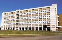
Interesting places of the Urals by car. Automotive travel route for two days on the sights of the Chelyabinsk region
The idea to visit the Ural arose literally a month before the trip. I decided to take a short vacation - 1 week - and somewhere ride. After a brief search, I stopped in the Urals.
10 days in sum. Of these, 4 days on the road there and back and 6 days there. Such a preliminary alignment. I'm going to lead the logbook and write everything is not too lazy. (Kilometers on odometer and time Moscow everywhere).
I take a tent and sleeping bags, but it's just in case. Live going in motels and inexpensive hotels.
May 19, 2010 23:59, Wednesday.
Start the logbook of the car. Saturday is appointed departure in the direction of the Urals. I have to defeat several thousand kilometers in Russia, visit the large and not very cities of the Urals and see different attractions. Today, many necessary things were purchased. It remains only to purchase an ax, sunglasses and engine oil. Filled a full tank of the 95th on British Petroleum.
List of things I'm going to take with me:
For auto:
1. Torch keys
2. Pasalti
3. Hammer
4. Isol
5. Cold welding
6. Motor oil Shell Helix 5W40
7. Washer fluid
8. Scotch
9. Ragges for wiring glass
10. Water (6 liter baccake)
11. Rubber on gaskets
12. Topor.
13. Reflector under the glass
14. Hose clamps
15. Navigator
16. Maps
17. Board (Support under the jack)
18. Lantern
19. Batteries for alarm key chain, lamp and a camera.
Other things:
1. Termos
2. Tableware
3. Boiler
4. Swiss knife
5. Tent
6. Bedrooms, pillow
7. Penozyrik
8. Polyethylene to cover the tent
9. Camera + Charger
10. Raincoat
11. Sunglasses
12. Means from mosquitoes
13. Tanning remedy
May 21, 2010 23:15, Friday.
All necessary equipment (if you can call it) purchased, including ax and sunglasses. It remains to pack everything, put in the trunk and can be touched on the road. But before shipment, it is necessary to make an important thing - sleep. This is what I will do now.
By the way, I was suggested at the forum that it was worth visiting the Lake and Park "Zyuratkul" instead of Taganay Park, as there is a road to the lake itself. I decided to take advantage of the Council, and there will be visible.
May 22, 2010 10:45, Saturday. Moscow. 54231 km.
Finally came the day of departure. Things are packed and laid. The machine is verified. Everything is normal - you can touch!
12:38 54305km. Somewhere after Noginsk.
Finally left the chain hugs of Moscow. 70 km in 2 hours is cool. Further seems free.
15:50 54571km. Mechkovo

16:50 54639km. Nizhny Novgorod
I decided to go through the city, and not around. On Saturday, the city is free, so that there were no problems with the passage. Filled on LUKOIL 30 liters of gasoline.
Cork in Chuvashia. There you have been doing five years old, but there is no progress.
Reduced: 80% of [800 to 449] - Click to view the full image

On the roads of Chuvashia at sunset:
Reduced: 80% of [800 to 449] - Click to view the full image

Reduced: 80% of [800 to 449] - Click to view the full image

23:50 55131km. Motel between Kazan and Elabuga.
So completed the first day of travel. Passed exactly 900 km. Roads came across different - both wide, and narrow, and smooth, and broken. But I can safely declare that there are not so many broken. Everything is in order with the car. I stopped at some wretched motel. 780 rubles came out money, and the conditions for 300 do not pull. I am unpretentious man, but somehow sorry for money.
May 23, 2010 8:48.
Having charged and breakfast, I go to the road again. Beyond +17, partly cloudy. Today I have to get to Kungur Ice Cave and, perhaps, have time to inspect it. My path lies through Izhevsk and Perm. There is little gasoline, and when there will be the next LUKOIL - it is not clear, so I decide to plunge on 300 rubles "Shemordannefteprodukt". I hope not to stall ...
9:55 55206km.
They stopped on some KPM in Tatarstan and recorded me in a magazine. With terrorists, probably fight. BD!
Reduced: 80% of [800 to 449] - Click to view the full image

13:19 55464km Udmurtia
He stopped relaxing into the fishing line, but the mosquitoes are chibantly evil, so long on the street is not working.
Reduced: 80% of [800 to 449] - Click to view the full image

14:35 55529km game
Could not pass by the modern LUKOIL refueling. I drove, refuel, went further.
19:39 55790km Perm. Cafe "City cafe".
I drove to Perm. I sit in a cafe, waiting for the order. He looked like a little on Perm, picked the Kamu, the center, saw one club traveler - with a sticker, but without the rear bumper.
Reduced: 80% of [800 to 449] - Click to view the full image

Reduced: 80% of [800 to 449] - Click to view the full image

Reduced: 80% of [800 to 449] - Click to view the full image

22:36 55856km Kungur.
Stopped at the Stalagmitis Hotel. Relic hotel of the middle scoop period. Money fights decent, but conditions like in a hostel. Well, okay, we do not get used to us, the main thing is that the bed was.
Today I drove a little more than 700 kilometers. The theme of the day is the road. Roads are terrible here. If good roads are dominated in Tatarstan, fifty-fifty fifty, then in the Perm region of good roads only small spraces. It looks like this:
Reduced: 80% of [800 to 449] - Click to view the full image

Reduced: 80% of [800 to 449] - Click to view the full image

Reduced: 80% of [800 to 449] - Click to view the full image

Perm Road - Yekaterinburg, at least to Kungur, disgusting. And not only with its most advanced bruise, but also throughput. Such roads are associated with neighboring villages, not two major cities. GAI continues to sit in the bushes ...
At the departure from Perm, they stopped and checked all database documents. To their regret and my pleasure with them everything is in order.
Nature is beautiful here. Wooded hills and small rivers. I liked Udmurtia more, although Kama is also impressive in Perm.
Izhevsk traveled safely, but Perm drove through the center. I did not find anything surprising there. All regional centers of Russia are similar to each other. Where can I eat immediately found. A pair of sushi bars do not count. Having left away, led to the "City Cafe", cheap and tasty.
Given the quality of roads and the Nevaznets, the speed of movement, you have to block the original route and cancel Tyumen with Tobolsky. It hurts for a long time. This is not from Moscow to Voronezh to catch up, 500 km in 5 o'clock. Here is the average speed of two less. Tomorrow Cave and move further towards Nizhny Tagil on secondary roads.
May 24, 2010 11:10 Monday. Kungur.
Breed in a hotel. Standard scrambled eggs and tea. I visited Kungur Ice Cave. For 300 rubles a guide, the hour drove on the grotto and told the bike.
Reduced: 80% of [800 to 449] - Click to view the full image

Reduced: 80% of [800 to 449] - Click to view the full image

14:18 55989km. Chusovoy city
Pofotographed the Chusovaya River in the city of Chusovoy from the bridge over this river. Summaged in the cafe "Pass". Going further.
Reduced: 80% of [800 to 449] - Click to view the full image

Reduced: 80% of [800 to 449] - Click to view the full image

Reduced: 80% of [800 to 449] - Click to view the full image

Reduced: 80% of [800 to 449] - Click to view the full image

14:44 55998km
Exceeded the speed per 100 rubles (in the photo is not me).
Reduced: 80% of [800 to 449] - Click to view the full image

16:13 56094km. Border of Europe and Asia.
Crossed the border. One pair of wheels in Europe, the other in Asia ... 


20:39 56237km. Upbeat.
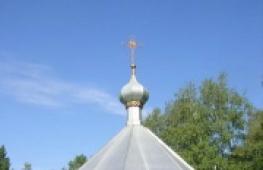
Received to the city of Verkhoturier, examined the Kremlin and the Cathedral.
Reduced: 80% of [800 to 449] - Click to view the full image


Reduced: 80% of [800 to 449] - Click to view the full image

Reduced: 80% of [800 to 449] - Click to view the full image

I discovered that there is a hotel, or rather I suggested the navigator. I decided to stop here and do not go further. Not very nice
ride in unfamiliar country roads to eats. In general, the third day of my auto operating was not bad. In the morning I visited Kutgur Ice Cave. It took about one and a half hours.
Then he went well to Verkhoturia. Nobody, because there are no roads in the Perm region. What was my surprise, drove into the Sverdlovsk region, find out what the roads are here. So I want to say that as if I got into Europe, but no!
Everything is just the opposite - today I crossed the border of Europe and Asia. The border passes almost along the border of the areas. In general, Asia pleased.
Verkhoturia at the entrance is not impressive. It seems the next same type of village, but then you notice the dome, another dome. On the high bank of the river Tours there is a monastery and the Kremlin. And an excellent view of the other side. Some kind of peace
hanging over the river. Sunset there is just wonderful! Tomorrow morning the early rise and the way. Lower Sinychikha, Alapaevsk, Nizhny Tagil, Nevyansk and in the evening to get to Yekaterinburg.
May 25, 2010 8:37. 56237km. Upbeat.
Breakfast and I go to the bottom buscier.
10:00
Refueling for some kind of gas station with some gasoline. I hope somehow I will do.
10:55 56404km. Nizhny Tagil
Lukoil refueling.
Pictures of Nizhny Tagil:
Reduced: 80% of [800 to 449] - Click to view the full image

Reduced: 80% of [800 to 449] - Click to view the full image

13:48 56527km. Lower bruise.
We are proceeding to inspect the museum.
Reduced: 80% of [800 to 449] - Click to view the full image

14:40
The museum is examined. Move further towards Nevyansk.
17:20 56693km. Nevyansk.
Examined the turret. Unfortunately I did not get inside - the museum was already closed.
Reduced: 80% of [800 to 449] - Click to view the full image

18:10 56769km. Yekaterinburg.
He stopped at relatives. So today I looked at the museum of architecture in the lower Sinyachah and the Nevyansk inclined Tower. A country road to the bruise was, to put it mildly, not very.
Reduced: 80% of [800 to 449] - Click to view the full image

Reduced: 80% of [800 to 449] - Click to view the full image

The gravel and dirt road, according to which, probably, the ore was taken from the Shaitan mine to the bottom or the upper night. By the way, in any self-respecting village there is a urban pond, which in the old days used for
drive water wheels Combine. Well, the metallurgical plants are fully. The road and we were heroically overcome and reached the bruises. The museum consists of several log houses, turrets and churches. Looks like
not bad, especially at a high-tender slope of the river Sinychikha. Nevyansk is famous for the oblique tower of Demidov. She really turned out to be tilted that it was necessary to prove.
It is worth saying a few words about Lower Tagil. I drove only around the edge, and I was struck by the number of plants and a decrepid view of the city. Do plants do not bring profit? Or do not pay taxes? Or the government does not want to repair roads and buildings?
In general, there was a strange circumstance today. Between the settlements of the road is good and excellent, in the populated points are completely broken. It is not clear why such a skew.
I also noticed one chip. If you see such a shield and on it, LLC "Magistral" - boldly go through this road, she good quality, only without marking.
Reduced: 80% of [800 to 449] - Click to view the full image

10:14 56889km. Nature Park "Oleni streams."
Reduced: 80% of [800 to 449] - Click to view the full image

14:49 56889km. Natural park "Oleni streams".
Protopal kilometers 15. Feet buzz.
17:21 57006km. Yekaterinburg. Cafe "True" on Karl Liebknecht Street.
Finally, I sit and eat, before that I was standing on my feet and was hungry. Today, the day began with traffic jam, feeling the density of the movement of Yekaterinburg. Well, not long.
Park "Oleni stream" is 120 kilometers from Yekaterinburg. 120 rubles from the nose + 50 rubles for parking and walk to yourself how much will fit. There are two routes - 6 km and 15 km. I chose the second.
Sun, sky, forest, river, rocks, birds sing, insects buzz ... Lyapota! The most it is to distract from the city bustle. But I was decent. Feet sobat, corners buzz. I do not know how three more park I will visit.
I returned to Yekaterinburg, looked at the temple, urban pond and I sit in a cafe I write this opus. I respect the institutions that can cook Befsteks.
May 27, 2010 08:49 Thursday. 57018km. Yekaterinburg.
I stand in line for washing. We must wash insects from the face of the car's face. Another place was added to the route - "Ganina Yama." There now go.
Reduced: 80% of [800 to 449] - Click to view the full image

Reduced: 80% of [800 to 449] - Click to view the full image

14:00 57072km. On the road from Yekaterinburg towards Chelyabinsk.
Stop at refueling
14:45 57096km.
The driver also reins itself in the Café "Mainer".
16:55 57238km. Lake Uvildy.
The weather confused all the plans. Pours heavy rain and nothing can be seen. In such conditions, it will not work out natural attractions. I do not know what to do next.
19:33 57351km. Zlatoust.
I examined the lake Turgoyak. Rain ran out, but still very wet. Now I will look for a hotel in Zlatoust.
21:45 57357km. Zlatoust. Hotel "Taganay".
Located in a good hotel. Room with shower and TV for 900 rubles.
In the morning I visited the monastery "Ganin Yama". The feeling of fresh-bearing is pretty clearly present. Some kind of political order. Although it looks pretty organic. Breeding churches and houses in a pine forest.
After moving in the direction of Chelyabinsk to see the lake and, maybe Taganay. He stopped photographed some kind of lake, clouds have already hung heavy, but the rain has not yet walked. It was worth going off a couple of kilometers and a wall of water fell on the ground.
The number of lakes amazes, but they failed to evaluate their beauty, only Turgoyak pleased. One strange place is Karabash. I look - like a mountain, but, driving up closer, I saw that the mountains seem to be artificial. Mountains of some slag. And the earth around as if
scorched. And on the real hills, very rare trees are growing. There are no herbs and bushes. Martian landscapes. I later learned about the dirtiest city on Earth ...
Looking Lakes Udlud and Turgoyak and arrived in Zlatoust. It remains to find out if you can see anything in Tagana in one day and call on Zyuratkul.
That's where I discovered one more kind thing - a tick was sitting on my back. Looks like a day. I went to the traumapunk, there I was removed and said what kind of medicine to drink.
I do not know what the consequences will be, but the sightseeing program is placed. I go home. I do not want to get to the hospital away from home.
16:07 57800km. Somewhere after Ufa.
I was attempted and refueling.
22:40 58347km. Chuvashia. Kanash.
He stopped at relatives. Today I defeated 990km.
May 29, 2010 13:30 Saturday. 58357km. Chuvashia.
Refueling before the last jerk. In the evening I hope to be in Moscow.
22:45 59092km. Moscow.
I'm at home.
Conclusion.
Travel, I think it was generally possible (if you do not count the tick). The route turned out to be:
Moscow - Kazan - Izhevsk - Perm - Kungur - Verkhoturia - Nizhny Tagil - Alapaevsk - Yekaterinburg - Miass - Zlatoust - Ufa - Naberezhnye Chelny - Kazan - Moscow.
Passed 4861km. Absorbing gasoline 350 liters. The average consumption is 7.2 l / 100km.
Filled mainly in Lukoil. In the Urals liter 95th costs 23.10-23.15, in the European part - 24.50-25.00
Southern Urals is rich in his tourist capabilities. You can fighten the South Ural rivers, visit the caves, ride between the Lakes of the Chelyabinsk region on bicycles, and you can walk with a backpack in the mountains, spending the night in the tents. Eight years ago I set my goal to visit all the ridges Southern Urals. Not that I have reached this purpose (more large-scale occupied my time), but I can say that when I call any vertex of the Southern Urals, it turns out that I have already visited on it, or stood on a nearby ridge and admired This vertex. This article summarizes my experience and is an overview of hiking routes from the South Urals.
If you imagine a typical South-Ural Mountain, then we will see her foot fir taiga with an admixture of deciduous trees and shrubs, which, when lifting, it will become smaller. The slopes of the abroad will be the absorption of granite blocks with dimensions from the ball to one-story house (in the Urals and in Siberia they are called the Turkic Word of Kurum). The languages \u200b\u200bof these placers are descended into the valley in the form of a stone river (it is not clear why trees do not grow on it). Even above, the trees become dwarf and turn into shrubs that grow to a height of 1000 meters above sea level in the north of the Southern Urals and up to 1200 meters in the south. Alpine meadows, tundra and horse marshes spread between the vertices of the ridge. The peaks themselves are Kurumny Domes with the rest rocks upstairs. This description differs only the eastern ridges where there is no Kurum and rare forest. This place where Ural Mountains Great Stephaus are replaced. On the northern slopes in hollow snow, the snow is often preserved until the end of June. Mountains are available for climbing almost from any side. This is a typical middle house.
Residents of Yekaterinburg are in a unique position. Yekaterinburg spread in the lowest part of the Middle Urals. You can live in Yekaterinburg, and do not feel that we live in the mountainous region (only the green ridge of ultrasonic ridges with lifts is reminded of us if the windows come south). But from the real mountains, we are separated by 6-12 hours by car to the south. It is so much time that we need to get to settlements, from which campaigns in the South Urals begin (cities from Zlatoust to Beloretsk).
Hiking hiking in the South Urals begin with the middle of May and end in late October. In early May and early November - off-season. At this time, you can feel the summer or winter depending on the weather. From December to April - this is the season of skiing, although you can walk on snowpad tracks that pass through the most popular routes. Even in the summer you have to prepare for the weather from hot summer to late autumn. And in mid-June, you can get under the snowfall. Ural delays clouds that come from European Russia to Siberia. Standing on top, I repeatedly saw how heavy clouds hung over all ridges of the Southern Urals, and the sun was shining above the West Siberian plain, and the light green plain emphasized the dark blue color of numerous lakes. The bulk of the element is taken by the Western ridges - Nara, Zigalga, Suk (the latter is translated as cold, windy). Clouds are usually hanging to the Uraltaau waterproop, according to which the border of Europe and Asia passes. Uraltaau passes east of the highest ridges and stretched from north to south by 500 km. Over the ridges east of Uraltau - Nurally, Irendel, Kryktytau more than traveling sunny weather.
On a clear day, a panorama opens with more than 50 km. If you are very lucky, then you can see the whole southern Urals in five trips, rising to the ridges of Taganay, Nurgush, Japles, Kuamardak, Shatak. In reality, you will need to do about 15 trips, after which, standing on the next vertex, you can proudly show beginners to neighboring ridges and call the names of their vertices, mentally flying with one to another and remembering the campaigns already covered. This is all your you met with the help of guidebooks and the Internet, but for the present - with the help of your feet.
The names of the Southern Urals indicate the various peoples that lived in this territory. There are Turkic names ending on Tau (Mountain), Kul (Lake) and Yelga (River). For example, Kryktytau, Zyuratkul. There are more ancient - Aryan names ending in Duck (almost all over the Eurasian ridges, which will end up for Dag, are witnesses of the relocation of Indo-European), for example, Kuamardak. Particularly interesting names that combine the roots of different languages. For example, the Karagana River ("Kara" in Turkic - black, well, and Gankka is a gang, river). And now the Southern Urals, as it should be the mountainous edge, is a weave of different peoples. Here are Bashkirs of various births, Russians, Cossacks, Tatars, Mishari, Nagaibaki, Mari, Chuvashi.
Almost any vertex of Ekaterinenburg can visit for 2-3 days, for example, having left on the night from Friday on Saturday, walking Saturday, Sunday, and perhaps Monday, and returning home. The same applies to the residents of Ufa and Chelyabinsk, only they need to travel from their cities early in the morning. And only the most remote ridges will require 5-6 days. It is logical from the north to start (there is also the most interesting and beautiful ridge of Taganai) and every time you ride everything south until all the ridges go. Let you not confuse that at the very beginning you will visit the most interesting, according to most tourists, the ridge - Taganay. As you move to the south, you will become an expert on the Southern Urals, finding unique beauty in every grief.
In this review I want to describe 31 route in the South Urals and place for each area KMZ card for GPS navigator and "Google Planet Earth". Almost all routes last from 2 to 4 days, that is, do not require leave. The goal of each hike is to get acquainted with one, maximum - two, ridges of the Southern Urals (the exception is hiking along the Zyuratkul and the surroundings of Beloretsk). In fanatic mode, if you go to the South Urals almost every weekend from May to mid-October, you can go through these routes in two years. In the more calm mode, six trips are enough for five years. In our necessarily there is a campaign in the South Urals.
Large centers from which routes on the Southern Urals begin are Zlatoust, Zyuratkul with Siberian, Tylyuk and Beloretsk with surrounding villages.
Neighborhood of Zlatoust, Tagana Natural Park
 In the Natural Park Taganai usually go from the city of Zlatoust. You can get there by train. This is the most concentrated place in the southern Urals in the number of diverse mountains. Here is the longest kouring river from white colors (quartz) river, double-headed stalls with kurum and rocks on top, rocky response comb, Valley of dwarf fir trees - Tales Valley, Round Dome of the Kruglitsa - Mountains, which is a snow with snow, looks like a five-tailed, mountain tundra Far Tagana, Relict Elnik Mount Jesil and others. The peculiarity of the natural park is that it has shelters. Therefore, if you wish, you can go hiking without tents. On Taganay, you can go hiking on the following routes:
1.1. Mount Jurma (2 days) - it is more logical to start with it, as this is the northern thousandth of the South Urals. This is a mountain covered with forest, with rocks on top. Start from the dirty city in the world - Karabash. In it you will see the river of a poisonous color and a bald mountain with poklonnaya Cross And the inscription "Save and Save" (vegetation burned acid rains). That contrast will be sensations when you find yourself in virgin nature. The third day can be spent on vacation on Lake Uvildy. The name of the mountain causes to think, and whether it is worth practicing tourism at all - translates as "do not go."
 1.2. The route, which is considered the most beautiful and popular in the South Urals: Upper trail: double-headed hill, responding crest, valley of fairy tales (1 day), Kruglitsa, Lower trail, stone river (2 day).
1.3. Lower trail to Kialim Cordon (1 day). Far Taganay, Izyl (2 day), lower trail in Zlatoust.
1.4. Mont Blanc (with this small rocky vertex you can see from the side to the tops of the Large Taganai Ridge), Small Taganay (1 day). Range Small Urals and Aleksandrovskaya Sopka (2 day).
 1.5. From Zlatoust you can go to another ridge, which is not part of the Taganai Natural Park - Ubeng (south of Zlatoust). For 1 day, you can go through the first and second sopes and the third peak - two brothers. In Ubarge, you can feel how the climate is changing as climbing up and see the expanses of the Urals from the top. At the two brothers, elegant marble cliffs upstairs. On the second day, you can go to the next natural park of the South Urals - Zyuratkul.
You can finish hiking on Lake Turgoyak. it pure lake Among the brownie vertices, which is called the younger brother of Baikal. And indeed, there is something in between them. On Turgoyaka is the island of faith with archaeological attractions of different eras.
Residents of other edges of our country logically take a week of vacation with adjacent weekends and go to Taganay and the surroundings of Zlatoust for 9 days.
(Dropping: 306)
Natural park Zyuratkul
 If Taganay is the ridges stretched from north to south, then the location of the ridges of Natural Park Zyuratkul I can compare with a blossoming bud with a drop of dew - Lake Zyuratkul, located at an altitude of 724m above sea level. Here is the highest top of the Chelyabinsk region - the Nurgush ridge with the largest Tundra on the southern Urals, accessible to novice tourists Ridge Zyuratkul, Mount South Wanted fountain - a well, from which water beats 5 meters (in winter it is a large icicle from which water flows) , rocky ridge suck (bitch), which is translated into Russian as cold, windy (this is the western ridge-thousandnik, who takes over the cyclones from European Russia). In the natural park there is a geoglyph of elk (large-scale image of the moose contour, visible from height).
 Routes can be started from Zyuratkul - spa place With the campgrounds and the zoo, Siberiana - the place closest to all ridges of the natural park, the village of the cassette. Options for hiking in Zyuratkul:
2.1. Village Zyuratkul, Zyuratkul Ridge, west shore Lake Zyuratkul (1 day). Ridge Moskal (2 day).
Download KMZ card for GPS Navigator and Google Planet Earth (Dropping: 290)
 2.2. Siberian, climbing Kalakazu, Uvansky fountain, climbing the Waw (1 day). Pass through the ridge suck, climbing the nearest vertex, access to the cattle (2 day). You can go for three days, spending the second day on a long walk lightly in the southern part of the ridge suuc. Waw is the central vertex of the natural park. It offers a majestic panorama of neighboring ridges.
 2.3. Siberian, Olympiyev Cordon, pass between Middle and big Nurguish (1 day). Walk to the middle Nurgush (2 day, optional). Traverse of the tops of the Big Nurgush (transition with a backpack through the top), descending to the southern tip of Lake Zyuratkul (3 day). Climbing Moskal, exit to the village of Zyuratkul (4 day).
2.4. Southern Ubengi. Village Zyuratkul, West Coast of Lake Zyuratkul, climbing Moskal, the foot of Lukash (1 day). Climbing light on Mount Lukash, go to the foot of Ubony (2 day). Walk along the rocky top of the southern Ubengi (3 day). Crossing through ah, access to the village of Dam (4 day). In the case of difficulties with the crossing, you can return to the same route as the approach (5-day route), or to the pass between the Middle and Big Nurgussa (4 day), climbing the middle and large Nurguishi (5 day), exit Siberian (6 day).
2.5. Traverse Ridge Large Nurgush (transitioning with a backpack through all the vertices of Nurguish) from the village of Zyuratkul to the village of Tylyuk - places where hiking is made from the next part of the South Urals. Duration from 4 to 5 days.
Download KMZ card for GPS Navigator and Google Planet Earth (Dropping: 197)
 Conditionally, we will take the area of \u200b\u200bNuralli to the same area, which is on the same latitude as the Natural Park Zyuratkul. This is the most unusual ridge on which there is no forest. It is located east of the Range of Uraltau and all the sediments consistently take the ridges: Suuk, Uvan, Nurgush, Ubarga, Uraltaau. Nurally is almost nothing. The ridge willolate and has deep sidewars. It is the source of the Miass River.
2.6. The village of Yalchigulovo Stiliusky District, the source of Miass, ascent to the southern part of the Nurali Range (1 day). Climbing the northern part of the ridge, visit the lakes at the foot, return to Yalchigulovo, climbing the mountain Austau (on top - the grave of the saint), Lake Aushkul, departure (2 day).
Download KMZ card for GPS Navigator and Google Planet Earth (Dropping: 87)
 Neighborhood Tyutuk. Natural park Jesnel.
Tyutuk - resort village. With several hurry. Hence the ranks begins interesting routes According to the South Urals. Here it is sacred mountain Jerlel is the second highest in the southern Urals. It is a horseshoe from the mountains of the stallion, the big gorevel and the three vertices of the small jippety. Here is the Big Jesle Plateau - the tundra with a palpal of dwarfish, the mountain Suktash with a string of rocks descending from the top. Horseshoe is surrounded by the swampy tundra and the Kurumny Rivers of the Valley of the Tygyn River and the Range Avalyak. To the north of the tylyuk are the ridges of South Nurgush (part of the Zyuratkul Natural Park) and berry with picturesque lake - The source of the river Tyutuk. The south is the village of Aleksandrovka, turned into ancillary by the movement of Anastasians (fans of creativity Vladimir Megre). From Tyutuk to Alexandrovka can only be driving on a high passability machine. It starts routes on the brutal ridge Bakats with picturesque rocks on tops and mountain Zigalga - a powerful ridge with kurumny rocky peaks and the biggest rolling swamp in the Southern Urals. On Zigalge there are Moraine - traces of an ancient glacier, through which among the rocky vertices flows the Evlakt River with a lake and a waterfall. The source of the Evlapse is lost among a huge Kurumnaya River, which goes to the top of the transverse (stretched not along, and across the ridge). I like to conduct training on this Kurumnaya River, and descend with the transverse already on the "Park Forest" next to the Kurumnaya River. The southern part of Zigalga is a variety of Kurumny dome-shaped - shells. According to the legend, only boys are born in those who visited her shellary. This part of the ridge is prohibited for visiting, as it is located in the South Ural Reserve. Routes of hiking in the vicinity of Tyutuk:
 3.1. Tyutuk - Horseshoe Big Jeslel. Climbing light on great rimel (1 day). Climbing light on a small gorevel, returning to the tiюлу (2 day).
3.2. Southern Nurgush (2 days).
3.3. The lake in the origins of the Tyutuk, the ridge berry (2 days).
3.4. Tyutuk - Pass between the big and Small Jerlem (1 day). Climbing light on big and small ripe (2 day). Transition along the valley of the Tygyn River, climbing the lines to the tops of the Avalyak ridge (3 day). Descent to the village of Nikolaevka (4 day).
 3.5. The river Yuruzan, not reaching the tiюлю at the northern tip of the Zigalga ridge. Crossing through the Yuryuzan (in the flood - on the catamaran). The transition along the Elakt River to the lake and the waterfall and to the beginning of the Kurumnaya River (1 day). Climbing on the transverse (2 day). Return to the start of the start (3 day).
3.6. Aleksandrovka village - Pass through Zigalga (1 day). Walking light on the middle of Zigalgi, the mountain frowning cliff (2 day). If it were not for the reserve, it would be possible to go flat on the shell (3 day). Descent from the pass to the village of Upper Katab.
The traverse of the entire ridge Zigalga would take 5 days.
 Download KMZ card for GPS Navigator and Google Planet Earth (Dropping: 217)
In the village of Upper Katav, you can finish another three-day route - on the ridge of dry mountains. It is low compared to neighboring ridges of Nara and Zigalg Ridge-thousand-thousand, from which magnificent views of the transverse, shells and the tops of the ridge are open. The peaks of dry mountains are a fabulous palpal of dwarf firings.
 3.7. Start in the village of Nilsky, the transition with a backpack for the pass through the dry mountains (1 day). Walk to the southern part of the ridge (2 day). Transition with a backpack across the northern part of the ridge in the village of Upper Katav (3 day).
Download KMZ card for GPS Navigator and Google Planet Earth (Dropping: 67)
3.8. Range Bakts from Tyutuk to Verkhnearshinsky village. It should be borne in mind that where the ridge ends, the South Ural Reserve (3 days) goes.
Neighborhood Beloretska
 The peculiarity of the area is that there is both elongated ridges, for example, Kuamardak and many short ridges-thousands. Each ridge is unique, so you can visit a lot of varied peaks in one trip. Kuamardak is a string of verthos-thousands with spurs: Small Kumardak and Bear. I like the stone river, descending with the Kuamardak numerous "tributaries", separated by spruce groves. Routes:
4.1. Quamardak Ridge: Tirlyansky village, Missel, Inzer, the cock, the foot of Kuamardak (1 day). Pass between bearish and kuamardak, climbing light on a bear, descent with pass, inspection Stone RiverClimbing light on Big Kuamardak (2 day). Climbing light on Small Kuamardak, exit to Verkhnearshinsky village (3 day).
 4.2. The Mashak Ridge, located west of Kuamardak, unfortunately, is located in the reserve. Kuamardak and Mashak are closed from the south by the Mountain Corner Mashak and divided by the valley of the river Yurazani (there is its source). This is one of the most deaf seats in the southern Urals. If it would be possible to visit, it would take 5-6 days.
4.3. Mount Yamantau, the highest peak of the Southern Urals, is located in the South Ural Reserve. The rise to it is strictly prohibited (3 days).
Download KMZ card for GPS Navigator and Google Planet Earth (Dropping: 116)
4.4. Village Tyralnan, Inzer gear, Crane swamp (1 day). Mount Yalangas, Noura village (2 day). From Mount Yalangas, you can look at the majestic ridges of the South Urals a little from the side.
 4.5. The neighborhood of the village of Nura. Depending on the number of days you can visit several short ridges. Mount Malinovaya and Kiell (1 day). Transition to the foot of Auriska (Salavattau) and Mayarch (2 day). Ascension on Mayrdak and Aurasak, the transition to the foot of Yalangas (3 days). Climbing to Yalangas, return to Nour (4 day).
4.6. Many mountains are located west of Big Inser - Capplet, Yeriktash, Karatas, Yush, Shiktash. All of them are included in the South Ural Reserve. Crossing through the Big Inzer is difficult (4-5 days).
4.7. Mountain Small Yamantau is open for visiting. On her top leads an ecological trail from the village of roar (not far from railway station Inzer).
Download KMZ card for GPS Navigator and Google Planet Earth (Dropping: 92)
Southern ridges
These are the ridges on which the forest boundary takes place at an altitude of 1200 m - that is, the most vertices. There are practically no Kurum on the ridges. Upstairs - steppes with sharp scalin vertices. Consider three ridges: Kryktytau, Krak and Shatak. The vertices of the south of these ridges are completely hidden by the forest.

This is a long ridge of west of Uraltau, so it is characterized by a sprouting tops with sharp rocks, the lack of Kurum, deep rock gorges with waterfalls. At the foot of Krattytau there are an Abzakovo ski resort and a bath. Near the bath is located Mountain Gorge - Place of training climbers. According to Kryktytau, you can make three three-day campaigns - along the northern, middle and southern parts. it favorite place Recreation of residents Magnitogorsk
5.1. Northern part Krattytau. The three-day route begins and ends in ski resort Abzakovo. You can go deep into the ridge, the next day to take a walk on the tops and on the third day to return to Abzakovo.
5.2. Banner, pioneerland, mountain gorge, climbing light on Yamanka (from the mountain there is a magnificent view of the Great Steppe and many lakes), climbing the tops of the Salavatov Mountain (Sollattau) (1 day). Transition with a backpack under the mountain Kusimov, the arrangement of the camp, the hike to the mountain of Kushai (2 day). Down the stream of waterfall to the lake bath.
5.3. Southern Kryktytau. Besled ridge with rock vertices, towering over the forest. The highest peak is karatas not far from the village of Kuzhanovo. You can finish in Askarovo (route for 3 days).
Download KMZ card for GPS Navigator and Google Planet Earth (Dropping: 70)
Kraka
A winding ridge with deep valleys of the streams. Valley thickets by forest, the ridge itself places bald.
5.4. The route begins and ends in Shigayevo. For three days you can visit the ridges a large and small craft.
 Shatak
It is very southern Ridge In the southern Urals, whose vertices rise above the forest level. South of him, too, there are tops-thousandnakes, but they are already completely hidden by the forest. At the top of the ball - a steppe in which you can meet wild horses, and rock vertices.
5.5. The three-day route on the ball begins and ends in the village of Ismakaevo. On the first day we climb the ridge until there is water. On the second day, we go on the steppe along the headpes along the ring route, examining the southern vertices of the tent and the ridge of Small Shatak. On the third day we rise to the most high vertex - Big Shatak and come back to Ismakaevo.
Download KMZ card for GPS Navigator and Google Planet Earth (Dropping: 53)
Routes except South Urals?
Planning 2-4 day trips from the night, logically pay attention to the north. In the Northern Urals of the Mountain, it is similar to the mountains of the Southern Urals, only the border of the forest is much lower - at the level of 800m and instead of Elnikov - Cedars (Sibirskaya Siberian) and the climate of more severe. Throwing is hampered - almost everywhere except the array of Konzhakinsky stone and Kachkanar is required to transport increased traffic.
Logical development tourist life After hiking from the night in the Urals - hiking from 1 to 3 weeks in Altai and Siberia. These trips in Turkluba "New Nomads" are held within the project "".
Map "Southern Ural - Stitched 5-kilometers"
Hiking from the night in the Urals (see also):
The cliff of Sokoliy Stone, which is located in the Sverdlovsk region between the two settlements - Krasnoyar and Zausensky, are not so visited by tourists as other natural sights of the Urals. A, in vain, journey This may be unforgettable. It is also quite often confused with a falcon stone near North. But with this stone she has nothing to do.
Traveling around Russia: Sokoliy Stone
Deciding to start a journey through Russia and being in the Urals, it is worth paying time to visit the cliff of falconia. This rock has such a poetic name, most likely, because of the large number of falcons that lived in these places. A toponymist Matveev A.K. suggested that she was so named because of his beauty, and she was personified with Salol.

Indeed, the cliff itself is very beautiful and picturesque. Its height is 514 meters. It has rock outputs that can be well displayed even through the satellite. They are located at a distance of about 500 meters from each other, and each of each such protrusion average is 20 meters.
Sokoliy stone and interesting places around it
Views that open on falcon stone are captured by the Spirit. Here is very good visibility. Moreover, near this cliff there are very interesting places of Russia, which, by the way, are not far from her. So they can also be visited. From the tops you can see the mountain Shunut, and on the other hand, the tops of the Azov Mountain are visible. Beautiful white stone cliff is located a little further along the way.

A mixed forest of young trees is growing on the rock, obstacles are found from cutting down. Places here are picturesque. Especially beautiful here at the end of summer, rest in autumn in these places, like a fairy tale when the leaves change their color. There are almost no signs of a person here, therefore freedom is felt away from civilization. Next to the cliff flows the Kuzih river, which is a tributary of the Revda River.
How to get to falcon stone
Sokoliy stone rocks are located between the villages of Zausen and Krasnoyar. The road to this place is quite complicated, so it is necessary to use the card or navigator. Otherwise you can leave there. Usually the route starts from Krasnoyar. To get to this village, you need to get to Revda by bus from Yekaterinburg, and from there already to Krasnoyar.

From this village will need to overcome 12 kilometers to the destination. First you need to go to the Revda River, then pass the bridge (do not move the river!) And on the fork to stick to the left road. Soon a falconian stone will appear, from which it is quite close to the white stone and Azov-Mountains, and then you can go to the village of Zausensky.
If you like the active vacation, then the journey through the Urals is what you need to try. Here for you are presented huge opportunities for active tourismYou will discover the world of amazing adventures and vivid impressions.
On a trip to these picturesque edges, you can go on a car, quad bikes and even a bike. Equestrian tours and hiking are also available. Favorable for active rest climate, regardless of season, will contribute saturated holidayYou will remember long for a long time with pleasure.
Ural - Holidays for every taste
The edge of lakes and rivers - so often refer to the Urals due to the huge number of water bodies on its territory. Three and a half thousand rivers occur in the Chelyabinsk region alone. That is why one of the most popular sports here is rafting, which are coming here thousands of tourists come here every year. There are many routes for traveling water, you can also go on a tour of the waterfalls or caves of the Urals or go fishing on one of the most beautiful reservoirs.
In winter, the Urals are fabulously beautiful. At this time, you can take advantage of one of the lathers that are especially popular here. The journey will be in picturesque mountain and forest paths covered with shiny snow, under the bright sun.
For those who prefer calm rest, There are many tourist bases where you will enjoy complete unity with nature away from the noise of large cities.
And if you want to go on a journey through the Urals on foot, exists wide selection such tours.
Thus, if you decide to go to one of beautiful corners Countries, you can choose a rest that fits you.
Most popular routes in the Urals
During the journey through the Urals, the routes may be very different, depending on such factors:
Travel method;
The number of time allotted on vacation;
Financial opportunities;
The most preferred type of recreation and other factors.
The following natural objects are among the most popular routes:
Ural Mountains - unique with geographical point Vision region where the border between Europe and Asia passes. At a distance exceeding two thousand kilometers, there are many monuments and memorable signs.
Azov Mountain, considered one of the most mysterious places Sverdlovsk region. With this place, legends about treasures hidden by robber, the mysterious ghost girl in white, candle lights, igniting at night, and many other no less mysterious and interesting stories.
High mountains, hedgehog, Shunut, Yuriev Stone, each of which is unique in its own way.
You will begin your adventures in Ufa. The first point of travel will be an "ice fountain" (Siberian), a magnificent monument of nature, built by man. In 1976, the drillings in search of iron ore accidentally stumbled upon a powerful underground river, which escaped from the well. The workers tried to install the cap, but the stream stream broke through it. A few years later, the well was still closed, and now she beats up like a fountain. In winter, it freezes and turns into a real miracle of nature. Especially spectacularly "Ice Fountain" looks at night when the purest snow plays multicolored glare under the light of the stars.
The hydroelectric station "Thresholds", built by the Germans, is the only hydrotechnical structure, which is erected by masonry from wild stone - sandstone. Hydroelectric power station supplies electricity to the village of the same name, as well as other settlementslocated nearby. Since 1993, "Thresholds" has been included in the list of monuments of international importance.
Turgoyak - large lake With fresh water. It is surrounded by mountains and coniferous forests. Monument of Nature S. purest waterClose in quality to Baikal.
Traveling on the car in the Urals will be incomplete without a visit to the famous caves. This route includes Cave Cave (Shulgan-Tash), which is the only one in the territory of Eastern Europewhich is well preserved paint paint samples related to the stone century. All over the world, such an ancient rock painting has been preserved only in two countries: France and Spain. It was studied only by a small part of the huge territory of the cave, scientists and speleologists were able to pass only 1.5 km. Tourists attracts a positive energy of the place, as well as the healing properties of cave water, air and clay.
Arkim is a place that is sacred for many people belonging to different religions, and even atheists. Summer Sunstream Day is special here. At this time, the arcama can see the communication of shamans with spirits, and the stones brought from here are considered talismans and carefully stored.
The three-stage gaddle waterfall, having a total height of up to 15 meters, is a majestic sight. Here you can find jashers and yashmoids, diverse stones that are known all over the world.
The ride is completed at the point of reference, in Ufa.
If your choice has become traveling through the Urals by car, the routes can be the most different. Every place here is unique and worth visiting.
Quad bikes - the best travel transport in the Urals
Of course, it is nice to ride a flat asphalt road, but more and more people are leaning toward roads off road. Perfect transport for this kind of trips is a quad bike that will take you to the most difficult places, giving an unforgettable impression.
There are many options for such trips. One of them is a journey on quad bikes in the Urals along the route Ekaterinburg - Jurma - Yekaterinburg with stops in the Upper Sysert, Araculian Shhahani and on Mount Hydia.

This method is the best for the feeling of complete unity with nature, relaxing from the benefits of civilization and enjoy the speed and picturesque species. The rocky array of Araculian lumps with a length of more than two hundred kilometers consists of a variety of cliffs of the most bizarre forms that stand here since the times of bronze and iron centuries.
Mount Highza is one of the most picturesque and high. On a quad bike, you can climb on it only in summer, in winter it is possible only on the ski lift.
See such a number of vertices with breathtaking panoramas, make a quick transition from the Middle Urals to the southern, enjoying forest roads and extra clean air - all this can be done on a quad bike for the shortest possible time.
in Urals.
For lovers of active ecotourism, a journey through the Urals by bike will be an ideal way. Of course, so you will not be able to get to the most hard-to-reach places and wipe off the off-road breeze. However, an excellent physical form, a lot of positive emotions and beautiful places that you can slowly inspect - all this is guaranteed.

A lot of cycling tours is organized in the Urals, but you can go on a journey yourself.
The most popular cycling route in Urals passes through the territory national Park "Bashkiria", which borders the Schulgan-Tash reserve. In the latter, they are protected by real bees, so while during the way you can try the most environmentally friendly honey.
Hiking in the Urals
Despite the abundance of types of transport, on which you can go on a journey through the Urals, hiking continue to be kept in constant popularity. The advantage of this method of movement is the introduction of the territory on which we travel. In addition, hiking is a great way to maintain physical form, as well as the opportunity to visit unique placeswhich are rarely described in guidebooks. Among the popular routes of hiking in the Urals:
Visherian reserve.
Pathedral (Kolchimsky) Monument.
Plateau Quarks.
Reserved tours on basgi and other no less interesting places.
You can go to the campaign in the composition tourist group Or friends, but in the latter case, you should thoroughly consider the route and prepare the necessary gear.
Horse tours in the Urals
Continues to be very popular in the Urals. Various ecotures offer trips to the places that retain the pristine beauty of nature, and small villages found in the way, only strengthen the overall impression of the trip to the past.

Tour programs are diverse. Tourists are invited to take a walk to the origins of the Ural rivers, ride in the forests and the mountains with the clean air, as well as visit the set natural monuments. Equestrian tours are something that the Urals have always been proud of. Traveling, photos from which you bring home, will still remember long.
Rafting in the Urals
The Mountain Rivers of the Urals are well suited for water tourism. The river alloy can be carried out to everyone, regardless of the level of preparation, as various programs are provided. The difference between local rafting in amazing nature - the majestic rocks surround the rivers, according to which the descents are organized, create unsurpassed beauty. Here, as a rule, water tourism is multi-day and suitable for family holiday. Routes of alloys pass along rivers:
Jurazan;
Chusovaya;
Big Inzer;

Each of them has its own fans, which from year to year come here to enjoy water tourism.
Ski rest in the Urals
As with any mountains, in the Urals there is an opportunity to go skiing. There are tracks for both true professionals and beginners to develop this sport. More than 50 ski centers, the total length of which is 200 km, function here. Most of all in Bashkortostan, Chelyabinsk and Sverdlovsk regions. The longest routes can be found in such ski centerslike Abzakovo, Zabyulich and Agigardak.

You can go to the present ski journey On the snow-covered slopes of the Urals, the natural beauty of which will not leave you indifferent.
Connon-Sunny Journey through the Urals
On the journey through the Urals, you can go on the sleigh who are harnessed by horses. Such tours are particularly popular with outdoor lovers. Frosty air and bright sun, under which the purest snow sparkles, is what awaits you in such a campaign. The routes of equestrian tours go through nature monuments and through which picturesque panoramas are opened.

When it is better to go to the Urals
Traditionally it is believed that better time For hiking is the period from the beginning of July to early September. This gap is most favorable in terms of weather conditionsSo, it is the routes that you will follow.
If you are going to winter holidaysFrom the beginning of November and until the end of March you can enjoy all the delights of skiing and sled tours.
Whatever you go on a journey through the Urals by car, quad bike, bicycle or prefer hikingImpressions from visiting this edge will be unforgettable.
Tour review on your car in the South Urals. Tips for tourists, nature of the Urals, unique attractions and photos.
Preface
We started the journey from the city of Perm. Perm region - This is a priest. There's very beautiful. You must see the Kama River - this is an exciting sight. The Ural itself is very beautiful and unusual. Our team is 4 travelers. The purpose of our trip is to see the unusually beautiful places of the Southern Urals. All 7 days of trips passed with benefit and flew as an instant.
In the journey used Google maps and Yandex-navigator. The latter constantly paved the path on the bypass, but good road.
Our route was as follows:
- Permian.
- Kungur (Kungurskaya Cave).
- Yekaterinburg (Ganina Yama).
- Sysert (Talcs Stone).
- Chelyabinsk and a little Bashkiria (river ah).
The road to the Urals
On the way we made a big hook. However, this is not overshadowed a trip: the journey turned out to be very interesting, fascinating, though difficult. All the way passed mainly on a normal road. Periodically came across pits and traffic jams in the city center - especially for Ekaterinburg.
In every major city at the entrance, there is a refueling. All the trip to gasoline spent 3280 rubles.
I would like to say that during long journeys you need to be prepared for everything. For example, we had overheated by the fan of the car because it was very hot.
It is also worth noting that in the Urals the weather is unpredictable: for the day she can change several times. For example, in the morning the sun comes out, it rains in the afternoon, and in the evening snow suddenly falls. That is why you need to take warm things on the road.
Kungurskaya cave
Leaves from Perm (district railway Station) On July 8, early in the morning, local time at 06:00 (the difference with Moscow is 2 hours). We drove through the following villages: Lobanovo, Khanyanovo, Janichi, Kukushtan, Shadeka. After 2.5 hours arrived in the city of Kungur. The weather promised to be pleasant, sunny. We drove very slowly, as some roads leave much to be desired. Distance to Kungur - 100 km. This is the first big City After Perm.
A lot of tourists come to visit truly a truly unique kungur cave. Having been at this place at least once, fall in love with him forever.


Kungurskaya cave
At the entrance bought tickets (adult - 700 rubles, children - 500 rubles) and went to a sightseeing tour.
Book a hotel in advance on the site. The most closest hotel can be found. There is also a pool, and even a sauna, but the prices there are decent. During the day, the usual double room costs 2300 rubles.
Travel to Yekaterinburg
From Kungur to Yekaterinburg, we drove 4 hours. The road on the highway R-242 is good. We specially made a circle (went through Yekaterinburg, not Krasnoufimsk) to see more attractions. On the way, the city of Revu and Druzhinino drove the city, where they shipped the car and snack. I liked the cafe "Holy Rus", but for some reason gasoline turned out to be more expensive than in Perm.
The Sverdlovsk region is considered the capital of the Urals - there are many interesting and beautiful places here. We have more accentuated my attention in nature than on the sights, so in the city of Upper Pyshma visited only two interesting places: Museum of automotive equipment and "Fighting Glory of the Urals".

Museum of military equipment
At first we visited the Museum "Combat Glory of the Urals", as he was closest along the way. The ticket cost 100 rubles. There you can also buy various souvenirs associated with the Great Patriotic War. In the "Battle Gloal of the Ural", we at the same time purchased a ticket to the Museum of Automotive Technology.

While we walked in the building, we considered all the exhibits and made a lot good photos. Later arrived excursion busAnd we went to another place.
Of course, such a car technique impressed us. All cars were completely in working condition.

Museum of automotive technology
We liked everything, only in the territory of museums there is no coffee shop, nor even a stall, where it would be possible to buy simple water. The nearest cafe is located approximately 500 meters from the building.

Gas "Seagull" from the museum of automotive equipment
Ganina Yama
We visited the famous male monastery. He is very beautiful, but in the indoors of the church it is impossible to take photos.


Ganina Yama
Unfortunately, we were a little late for an excursion, but I still liked it very much there. In the church itself beautifully, pure and calmly. Sign up and learn about tours can also be on the official website. On the territory of the monastery there are monuments of the Romanov family.

Not far there were a family of Romanovs.

There is a museum in the temple where the life of the royal family (exhibits, paintings and more) is described in detail.

Portrait of Romanovs
In the temple, you can not include girls without scarves and with open knees, as well as in the pants. But at the entrance gives scarves and long skirts.

Entrance to the temple
City of Sysert
There is a lake in this city, which is surrounded by the forest and is called a monument of nature. His second name is "Bazhant places".

Lake in Sysert
This fabulous place fascinates with its beauty: pine forests, birch grove, quiet pond, beautiful lake, Forest animals, delicious berries and purest air. It is just necessary to see with your own eyes.

If you travel through the forests of the Urals, then you need to stock by special means against mosquitoes, midges and ticks. We were not enough such funds, and I had to wear high rubber boots in the summer.

View of a break from Talkova Stone
At the entrance to the "Bazhov seats" a pleasant woman is sitting, which sells tickets and tells about the route with a length of about 5 kilometers in one direction. The territory is very big. Together with the tickets, a card is issued, on which it is noted, how and where to go, and what can be seen on the way. Along the route pointers were placed, so it's difficult to get lost.

Signature "Talkov Stone"

Forest talkov stone
The price of a ticket - 60 rubles, but other services are provided here. You can rent a tourist inventory (tents, sleeping bags and other equipment), as well as order a tour or even rent a gazebo on a day.

Talkov Stone and Incredible Nature
On the way K. famous Lake We met protein, wild birds (in many places the feeders were hung). Unfortunately, we did not see Bobrov, who live in the dam, as they arrived there in the morning, and animals appear to seem in the evening.


Talkov Stone and Beautiful views
Got a lot of impressions, looked out of it incredible beautiful place with sadness.
City of Karabash
When we drove out of Sysert in Chelyabinsk, we had a strange city along the way. We looked at the Internet and found out that this is abandoned Karabash. It is considered the most dirtiest city in the world.

Abandoned Karabash
At home there are empty, everything is abandoned - both plants and mines. Water and earth orange, nothing grows.

Orange land in Karabash
It becomes scary when you get into such a place.
City of Zlatoust
On the way to Chelyabinsk, we had to stay in the city of Zlatoust. First, we "boiled" the car, secondly, it was the first full-fledged city after Sysert, where there are big shops, refueling and cafes. It is in this city that is the famous national Park "Taganay". We could not go there, but we promised themselves to visit him another time. For one trip, all unique sites of the Southern Urals are not going around.
I would also like to note that the most beautiful sunset is in the Urals. When a large red sun sits down, the clouds are painted into a rich pink color.

Nature of Zlatousta
Chelyabinsk city
We are almost with the goal. For all the time, nobody felt tired. We, as at the beginning of the road, were still full of strength and energy.
Arrived in the village of Mezvea. Here begins crossing water. We rented boats, or rather, ordered a tourist trip along the river ah, as this is the only way to get to the most picturesque places.

We booked a trip along the river in advance, and already in place, in Megeve, paid 3,500 rubles per person. We were granted boats, a tent, sleeping bags, and also organized breakfast, lunch and dinner. The price includes insurance and instructor services, who sailed with us in inflatable boats.

River ai river
6 people were placed in each boat.
Cave Kurgazak, dry waterfalls and Sicyaz-Tamak
The depth of this cave is 18 meters. Down we did not go down, because there were no special equipment with it. Inside the cave is cold enough (the temperature was approximately +6 degrees), and dirty (rubber boots were put on).

Dry waterfalls are a unique natural attraction. On the stones in the spring flows water, right into the river, and in the summer the water completely dries. This phenomenon and gave the name "dry waterfalls".

The cross-cutting cave Sikyak-Tamak is a dance grotto. Extreme lovers should like. However, if you suffer from claustrophobic, it is better not to risk: in the cave you need to have a very narrow tunnel on all fours. We had to stand in a long queue before we could get into this grotto.
On all of the way, we still have a lot of caves and grotts, we could not even consider everyone.

Grotto near River Ai
We also met a real artesian fountain and a turtle, which Nature itself did.


Artesian Fountain and Natural Turtle
Village Lacla
The end item is Lacla. There are shops here, but the number we ordered in the village of Megeve in advance. Stopped in guest House "Lake Ah".
You can go swimming each, without having any experience.

Water in the river ah
Here is finely and safe for children. Water is incredibly clean. This is such a Bashkir cows. In addition, we met bears.


Animals in Lacla