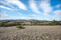
Siberian ridges with whitewash mountain. Beluha - Three-headed Sacred Mount Altai
Location
Mount Beluha (Alt. Uch-Sumer - Three-chapted, Kadyn-Bazhay - Top of Katuna) - the highest point of the mountain altai (4506 m), a crowded ridge. Located in the north-east of Eastern Kazakhstan on the border of Kazakhstan and Russia (Ust-Koksinsky district of the Altai Republic). The name of the mountain comes from abundant snow covering the mountain from the vertex to the very base.
Geographical data
Relief
Beluha .... the names of this mountain a lot: Belukha died the russian mountain for the abundance of snow cover. Altais called her "Uch-Sommer" - three-headed, "Ak-Symmer" - a white head, "Katyn-Bashi" - the top of Katun and Ak-Su-Ruu - White Water. Kyrgyz South Altai was called Belukha "Muss-Doo-Tau" - Ice Mountain.
Beluha is the highest point of the mountain altai (4506 m), a crowded Katun ridge. Geographically, the mountain is located on the territory of the Ust-Koksinsky district, where the largest Altai River - Katun is originated. The top of the White Mountain is represented by two vertices in the form of an incorrect pyramid - Eastern Belukha (4506 meters) and Western Belukha (4435 meters), almost falling to the north to the ankle glacier and gradually decreased to the south, towards the Katun glacier. The lowering between the vertices, the name of the "Bello Saddle" (4000 meters) also turns into the north to the ankle glacier (another name - the Akkem wall) and more than the South goes swaying to the Katun River.
Despite the fact that the Belukha Mountain is relatively low, it is still considered harsh and inaccessible, which is explained by the harsh climate of Beluhi: it is always cold here, shrill wind blowing, rocks almost everywhere are covered with thin glacial icing, and the Belochi region itself is located on The boundaries of the zones of 7-8-point seismic activity, and therefore the micro-semid sections are very frequent here, the consequences of which - the breaking of the ice shell, the gathering of avalanche and collaps.
The most complex is considered the route of climbing from the north on the Akkeke wall - the sheer section of the Northern side of Beluhi between the eastern and western peaks.
From all sides of Belukha is surrounded by glaciers. From the north, the Akkemsky glacier is descended (other names - the Akkem Wall, or the Rodzevich glacier), from the north-east, is a glacier Sapozhnikov (Jewygham Glacier). From the southwest there are Glaciers of Gebel (Katunsky Glacier) and Small Berelsky, from the south of Big Berelsky and Black Glaciers, and from the West - the stepped icefall of the trowse brothers glacier (Kucherlin Glacier). All glaciers are large, from 2 to 10 square kilometers. Many of them descend below the forest borders, so the path to the top passes through ice and snow. The total area of \u200b\u200bBelukhin glaciers is 70 square kilometers. They give rise to the river Katun and her tributaries. There is in the Beluga and Lakes area, the largest of them lake Akkese and Kucheral.
Beluha is also the highest peak of Katunsky Central Altai Range. The main watershed of the ridge is raised in the eastern part and forms at the junction of three springs with a snow-white crown. Remote to the same distance from three oceans - the quiet, Atlantic and Indian, it turned out to be the central vertex node of the giant mainland Eurasia.Beluha is the main top of the Central Asian continent. Only on the periphery of this extensive mainland region there are giant mountain chains and vertices formed by Paleozoic and young alpine folds. In the intracontinental region of Russia, Belukha there is no equal in absolute altitude, only in the Pacific zone of the mountains, its height is superior to Klyuchevskaya Natka on Kamchatka (4750 m).
Paleogenic raising was reflected in the nature of the relief - it is everywhere high-along, typically alpine, with deep gorges, vertical alpine ridges rise above them up to 2500 m. Large area of \u200b\u200bthe array are occupied by rocks, scree and sea. The slopes are susceptible to the devastating effects of the villages and avalanche. Beluha is a museum of a wide variety of geomorphological processes and relief forms.
Erosion and accumulative relief forms are widely represented in the Beluhi area:
- punctures (huge circcken recesses);
- tropows (troughting valleys treated with glacier);
- Carling ( mountain peaks pyramidal form);
- Baranje foreheads (indigenous breeds, settled and polished by the glacier)
- terraces, moraine (chip material of rocks falling on the glacier and transferred by glaciers to his language)


- fluvioglacial deposits Water-glacial sediments.
Beluha is surrounded by glaciers from all sides: from the north the Glacier Akkeke (Rodevich) is descended, from the northeast there is a glacier Sapozhnikov (Jewyghemsky), the largest of Beluhi satellites. From the southwest there are Glaciers of Gebel (Katunu) and the Small Berelsky, from the south of Big Berelsky and black, and from the West - the stepped icefall of the Glacier of the Trone Brothers (Kucherlinsky). All glaciers are large, from 2 to 10 square meters. Many of them descend below the forest borders, so the path to the top passes through ice and snow. The total area of \u200b\u200bBelukhinsky glaciers - 70 sq. Km. They give rise to the river Katun and her tributaries.
On the slopes of the Beluhi massif and in the valleys, 169 glaciers are known, the total area of \u200b\u200b150 square kilometers Mount Beluha carries almost 50% of the Katunsky ridge glaciers, which is over 60 percent of the area of \u200b\u200bits glaciation. By the number of glaciers and glaciation, Belukha ranks first at Katunsky Range.Beluha is also the highest peak of Katunsky Central Altai Range. The main watershed of the ridge is raised in the eastern part and forms at the junction of three springs with a snow-white crown. On the slopes - in the origins of the Katun River, its ducts and the rivers of Bereli - there are numerous glaciers (Mersu, Katun, Berelsky), the total area of \u200b\u200bwhich is 70 square meters. km. Natural zone The mountains are very diverse: the lower slopes are a steppe and forest zone, above - subalpian and alpine meadows, rocks, screaming, glaciers.
The first managed to analyze the origin of the name of Mount V.V. Sapozhnik. The researcher himself treats her name by an abundance of snow cover on the moans, from here - Beluha. Other names are given by the ancient Turks: Kadyn-Bazhi (Top Katuna), Ak-Sura (Morning), Musdutuu (Ice Mountain), Uch-Ayra (Mount with three branching). All of them do not contradict the face of the mountain and correctly reflect its physico-geographical features.
The climate of the Belukha region is severe with long-term cold winter and short summer with rains and snowfall. It changes, in accordance with the height tonality, from the climate of the valleys - at the foot of the vertex to the climate of high snow and glaciers. Instrumental observations lead two stations - Akkem and Karatyrek, located respectively absolute altitudes 2050 and 2600m. Near the Gleblare glacier, on the southern slope of Beluhi, was previously worked by the meteorological station Katun. average temperature July s valleys at the upper boundary of the forest 8.3 degrees with (accomes), and 6.3 degrees c (karatyrechek) were 6.3 degrees. In the summer, on top of Beluhi, it is not rare frost to -20 degrees C.
In winter, negative air temperatures are observed in January to -21 2 degrees C and remain low even in March to - 4 degrees C. Temperature inversion is widespread. By A.M. Komlev and Yu.V. Titovaya, normal annual Ospalkov For stations, Akkem and Karatyrek is 512-533 mm. Solid precipitates fall out at an altitude of 3000-3200 m, and their annual value is 35-50 percent of the total. In the prival-looking zone of Beluhi, more than 1000 mm of precipitation falls over the year. Mountain-valley winds and hair dryers are common here.


. Tian-Shan species of animals live here: Arkhar, a mountain goat, from birds - white and tundry partridge. From the sparrows dwells: Dvorchitsa, Alpine Galka, Himalayan cheer. The Siberian Mountain Reel is much less likely and an exotic look - Archery Dubonos. From the species entered in the Red Book of the Altai Republic, a large lentils, Berkut, Altai Ular live inhabit.
. From small mammals on rocky placers and eryniks are common: the tundry burzubka, red-gray, red and the biggest pools. In the origins of the Katun River, Altai Momovka and Cocor are inhabited by its right bank.
The first mentioned the grief of Belukha in his travel notes, belonged to 1793, the traveler P. Shangin. Lush, like Siberian fur coats, snow robes on the elegant shoulders of Beluhi made an indelible impression on him. Altai Mountain Beluha received worldwide fame after in 1923 a Russian artist and philosopher N.K. Roerich announced his intention to build on her ledge, at an altitude of 2000 meters, the temple, who had to become the sacred center of the world; At its top - to create a "place of meetings", and at the foot of the city of their like-minded people.
Geology The White Mountain Array is composed of middle and upper Cambrian. Many sneakers of the array are sandstone and slate outs. Less will spread conglomerates. A part of the array is based on typical flue-shaped formations. About the tectonic instability of the territory of Beluhi testify faults, cracks and rocks of rocks. Cool, almost sheer slip areas are characteristic of the northern slope of Beluhi, especially from the valley of the r. Akkem.
The Belochi Area is located on the border of zones of 7-8 ball seismic activity. Microelectrics are very frequent here. The consequences of them are the breaking of the ice shell, the gathering of avalanche and collaps. From Paleogeneogen, the territory is experiencing an intensive tectonic raising that continues and now.
The formation of the Belukhinsky potstation (elevated areas of the earth's crust) belong to early-taught time (1.5 million years ago).
Climate


The climate of the Belukha region is severe with long-term cold winter and short summer with rains and snowfall. It changes, in accordance with the height tonality, from the climate of the valleys - at the foot of the vertex to the climate of high snow and glaciers. The average temperature of July in the valleys at the top border of the forest is 8.3 degrees with (accomes), and 6.3 degrees with (karatyrech) are 6.3 degrees. In the summer, on top of the Beluhi, the frost is not rare to -20 degrees S. In winter, negative air temperatures are observed in January to -21 2 degrees C and remain low even in March to - 4 degrees.
Water resources
The Beluhi rivers include the Katun River basin, arising from the southern slope of the Glacier Glacier. Here also take the beginning of the Kuchecher River, Akkem, Idygham. Water streams born at the glaciers of the Beluhi form a special Altai type of rivers. In the nutrition of rivers take part of the melting waters of glaciers, snow, the rain precipitation has a slight value.For rivers, the maximum flow is characterized in summer and low during the rest of the year. Rivers are fleeting, often form waterfalls.
Lakes in the area of \u200b\u200bthe Mountain Belukha lie in deep carries and the trigger valleys. Their origin is associated with the activities of the ancient glaciers. Large lakes - Big Kucheral, the lower Akkem, etc.
Flora and fauna


For the Belukhinsky massif, as for any mountainous country, characteristic of the flow of vegetation. According to many researchers, the main part of the ridge belongs to Katunsky high-mountainous area, where a large variety of forest and high-altitude formations are noted: the lower slopes are a steppe and forest zone, above - subalpine and alpine meadows, rocks, screaming, glaciers.
In the upper reaches of the Katun River and the Koksa River, dark-willed forests predominate with a predominance of ate of Siberian, cedar, Siberian fir. Larch and deciduous breeds are common: Birch, Rowan. Shrubs are represented by Tollgoy, honeysuckle, Karagana. The role of cedar is significantly increasing, the honeysuckle and lingonberries are beginning to prevail from shrubs and shrubs.
At the top forest belt Birch has a round-hearted birch of shrubs; From herbs - subalpine and alpine dispersion. Currant and raspberry are also common here.
From small mammals on rocky placers and eryniks are common: the tundry burzubka, red-gray, red and the biggest pools. In the origins of the Katun River, Altai Momovka and Cocor are inhabited by its right bank. Occasionally come in trot, snow leopard, and from unfortunate: Siberian mountain goat.
Birds are much more diverse. From hunting-commercial: white and tundry partridges. From the sparrows dwells: Dvorchitsa, Alpine Galka, Himalayan cheer. The Siberian Mountain Reel is much less likely and an exotic look - Archery Dubonos. From the species entered in the Red Book of the Altai Republic, a large lentils, Berkut, Altai Ular live inhabit.
History of Places
The first managed to analyze the origin of the name of Mount V.V. Sapozhnik. The researcher himself treats her name by an abundance of snow cover on the moans, from here - Beluha. Other names are given by the ancient Turks: Kadyn-Bazhi (Top Katuna), Ak-Sura (Morning), Musdutuu (Ice Mountain), Uch-Ayra (Mount with three branching). All of them do not contradict the face of the mountain and correctly reflect its physico-geographical features.The first mentioned Mount Belukha in his travel notes, belonged to 1793, Traveler P. Shangin. Lush, like Siberian coats, snow robes on the elegant shoulders of Beluhi also made an indelible impression on him.
In the first half of the XIX century. Friedrich Gebler traveler opened here, at the origins of Katun, the first Altai glaciers. One of them is called him name. Goebeler made another discovery: it established that Belukhsky vertices are the highest point of Altai. Later, the height of the Beluhi was determined 4506 meters above sea level.
Well, the first ascent on Belukha was made in 1914 the brothers of the trows, in honor of which today is also called one of the major glaciers located above the Kucheral Lake.
World Fame Altai received after in 1923 a Russian artist and philosopher N.K. Roerich announced his intention to build on her ledge, at an altitude of 2000 meters, the temple, who had to become the sacred center of the world; At its top - to create a "place of meetings", and at the foot of the city of their like-minded people.
Predated Beluhu considered the sacred. And they also considered it the refuge of the Terrible Forces and were afraid even to look at her. It was believed that in her ice charges and caves, Erlick's evil spirit dwells, who shines anyone who dares to climb on the slopes of Belukhi: avalanches, stonepads, collaps. They said that everyone who dares to climb on Belukha will lose sight. Many of this now has an explanation. So, for example, the first coupons trying to climb the glaciers and snowflakes without dark glasses, really blind from the burning light.
Beluha has long been shrouded in a halo of myths, secrets, legends. Many believe that somewhere there is hidden a mysterious Shambala, Paradise, which will come after the disappearance of people.
Umai dwells on Belukha - the goddess of the Turks. Hence the great Buddha - Gautama came to India. Starbers believe that somewhere nearby is a happy country of Belovodier, to get into which not everyone may be.
According to others, beliefs from Beluhi right to Everest there is an energy bridge. Here is the center of the Earth, energetically associated with space.
The indigenous altairs closely do not approach their shrine. In general, the cult of the mountains is very developed in Asia - to the sacred or revered top approach, with humble in the heart, with clean thoughts.
But even now many believe that Belukha is a place energetically associated with space. They are confident that this "PUP" of the Earth (so nicknamed Belukha for the fact that it is equally removed from the three oceans - the quiet, Atlantic and Indian) can give people a charge of cheerfulness and health.
Beluha - not the most high mountain In the world, however, according to the degree of danger, it is among the first. Glaciers descend so low that almost all the way to the top passes exclusively on ice and snow. On the top of Beluhi there is only one relatively light route - along the Gleblera glacier, everyone else requires high climbing training. On the slopes of the vertices you can meet with snowy gluts, and with bulk snow, and with formidable avalanches. Beluha is rarely open, it is usually wounded into the clouds, and even in clear windless days you can see how snow flags of the most bizarre outlines are formed on its vertices. Bearing in mind this property, the Altaians say: "Beluha - a woman, beautiful and inaccessible, ... and according to that fabulously attractive." Not only the weather changes, but also relief. There are constantly icefoots of the stonepads. Beluha has unique natural features claiming relatively not high vertex On a row with the greatest peaks of Pamirs and Tien Shan. Suffice it to say that the peak of communism, being above the Beluhi by almost 3000 m, rises above the line of eternal snow only per 1000 m more Altai vertex.
Characteristics of the place of power


Psycho-emotional influence of Belukha
The influence of this mountain on human thinking is distinctly and noticeable even at a distance. This effect extends to the human community as circles on water. It is invisible for the eye, but felt at that moment when we start thinking about Belukha or, to learn about it.
The mountain is notable for its unconditional exposure to the nature of Altai, Russian Siberia, Northern Kazakhstan.
Energy of Beluhi consists of several stable, characteristic of this mountain sensations transmitted by non-verbal channels. First of all, it is a feeling of high mountains. it special state Consciousness, which clarifies thinking, feeds the romantic hearts of those who live in lowlands and on flat terrain. So it affects any high peak, but Beluhi has a special flavor. Due to the fact that this vertex is fully covered with glaciers, it derives harsh beauty and power.
In generalized perception of Beluhi also includes its special form. Mountain ridge (with this mountain) is located semicircle. This semicircle will open north. And for most observers, the beluga ridge works as a reflective curved mirror aimed at an observer. Such an impact creates an energy overload of the observer's thinking and requires its implementation.
Behind this generalized impression is a bright state of identification with the mountain itself. It is brought by those who climbed the mountain itself or approached as close to her foot. This layer of sensations in the collective consciousness is found not immediately and carries a distinct emotional force and clarity of perception. In addition, this is present a vector focus of precipitated attention to the north for the flow of the Akkem River.
Another major characteristic of Beluhi is an accum and a wonderful ecosystem, who seizes the stone dies between the lower glaciers and the beginning of the lake itself. The ecosystem is engaged in Belukha and creates the effect of a living organism grown under its protection. And the lake of the accum soothes and adjusts to contemplation.
Well, another factor affecting and filling the living creatures of energy is the active movement of the air masses around this mountain. Such a living climate leads to a rapid change in weather and this contrast, as a charged battery, attracts a huge amount of natural energy to the mountain.
All this could not not have their impact on the mythology of the mountain itself and on its social attractiveness later. The social aura, which envelops Belukhu, has lamination and penetration into this lamination is possible only with the personal presence in the mountain aura. This layer is possesses a very interesting feature - each surface layer has grown in the previous one, and the deeper it is to penetrate into this layer, the better the human experience gaining the hill in this place.
Practice and technology work with the place of force


As a place of power, Belukha is serious enough to use her in trifles. This place is best suited in order to support a very important, intimate goal. The goal that will benefit not only to you, but also to other people. The goal that will be beneficial not only to people, but also to other living organisms.
The future of each of us is formed from our past and the social trend that surrounds us. It is very important when selecting your future, look for him in yourself, to prove the possibilities of his emergence outside of yourself, and know how to achieve it. Such a look at the future is constructive and is an excellent rail for the direction of the energy that felt around the beluga.
Belukha will make your way creative and promising. It will add to your image of importance and tranquility.
With a more professional approach, the egregional activity that mastered Beluhu is quite applicable as gasoline to move towards different purposes.
Belukha appears unexpectedly in the lumen of dark firings, 1000 m above the surrounding mountains, shining in heavenly blue thinly outlined white faces. Unusually beautiful spectacle! But not only with its beauty attracts Belukha. Altaians consider Belukha sacred. In Altai, there is a legend of insidious and evil spirit of Erlik, inhabiting in ice draws and underground caves. He must show anyone who dares to join even on the slopes of the mountain, in the refuge of the Terrible forces, manifested in avalanches, stonepads, collaps, thunderstorms. It is here, in Altai, two centuries in a row Russian people sought mysterious Belovodye - a sacred country, the country of happiness and joy. The peaks of Beluhi are closest to the sky, so since ancient times the mountain was considered the inhabitants of the gods and spirits. Under the ancient beliefs on Belukha lives Umay - the goddess of Turks, Belukha is a house of lightning, thunder and a double-headed eagle. Lightning - the commandment of the gods to create life from his very center itself, the awesome fire can hit the uninitiated, obsessed pride, can bring light and enlightenment to the pure heart.
The indigenous altays worship this place, and do not disturb him in vain, believing that the mountain is taking a threat to those who are unprepared to come in touch with him.
And the legend walks in Altai, that once the whole people left underground, so as not to submit the "White King". The image of the Beluhi is associated with the arrival of white Burkhan, with the prophecies about the Great Future. The following prophecy is also associated with Belukha: When Belukha changes its outlines, the time of the new religion will come. Altaica Beluhu called "Temmer" (Three vertices). The indigenous population calls her also "a mountain for which you can not step by feet." One of the peaks of Beluhi is called Urusvati. Sahaja Yoga believes that the Uch-Summer is the embodiment of trigunutmiki (three forms of the Great Goddess): Mahakali, Mahalakshmi, Mahasaravati.
This grief is not just passing. You will not drive it on a comfortable car. To a certain place, the track leads, and then 50 km need to go on foot, not everyone will pass, you need to be prepared. Narrow trail, narrow gates ... on both sides of the trail - two lakes, the distance between them is not more than a meter, one black, lifeless; Other - blue, transparent, on the bottom there are stones. It is as an allegory of the ego and a person's super-human and a narrow passage to the Agia Chakra, which must be crossing up to move from the mental perception of the world to the spiritual.
When you pass the "narrow gates of Agia", a beautiful panorama opens in front of you - a huge three-headed peak of sparkling snow and ice.
Energetically, the "Women's Beginning" is very felt here. Altai people call this mountain Kadyn-Bazhay - "Great Shakti" (i.e., the Great Goddess).
Panorama with Kara-Tareare Pass on Belukha, Akkese Lake and the Yarla.
On Belukha there is an Akkem wall - a two-kilometer sheer block of ice. Almost all over the height of the Wall Nature created an image of a woman standing in full height, her hair flunks her dress. Not everyone who visited Belukha, see a woman, local residents Call her spirit of the mountain. The most amazing thing that every two years she carries in the hands of a child.
At the foot of the mountain there is a lake Akkem (tourists call him Mecca, if you read the name on the contrary). Beautiful mountain reflects in the clean water of the lake ...
The main River Altai is originated from Beluhi - Katun, the Altai Name "Kadyn" - "Mistress", "Woman", "Beauty". Katun changes its colors each season: in winter it is stolen; In the spring, when stormy and full-flowed, when sand and gravel are washed out, she is gray; In the summer - white - limestones are washed out at this time. But the most beautiful Katuun in the fall, when it becomes emerald green.
Merging with r. Bay ("Bii" - "Vladyka"), they create the great Siberian river Ob ("O" - "calmed down", "humble"). A lot of legends and legends are folded about Altai Rivers.
Hearing all these stories, legends and legends, it is difficult not to decide to go to worship with a snow-white beauty, but maybe if it is lucky, and see the world from her top. This mountain manits thousands of people from around the world. However, it is not so easy to see it. From the nearest car roads to it, it is necessary to pass more than a dozen kilometers by mountain trails, overcome passals. However, nothing stops passionate. The Altaians believe that in the sky over the ridges of the mountains is the spirit of Altai with the companion of Umay-Hene - Mother Umai. In honor of them on the trees of Potals, the Altai, and now tourists, they say white ribbons, because they depend on them whether there will be a prosperous path. Water Ak-Kema Milk-white. "Ak-Who" translated "White River". Left will come out the purple ridges of the valley of the crown with the glada of Edelweices, to the right of the valley of the seven lakes. The unearthly beauty of the sparkling two-headed vertices, an amazing shift of the paints, the proximity of the sky, the flickering of stars on Ak-Keme and Semiodezier - the reflection of the Divine beauty on Earth, and at the same time the center in which the "two worlds" are connected: Hell and Paradise, Darkness and Light, Death and a life. Two black Mountain Armor and Boris, as two guards, frame from two sides
On a snowy slope you can see the girl - the soul of the mountain, which creates the wind and the coolness of the wings. On a sunny day, its snow-white clothing, reflecting the sky, acquire a golden glow, giving upgrade and hope, to everyone who looks at her. At night, along with the stars - snow-white lambs, it is reflected in the depths of the Ak-Komsco lake, reminding that our soul is formed in the dark, in the darkness of the underground world. With his dance, the girl offers to connect with the sacred spark inside you and show it in the world, as a conductor in the kingdom of the soul, she is always with you.
Mandorla, born by the intersection of the two-headed vertices and the sky, warns about the test that would have to have anyone who wants to approach Belukha, to conquer her, touch the sacred. Mandorla recalls that in order for the events in the earthly reality, it is necessary to meet the tests in the earthly reality, including all the opposite poles of life: good and evil, love and hatred, and combine all these aspects of bright and dark.
It's not difficult to get to Mount Belukha, but to the shrine of the Golden Mountains - Belukha - the path is not simple. Store purity, Weekly Mountain can be covered with clouds, and avalanches go one after another ...
If the Belukha takes you, then you may be lucky to see the Orel dance. This is a sacred dance that will strengthen your spiritual aspiration, urgent vision and the ability to soar in the clouds.
This is what Sergey Alekseevich Filimonov, Master of Sports on mountain tourism, the Belarusian "Snow Bars" (i.e., the one who climbed five seven thousandnesses): "Altai differs from other areas in which I had to be. When I Went in purely sport hikingAltai attracted the proximity of the glacier and the forest zone. Those. It was possible to scream in the ice all day, and in the evening go down to the grass to the fire. Each RA
An unusual picturesque landscape opens in front of the traveler who went to admire the huge Altai Glacier located in the upper reaches of the Katun River. Like a full-water river from the vertices, snow-white streams that make separate sleeves are descended. This is Katun Glacier, feeding the source of the Katun River.
The second name is the Gleblare Glacier. He is named after Friedrich Augustus von Gebor, an outstanding natural scientist, geographer, corresponding member of the Russian Academy of Sciences. Traveling in the southern slopes of the Beluhi mountain in 1835, he first saw and described this glacial education.
His ancestors belonged to a well-known old family and occupied high positions at Prussian and the Austrian courtyards. The 16-year-old Junior Gebler entered the university of the city of Yen, where he studied medicine and natural sciences. At the end of the university received a doctor of medicine and surgery.
Having learned from the newspapers that the Russian government invites for the work of foreign specialists, Geborler in 1809 comes to Petersburg, and then to Altai, in Barnaul, who soon became the second homeland. In addition to Medicine, Gebler was engaged in research by Katun and Chui proteins, Kuraysky Ridge, Valley of the Chii River, Salair Roggy, and other places of the extensive Kolyvan-Resurrection District.
The results of his research is a rich herbarium of the Altai Flora, a description of the Altai mountains, lakes, population, varieties of Altai fauna. In those distant years, Siberia was just beginning, and Friedrich Gebler became a pioneer of Altai entomology, describing many new types of beetles.
In 1836, his great work was published "Review of Katuan Mountains with their greatest vertex Belukha in Russian Altai." For the first time, the famous Beloku glaciers were investigated and deposited on the map, rock rocks, the categories of Katun Range, Animal and vegetable world Alpine zone, the origins of Katuni.
Goebeler was one of the founders of the Museum of Local Lore in Barnaul and constantly contributed to its development. From 1812, Dr. Geborle received Russian citizenship and received a name Fedor Vasilyevich (Wilhelmovich) Gebler.
If you carefully look at the outlines of the Katun giant, you can immediately notice two main streams - "East" and "medium". It is they who feed the saddle of the Mountains of Beluhi. Another influx - "Western" adjoins them from the opposite side.
Traveling through the eastern direction of the glacier, it can be noted that it is located below the descent from the saddle, covered with gigantic cracks and seeks further in the southeast direction. After 350 meters, it goes into a drop-down stream with steep snow-franchise canopies.
The central stream, located on the right side of the glacier, forms two branches. One of them goes left from the descent from the saddle of Beluhi and stretches to the south. The sleeve of the glacier is cool drops down, forming a stepped bed and icefalls, which are above and below the jumpers of a separate crest. Here, the central flow merges with a big right branch, which descends on the slopes of Western flares of Beluhi.
In several places there are visible gigantic cracks that form icy grots of unprecedented beauty. From one such ice gorge and river Katun river.
By the way, according to scientists, for 120 years of study, the largest glacier of the Beluhi decreased in size by almost 2.5 kilometers. The speed of the departure of the glacial education depends on many factors that currently Trying to find out experts. The rapid melting of the Glacier Glacier cannot but cause anxiety, every year he is on average retreating 15 meters. Over the past decade, the glacier has become less than 150 meters. The main reason causeing so fast melting is the warming of climate.
# Gardengebler # Katukhuchnik # holidays #rfarus
It is worth noting that there are several geographic objects with Toponym "Beluha" in Russia: Mountain, River, Island and nature Park In the Altai. We will talk here exclusively about the top. The Beluha Mountain has always been a sacred, sacred object for the peoples of the Altai Mountain Altai. She is even awarded to attend the modern coat of arms of the Republic of Altai. Altaisa refer to her "ӱch-some", which is translated as "trothing top". After all, this kind of from afar has a Mount Belukha. Photos of this beautiful vertex you can also see in this article.
Mount Beluha is located in the Ust-Koksinsky district of the Altai Mountain Altai. It is the highest point of Katun Range and the highest point of Siberia. Beluhi has two vertices, in the form of an irregular pyramid - Eastern (4506 m) and Western (4435 m), between which there is a slide - "Belohi saddle", with a height of 4000 m. Two peaks of Beluhi and on the left and on the right vertices of Delone and The crown of Altai, form an accy wall, almost vertically falling down towards the Akkele glacier.
Mount Belukha
On the territory of Russia, behind the Urals, only in Kamchatka there is a vertex exceeding Belukha - Klyuchevskaya Natka. But not so much height of her attracts this mountain. As the climbers say: Beluha is not for records, but for the soul. From it there is some special impact, which is noticeable even at a distance from her foot. For the first time seeing Beluhu, a person is filled with delight. In the valley of the lake Akkem, at the foot of Belukhi, atmosphere atmosphere atmosphere and fraternity with everyone, nearby, even unfamiliar people. What felt tourist.ru, having visited in August 2008
Mount Belukha 
Altaica worship Belukha and consider it to the sacred mountain. Altai names Beluhi - Kadyn-Bazh(Top Katuna), Ak-Sura (Morning), Misdutuu (Ice Mountain. Beluha Non-easy mountain, it is an antenna, receiving information from space, transforming it, and extending to the whole land. People prepared, harmonious, in connection with nature, They can "communicate" with Belukha and "read" the information that she carries. Beluha has a harmonizing effect on a person, increasing its sensitivity and love for nature.
Mount Beluha consists of Cambrian rocks. Many rocky sorrow of the mountain - this is nothing more than the exits on the surface of the shale and sandstones of the Central and Verkhnekmbrry age. Conglomerate formations are also found, but much less often. An array of the White Mountain is unstable in a tectonic plan, in this area, weak earthquakes occur in this area.
The latter may be causes of collaps and sudden avalanches, which constitutes a serious danger to tourists and climbers. In Paleogen, the Mountain Array of Beluhi began to test the tectonic raising that continues today. The result of these processes was the formation of typical alpine type landscapes here, with steep rocky crests, massive oids and deep canyons.
In addition, the territory of the array is extremely subject to fission and collapse. Thus, here you can meet a wide variety of relief forms. The climatic features of the territory is very important for tourists and climbers are knowledge of the characteristics of the climate of a specific territory.
The climate of the Beluhi massif is characterized by severeness.
Winter here is cold and long with air temperatures up to -40 degrees, and summer is short and rainy with temperatures that do not exceed +10 degrees in the valleys. But on top of Beluhi, even in the summer may be frosts to -15 ...- 20 degrees Celsius. To this you need to be prepared when climbing Belukha.
Within the mountain per year, about 500 millimeters of precipitation falls. At the same time, 30-50% of them falls in the form of snow. On the slopes of Beluhi, the mountain-valley winds and Finu are quite common.
Mount Beluha - one of the leaders in the Altai in the number of glaciers. Total within this array is aware of 169 glaciers of different sizes. Glasiologists (scholars studying glaciers even allocate Beluhi glaciers with a separate type.
The largest of them is the glacier Sapozhnikov, which stretches for ten kilometers long. From glaciers, the Belochi flow rivers that mainly belong to the Katuni pool. They feed in the main glacier, as well as snow waters.
For all rivers, the massif is characteristic of the rapid flow, the abundance of cascades and waterfalls. There are several picturesque lakes, which are confined to the carama and ropes (ice mills relief). 
The famous Mystic Artist, Traveler's Artist Nikolai Konstantinovich Roerich in 1926 who visited Beluhi during his Central Asian expedition, also noted the unusual space near Beluhi. He wrote: "We saw Belukha. It was so clean and ringing. Straight links. The artist felt that there was an energy bridge between Belukha and Everest, as two cosmic antennas. "Altai - Himalayas, two poles, two magnets" - so he wrote in his diaries. Roerich made a large number of etudes in the Beluga area. And after the Beluhi visited the south side, he wrote a picture of Beluha. In 1942, Nikolai Konstantinovich wrote a picture of "Victory". In its first plan, a warrior in the ancient Russian armor, which struck the dragon. On the second - shining peaks of Beluhi. In honor of N.K. Roerich and his family members are named four peak of Katunsky ridge in the Beluga area. 
The first records about Belukha appeared over 200 years ago, when the Russian scientist and traveler P.I. Shangin in his expedition across Altai, having visited the Uymon Valley, recorded stories about Belukha hunters and prospectors.
Beluhi first managed to achieve the same in 1835 by the scientist and researcher, the doctor of the Kolyvan-Resurrection factories by Glebor Friedrich Vilgelmovich. In order to collect and study medicinal plants, he traveled a lot in Altai and in 1836, seeking to source Katun, he came up with the south to Belukha and opened the Katun glacier, subsequently named after him and the Berelsky glacier. Gebeler then rose to the southern slope to the border of the unnoticing snow, made an attempt to determine the height of the beluga. Later in his article "Comment about Katuan Mountains", Geborle says Belukha, as the highest top of the "Russian Altai". 
The Siberian Researcher and Scientist, Professor of Tomsk University of Vasily Vasilyevich Sapozhnikov, who, from 1895 to 1911, was repeatedly in the Beloup area from 1895 to 1911, who, from 1895 to 1911, was repeatedly in the Beluga area with North and the South Party and discovered and described the Glacier Massifle: Glaciers Akkese , as well as their tributaries and satellites, a black glacier, Mushy (trident brothers) and several other glaciers in the headwaters of Kuchurla. In 1898, after two unsuccessful attempts in previous years, Sapozhnikov with their companions reached Beluhi saddles and measured the height of her vertices. 
The first catalog of Altai glaciers was compiled by Boris. Trone. Brothers trone after three attempts held for two years, for the first time, managed to climb the top of Beluhi from the south side in 1914 and this year is considered the beginning of mountaineering in Altai. 
Flora and Fauna Mountains
For mountain range, Beluhi is characterized by very rich vegetation with a huge manifold of forest formations. The belt belt reaches the marks in 2000 meters here, the subalpiic belt with a parel, shrubs and disintegration begins above. On the mountain slopes, you can find many rare plant species (up to 30). Among them - the gibbleness of the Ukok, the Krylov Phackle, Rhodiola pink and others. From representatives of the world of fauna, you can meet the ground, snow leopard, a mountain goat and lynx.
However, Ornithofaun Beluhi is richer. Within this area, different feathers live: Galka Alpine, Berkut, Lentils and others.
Beluha Mountain: How to get to the top?
To climb the mountain you will need the appropriate tourist (or climbing, depending on the complexity of the selected route) Equipment. The most suitable for conquest Beluhi is the period from June to September. Of course, for a safer climb, it is desirable that the team has a person who is familiar with this terrain.
How to get to Beluhi?
The easiest way is to use the following algorithm: get there by train to Barnaul; Getting by bus to Gorno-Altaisk; Then take the bus (or by taxi) to the village of Tungur; Get on foot to the foot of Beluhi. The starting point of your trip should be Gorno-Altaisk, 250 kilometers from which the Belukha mountain is located (the photo of the nearest grief major city - Below).
Next, you need to move towards the village of Tungura, where numerous tourist complexes are located. In this village you will tell you in detail how best to conquer Belukha and which of the routes to choose. From Tungu to the mountain itself - about 50 kilometers.
And this site will already have to overcome on foot (either - on horseback). There are several routes to Mount Belukha. You can climb to its vertex from the south ( a tourist route Categories 3A, simpler) or from the north, according to the Acceiture Glacier (climbing route category 4A-4B, the most complex and dangerous).

In 1926, an attempt to ascend the eastern way to Belukha is more difficult, from the north side, two climbers from Leningrad, N.V. Zelheim and B.N. Delune. Experienced climbers remained overcome the height of about 400 m, the code in front of them from the ridge, later called Delone, broke down a large snow eaves. Expedition participants had to return. Another expedition under the leadership of Vitaly Abalakov, who smiled at luck, and the participants of the campaign for the first time reached the tops of Beluhi from the northern side for the first time.

In 1935, the first Allupist Alpiniad was held in the Beluhi area. Members of the Alpiniad - 84 people climbed the southern slopes of Beluhi. Of these, 43 people have reached the vertices, and the rest rose to the saddle. This year, all the central newspapers wrote about Beluhu.

In the next 1936, it was finally conquered, and the Western Top of Beluhi. We especially visited the Beluga district after the 60s, when many nearby peaks of Katunsky ridge were found and passed. In the period from 1982 to 1988, the foot of Belukhi acted international alpinist camp. 
Beluhi district is interesting for researchers and as an area of \u200b\u200bancient glaciation. So k.g. Tyuments, who worked with an expedition from the south side of Beluhi in 1933, allocated four epochs of glaciation in Altai. The ancient glaciers of the Katunsky Range, going down from the mountains, formed a lot of valleys filled with the melting of glaciers with water. So many lakes were formed, in particular the lake of the accum at the foot of Beluhi.
Beluha is one of the main Ice Centers of the Altai Mountain Altai. 
On the slopes of the array of Beluhi and in river valleys associated with it, there are about 170 glaciers. Half of them bears the Mount of Belukha. In the names of glaciers, the array of Beluhi is perpetuated by the names of its researchers. The longest Glacier of the Katun Range, descending from the eastern slope of Belukhi - Mersu, was named after the faithful explorer Beluhi - Sapozhnikov. Its length is 10.5 km, the area is 13.2 km2. V.V. Sapozhnikov, who opened the Akkem Glacier, begins on the northern slope of Beluhi, called him in honor of his companion on the expedition, with whom they made shooting glaciers together - V. Rodzevich. The length of this glacier is 7 kilometers, and the total area is about 8.5 km2. Katun Glacier on the southern slope of Beluhi, named after its Gleb Owner. The brothers of the trones, the first beasts on Beluhu, are immortalized in the title of the Musiversion Glacier (brothers trone). The length of this glacier is 10.3 km, the area is 8.6 km2.

The Beluhi area is located in the zone of increased seismic activity, there are often microdellers, as a result of which cracks appear in the ice cover of Beluhi, collaps and avalanches. 
The climate in the area of \u200b\u200bBeluhi is severe. Negative temperatures are kept until March at the foot of Beluhi. On the top of the same Belukhi and in the summer there is often a temperature of -20 degrees S. Best time For a campaign to Belukha - the end of July is August.

In January 2000, Belukha and the territory adjacent to it: the Lake Akkem, Kucheral Lake (about 357,000 hectares) became known as the "Beluha National Park". Having visited the top of Beluhi or at her foot, I would like (and all contributes to this) so that a person began to feel like a part of nature and nature, part of himself and relate to it as gently, as to himself.

Lifting on Belukha from the south by the simplest way
(This path is simple only compared to other, it is necessary to skill and experience the passage of category 2B and the readiness for 2.5 km a set of height, fair physical exertion and possible non-judgment with forced debt!)
This path is estimated as 2B-3A and occupies 3 not too tense days in prepared and acclimated tourist group. On the rise there are short steep (up to 60 degrees) of ice, so that cats are better to have platform. About half the path passes through closed glaciers with plenty of cracks.
The rise consists of 3 parts:
1. From the beginning of the glacier to break in a separate ridge,
2. From the gap in a separate crest to the saddle of Beluhi and
3. On the saddle in. V. Beluha (per. Katyn-Bash) and from there on c. V. Beluha.
Lifting scheme
1. From the beginning of the glacier to a break in a separate ridge
There are two ways: along the central branch of the Katun Glacier (L. Hablera) and on the left (orogr) (l lion. Hablera). The central version is held on ice and rocks on the joint of the glacier and the ridge, this path is indicated on the diagram of a thin dashed line. So go easier with a large number of snow.
However, in the past few years, there is a noticeable reduction in glaciers and snowballs in the area, so that the path on the left branch of the glacier is described here. In distinguished from the first path, the path is marked with bold points.
Trail on the left (orogr) shore r. Katun is suitable for a glacier and begins to climb the moraine ridge of the south-east of the glacier to bypassing the lower houses. It takes 1.5-3 hours of pure time. As soon as the icefills end, it makes sense to immediately turn on the glacier - it's easier to go. Next, along the canopy part of the glacier to the second stage of the icefall l. a lion. Habler (seraki) approximately on the left quarter (along the way). The next place where you can get up, only in the area of \u200b\u200bthe separation of a separate crest, which will take 1.5 - 3 hours, and if you do not immediately find the path in serak, then more.
From here, the easiest way to climb the meters to 50 straight up and only then to go to the lower part of the snowfight, visible in the upper left corner of photographs between rocks and serases. Well choosing the way, it is possible to pass this site for 20-40 minutes without the use of the rope (except may, the last 5-10 m lifting on the snow shelf itself).
Then there is a simple rise in this snow pocket within 0.5-2 hours (depending on the presence of steps on the snowfield).
2. In the zone of the separation of a separate crest, you can put several tents, however, the place is not very cozy - easily blown. It is somewhat more convenient to get up to 300-400 meters further, close to a separate ridge, meters on 100 left trails.
Further from the breaking of a separate crest and almost to the saddles of Belukhi goes quite strongly torn closed glacier, choosing a path to which (if there is no trail) can take away a lot of time and strength. Along with major visible failures there are many medium and small closed cracks, so that the ligaments are required.
Approximately half of the way (the square in the diagram) goes to the right of lifting on the lane. TKT, before this place to go 2-5 hours. Here, the trail on the saddle of Beluhi turns to the left and the path is changing somewhat: the crack is becoming a little less, and on snowy respects are not very steep places on which you can dig space for a tent. It makes sense to do if the snow is strongly raskying √ the next morning in Nasta is going much faster. But in this case will have to get out of the dawn √ Before the saddles of Beluhi 1.5-3 hours.
By the end of the XVIII century. All Altai land entered the Russian Empire. Research and subsequent colonization of these lands was due to the ore wealth of Altai, as well as the presence of deposits of semi-precious and diverse stones. Search parties were created for their production, mines and plants were opened, where the engineers often worked by the ribbing foreigners. The management of factories also provided support and financial assistance to research expeditions of European scientists. Therefore, the first researchers of Altai were, mostly foreigners.
In 1771, Altai visited Peter Simon Pallas, leaving detailed description western country. Palace decided that Altai Mountains is the greatest in the world. As a result of the trip to Altai and Sayanam Pallas published the "theory of the formation of mountains."
In 1786, a service journey of Peter Shangin, a mining officer and the manager of the Salair mine was taken. Shangin explored the pools of the Inni Rivers, Charyusha, Kokusun, Katun, Kumun and Buktarth with the tributaries in them and opened the Self-Global Stone deposits in the Korgonian Range. In the diaries of the researcher, there are also the first mention of Mount Belukha, in its expedition on mountains Altai managed to reach the northern slopes of the Katunsky ridge and visit the Uymonary valley, where the description of the Belukhinsky array was made from the words of hunters.
For a number of years (1806-1809), in the mountains of the South Altai conducted research G.I. Spassky, geographer and geologist, historian and archaeologist, Corresponding Member of St. Petersburg Academy of Sciences. Spassky lived for more than 8 years and worked in Altai. He worked at the Mountain Office of the Kolyvan-Resurrection District, traveled a lot - visited Salair, Rudny Altai, Rippiece Buktarth, Mountain Kolyvan, Rippiece Charyusha. During travel, except for the general studies, led the observation of the animal world, for the state of the weather, followed the level of p. Obi at Barnaul, studied the climate, the nature of Altai. Much attention paid to the history of mining production, described the ancient mining and remnants of a melting case, rock paintings and writing.
In the summer of 1826, a trip to the mountains of Altai was made by Professor of Derpt University of Karl Friedrich Lepsur and his colleagues Dr. A.F. Bunge and K.A. Meyer. They were the first to see the glaciers of Katunsky ridge, but low clouds did not allow to make their detailed description.
In a few years in 1829, Altai visited the Great German Traveler Alexander von Humbolt. He studied the relief and the geology of the Altai Mountains, and also familiarized himself with the production of the mooring on the Kolyvan-Resurrection factories.
A completely exceptional example of serving Altai can be seen in the fate of one of his largest researchers of Dr. Friedrich Wilhelmovich Geborre. In the summer of 1835, he brightly penetrated Belukha. But the trigonometric measurements of the top height did not succeed, the height of the beluga traveler defined an eye about eleven thousand feet or 3352 m. The suggestion of the existence in the Katun Alps Gütters was confirmed. Goebler opened two large glacier - Katun and Berelsky. This is your journey and open glaciers, he described in the article "Remarks about Katun pillars constituting highest Ridge In Russian Altai. "
The highest peak of the country - Beluha Since the time of Gebor, I have not seen the researchers until 1880, when N.M. Nadrintsev. And after the Yadrintseva, Belukha was not attended for another fifteen years.
And in the summer of 1895 V.V. Sapozhnikov goes to the first expedition to Altai. In less than a month of field work, he conducts studies of already well-known glaciers and opens another glacier, which calls black due to the large pollution with the ground material. So the time of great interest in Belukha begins. In 1897, the shoemakers again at Beluhi. For this season, he "managed to visit from all sides, except for the Horovyev Kuchera, and make a pretty clear idea of \u200b\u200bthis bulk." This year, he opens up the Hopper Icepieces and Jedyghem, one of whom is the Glacier's largest in Altai.
The summer of the next 1898 was for a scientist most fruitful. Sapozhnikov "For the third time, directed by Zhasather and Koksus valleys to the origins of Katun with the solid intention to take climbing Belukha." Until now, none of the researchers have risen above the foot of a separate crest.
There were five of them:
- honorable professor
- student of Tomsk University of Vinokurov,
- three conductor from Kathada: Vitaly Arkhipov, Kuzim Czimmin and Innocent Matay.
"All three are beautiful walkers," wrote V.V. Sapozhnikov, but a well-deserved preference must be given to I.Matya, a tireless hunter for stone goats, marals. I must have a lot of courage and resourcefulness, both last year's climbing on the saddle Iikut and the present - on the saddle of Belukha. " In the middle of the day, on July 18, the detachment came out on the assault of the top, and by five o'clock in the evening already became a camp on the rocks of a separate crest. There were still fuel - dry brittle bushes of juniper; That was enough for the whole night. It was clear and quietly, and in complete haillessness, the waters heard a sharp metal laughter of ulars from the opposite slope of the glacial valley. When the morning came, the detachment continued the path. For two hours in the afternoon, shoemakers and his companions reached the saddle. "We stopped in front of a terrible breakdown on the Akkem Glacier. Close to the edge was not safe to the edge, as giant snow canopies were formed over a rocky wall here, together with whom we could be on the Akkem Glacier, which was not included in our route. "
The main task of Sapozhnikov was a barometric definition of the height of the saddles of the Beluhi and photographing the mountain chains. The professor put his bulky photographic equipment and made several pictures. The countdown, shot from the aneroid, gave a height of 4065 m for the saddle. This height corresponded to the theodolite measurement. Until that time, the height of the Beluhi was estimated on the Glebor in eleven thousand feet (3352m); The results of observations of Sapozhnikov showed for Eastern vertex 4542 m, for Western - 4437m, which is very close to modern data. During his travel, the origins of Katuni, along with the main ridges of Altai, made a lot of discoveries, reaching accurate maps The largest modern glaciers, in particular, Rodzevich's glacier (now the Akkem Glacier) on the northern slope of Beluhi Mountain (1897). In 1911, he again visited Russian Altai - Katun and Chui proteins, putting the beginning of a systematic observation of glacier regimens.
When the mountaineering went to Altai, in the center of all of all the attention was, of course Beluha - partly because each climber attracted the opportunity to become the first watersman of the greatest vertex of Siberia. In 1904, an attempt to ascend to Belukha took Samuel Türner. The Englishman made an ascent from the Akkem Glacier and reached a height of 4300 m, but obviously underestimated Belukha or overestimated his capabilities - the top was never taken. However, you need to pay tribute to his courage, ascent in April  exacerbates weather conditions, and the selected route requires special skill and experience. Later he wrote in his book "Siberia. Notes on travel, climbing and research »The following words "Panorama was such an alpine sunset. I felt that my journey was not in vain. Soon, I hope others will visit these mountains and write their impressions. And who knows, maybe one day, after the pioneers hack the ancient loneliness of these mountainous regions, organized excursions will be given here for the good of Kalmykov. And the owners of Kalmyk hotels will make their small state, as their Swiss predecessors did ... ".
In 1907 - a certificate of increased interest in Belukha - a group of young people (the grandchildren of F.V. Geblera - I.V. and O.V. Geborler, as well as P.V. and V.V. Scpeetov and S.A. Bellevsky with the conductors of Juvenalem archup and the proof system) make an unsuccessful attempt to climb to Belukha.
In 1911, in the Belhi district, a fifty-year-old Professor Vasily Vasilyevich Sapozhnikov rises for the fifth time and takes another attempt to climb the saddle, and perhaps on top. First, the climbers wandered in the labyrinth of the cracks of the Eastern Labor, then almost a week were sitting in the tents, waiting for the weather. But Beluha did not seem from the clouds and the climb had to be canceled.
In 1913, the Boris brothers and Mikhail Trows continued to study the South Altai Range study, and then attempted to climb Belukha. However, bad weather interrupted it at the very beginning.
In 1914, Boris and Mikhail Trows, after two unsuccessful attempts, made the first successful climb on Belukha! This event is considered to be the beginning of Altai mountaineering.
After starting on July 25 from Bivak on the shore of Katun, accompanied by local conductors, at 9 o'clock in the morning they began to rise across the Katunsky glacier, and for 16 o'clock they stopped on a bival at a separate crest. July 26 to 10 o'clock climbing rose to the saddle. The weather began to worsen, and the conductors abandoned further lifting. Despite this, the brothers continued to climb the eastern, higher vertex. On the crest they were overtaken clouds, a snowy croup went. The movement also complicated strong wind. Despite the unfavorable conditions, at 15 pm 30 minutes, the waters reached the top. In total, about thirty-chassis was spent on climbing and descent.
The next time Beluha saw the waters on their slopes only 12 years later in 1926. Two attempts to climb Belukha were taken. Two mountaineers who worked in the Leningrad Exploration and Geological Party of the Academy of Sciences of the USSR under the leadership of N.N. Padurova, who was sent to the Belhuhi area to study Radium deposits. One of them was Boris Nikolaevich Delone - Mathematician, who later became a member of the Academy of Sciences of the USSR and the Honored Master of Sports on the mountaineering, the second - student N. V. Zelheim.
The path lay from the Akkeke Glacier to Pass (named later in honor of Delone) and further - on the northeast ridge, the top of which was also named after the peak of Delon. Experienced climbing climbing climbers were approaching a height of 4100 m., But then they were forced to turn back, because in their eyes the huge fondor cornice collapsed.
Interestingly, this expedition of Padurova crossed in Altai with such famous personalities as Grigory Choros-Gurkin and Nikolai Roerich. Choros Gurkin directly participated in the expedition of Padurova, was her conductor and an artist. In funds National Museum The Republic of Altai is stored several dozen of its etudes and drawings of this period. On one of the sheets, the pencil is drawn the line of the Mount of Beluhi and recorded: "Sunrise on Beluhu in 1926. B.N. Delune, Padurov N.N., Zelheim. "
Nikolai Roerich with other participants of the Central Asian Expedition in 1926 visited Altai on the way to Mongolia and Tibet. A member of the expedition and friend of the Roerich family Zinaida Fosdik recorded in his diary: "In the evening, we were visited by a geologist of Padurov, Professor of Mathematics and a university student who had just arrived in the village (Upper Umon). The first is very pretty, from the geological committee of Leningrad. They lived in the Akkema, they were engaged in scientific research, they found radioactivity. Climbed to Belukhu, told about the amazing beauty of this area. "
Thus, it is likely that in climbing Belukhu, 1926, the head of the geological party of Padurov was also participating.
In another group, 10 people who tried to rise to Belukhu from the south, participated as the head of the future academician, the most famous Soviet physicist and climber Igor Evgenievich Tamm. This he was jokingly defined the mountaineering as "one of the ways to overvalue the summer, the truth is not the best." And again the whims of the weather of Katunsky ridge, forced the climbers to turn back at the very beginning of the climb.
1933 was marked by the second in the history of Altai mountaineering successfully ascent on Belukhu.
Altai arrived a group of climbers, participants of the first training Siberian campaign (society of proletarian tourism and excursions) under the leadership of Bitaly Mikhailovich Abalakov - the most famous Soviet climbers, the author of many technical techniques and devices used in mountaineering.
The group, despite the bad weather, the traverse of the Eastern Beluhi east vertices from the north to the south was held, committing a rise to the top along the northeast ridge from the Akkeke glacier and descending into the Katun glacier through the Belloka saddle.
In September 1933, another attempt to climb the group under the leadership of Mikhail Tronov, as part of the celebration of the 2nd International Polar Year, but unfortunately unsuccessful. Participants did not reach the top of about 120 m.
1935 year. An unprecedented mass climb on Belukha was held within the framework of the first Siberian mountaineard, organized by the West Siberian Regional Council of the OPTE and the editorial office of the Soviet Siberia newspaper. In addition to instructors and a doctor, 25 military personnel and 44 young "drummers" of industrial enterprises of Novosibirsk and other cities of the region were participated in it. The head of the mountaineard was Ivan long, in the past, the commander of the partisan and Chonovsky detachments operating in Altai during the civil war.
Participants were centrally provided with all necessary equipment:
- ice axes and cats were specially made on the forge of Novosibirsk plants;
- ropes, tents, high-mountain revinched shoes, hooks, carbines in the required quantity (about 100 sets) were delivered from Moscow;
- storm costumes for all participants sewed in Novosibirsk.
During this mountaineard on Belukhu, 83 participants rose through the Katun glacier and the saddle, of which 40 people reached the saddle, and 43 people reached the top. Also, the height of this higher Point Siberia, in 4620 m, which is higher than the data of Sapozhnikov at 70 m, but less accurately according to modern data.
Following the participants of the mountaineard, the group of students of the Novosibirsk Transport Institute as part of 10 people under the guidance of the Instructor of Korzun rose to Beluhu.
1936. In February, students of the same transport institute as part of E. Alekseeva (Transition Commander), S. Nagina, V. Khangin, L. Shatin, P. Evdokimova, I. Borodulina from Novosibirsk took a 22-day skiing along the Biysk route Inya - Beluha - B. Berel - Semipalatinsk. The participants of this campaign were the first to reach the eastern peak of Beluhi in the winter.
In the same year, at the end of July, the first successful climbing on the Western peak of Beluhi was committed. At the same time, its height is installed in 4,550 m (110 m above the numbers of the Sapozhnikov and 115 m above the modern value of its height). It was a team of climbers a second Siberian training campaign. Its task was to prepare instructors of mountaineering from Sibiryakov and ascent on the Western peak of Beluhi, on which no one had had. Alexander Fedorovich Gethe led the ascent, in the past, in the past, the absolute champion of Russia in boxing. He fascinated by mountaineering, he and in this sport reached considerable success.
1937 year. Expeditions of previous years laid a good base for further successful climbing on Belukha. A climbing camp has opened near the Katun Glacier. And new climbers not only repeated the successes of the predecessors, but also began to master new routes. Three shifts were held in the camp for 20 days, during which about 150 Icons "Alpanist of the USSR" were prepared. The camp participants committed three climbs on the eastern peak of Beluhi and two - to the Western.
In breaks between shifts, a group of camp instructors (Siberians Evgeny Alekseev, Vasily Belov, Boris Mezdraikov) held three new routes:
- traverse of the Western peak from west to east through the western plateau;
- traverse Eastern Vertine from East to West with an approach to the Big Bererelian glacier. With the rise, the group rose to the peak, which was given to the name of Berelsky;
- the traverse of the western part of the Beluhi array with a black glacier on the Akkeke glacier through a western plateau. The group has passed along the entire western plateau and climbed into the comb and apex, closing the plateau from the West. The top was given the name of the peak of the XX-anniure of October (height 4167 m).
1938. The last pre-war climbing on Beluhu was made by a group of sports society "Sprint", after which this area did not see tourists almost a half decades.
In the same year, a group of Moscow climbers climbed to the tops of Katunsky Range Boris (3375 m), the crown (3320 m) and Kara Oyuk (3825 m).
1952 year. The next and first post-war mountainead on Belukhu, organized by the Central Bank of SSPS, took place. It participated in 43 people under the leadership of the famous Soviet climbers Elena Alekseevna Kazakova. All members of the mountaineard rose to Belukha.
1953 year. New first diversion has been made in Katunsky ridge. Group of four Sverdlovsk  climbers under the leadership of A. Danilovich rose from the Mersu Glacier to the top, named 50 years of the CPSU (4060 m). Another group of four climbers under the leadership of P. Andriashin also from the menu glacier rose to the peak of Sapozhnikov. Another group of three climbers under the leadership of A. Pepin performed the peak of the peak of heroic Korea (3972 m). All these ascents for neighboring vertices are distinguished by significant technical complexity due to the steepness and nature of the slopes, a large set of height and complexity of approaches from the bottom of the menu glacier. The ascent on them in our time is rarely happening.
The group under the leadership of Elena Cossack was the traverse of Eastern and Western peaks of Beluhi from the Mersu Glacier on the Muste-Ire Glacier.
1963. The first traverse of the whole massif of Beluhi was performed by the G. Andreev group on the route of the twentieth year of October - Peak Delon. The same climbers made the first at the peak of Nikolai Roerich.
1972 year. The first pure wall climbing in the Beluga array at Delone Peak. The route along the North-Western wall of the complexity category 5b committed a group under the leadership of Andreev.
1982. The first climbing group V. County on the famous Akkeke Wall of Beluhi through the saddle, the category of complexity 4b.
The current period is marked by a large climbing activity. It became easier to get to the mountains of Altai, and mountaineering went beyond purely sports hobbies and became accessible to anyone who wants.
year 2000. Igor Levkin (Barnaul) and Ivan Usanov (Gorno-Altaisk) on Paraglins descended from the eastern peak of Beluhi and fell into the Guinness Book of Records of Russia.
2002. The unprecedented 46-day route "Altai Necklace" was held a group of Honored Master of Sport Sergey Ivanovich Blueberry (tragically deceased in 2007 in China). This campaign not only won the group water hikes At the Championships of Moscow and Russia of 2002, but also took the 2nd and 3rd places among the mountains (which did not happen before). In addition to the passage of complex water obstacles, the Blueberry group was committed to the tops of Kiytyn (Naimandal), the Russian tent, Iikut, Karagham Bashi, Maasha-Bashi and Beluha, that is, all the most significant tops of Altai.
Tomsk climbers A. Kirikov and A. Proskurin made the first position of the northern wall of the peak of Delon category of complexity of the complexity 6A along the climbing classification, as well as the first traverse of the western part of the accy wall (A. Kirikov, A. Oleinik, A. Proskurin).
On January 14, 2003, the Council of the Federation of Tourism of the Novosibirsk Branch of the Tourist-Sports Union of Russia approved the Regulation on the honorary sign "Bars Altai". Sign III degree is awarded for climbing any four-year-old Altai. Sign of II degree - for climbing three vertices of different Altai proteins: Eastern or Western Beluhu in Katunsky, Iikut or Irbist in South Chui, Maasha or Aktra in North Chui. The honorary sign "Bars Altai" I degree is awarded for climbing all of the above vertices, reluctance only in the choice of the vertex of the South Chui Range. Just only one mountain - or Iikt, or Irbist.