History of the discovery and exploration of North and South America. South American discoveries
Research history South America can be divided into two stages:
First stage
Europeans became reliably aware of the existence of South America after the voyage of H. Columbus in 1498, who discovered the islands of Trinidad and Margarita, explored the coastline from the Orinoco River Delta to the Paria Peninsula. In the XV-XVI centuries. The greatest contribution to the exploration of the continent was made by Spanish expeditions. In 1499-1500, the Spanish conquistador A. Ojeda led an expedition to the northern coast of South America, which reached the coast in the region of modern Guiana and, following in a northwesterly direction, explored the coast from 5-6 ° S. sh. to the Gulf of Venezuela.
Later, Ojeda explored the north coast of Colombia and built a fortress there, marking the beginning of the Spanish conquests on this continent. The survey of the northern coast of South America was completed by the Spanish traveler R. Bastidas, who in 1501 explored the mouth of the Magdalena River and reached the Gulf of Uraba.
The expeditions of V. Pinson and D. Lepe, continuing to move south along the Atlantic coast of South America, in 1500 discovered one of the branches of the Amazon delta, explored the Brazilian coast to 10 ° S. sh. H. Solis went further to the south (up to 35 ° S. latitude) and discovered La Plata Bay, the lower reaches of the largest rivers Uruguay and Parana. In 1520, F. Magellan explored the Patagonian coast, then passed into the Pacific Ocean through the strait, later named after him, completing the study of the Atlantic coast.
In 1522-1558. has been studied pacific coast South America. F. Pizarro walked along the shores of the Pacific Ocean to 8 ° S. sh., in 1531-1533. he conquered Peru, plundering and destroying the Inca state and founding the City of the Kings (later called Lima). Later - in 1535-1552. - Spanish conquistadors D. Almagro and P. Valdivia descended along the coast to 40 ° S. sh.
The study of the inland regions was stimulated by legends about the hypothetical "country of gold" - Eldorado, in search of which the Spanish expeditions of D. Ordaz, P. Heredia and others in 1529-1546 crossed into different directions The northwestern Andes traced the course of many rivers. The agents of the German bankers A. Ehinger, N. Federman and others surveyed, mainly, the northeast of the continent, the upper reaches of the Orinoco River. In 1541 F. Orellana's detachment for the first time crossed the mainland in its widest part, tracing the middle and lower reaches of the Amazon River; S. Cabot, P. Mendoza and others in 1527-1548 passed through major rivers Parana Basin - Paraguay.

extreme south point continent - Cape Horn - was discovered by the Dutch navigators J. Lemer and V. Schouten in 1616. The English navigator D. Davies discovered the "Land of the Virgin" in 1592, suggesting that it was a single land; only in 1690 D. Strong proved that it consists of many islands and gave them the name Falkland Islands.
In the 16-18 centuries. detachments of the Portuguese mestizo-Mamiluks, who made aggressive campaigns in search of gold and jewelry, repeatedly crossed the Brazilian Plateau and traced the course of many tributaries of the Amazon. Jesuit missionaries also took part in the study of these areas.
Second phase
To test the hypothesis about the spheroidal shape of the Earth, the Paris Academy of Sciences sent an Equatorial Expedition to Peru in 1736-1743 to measure the meridian arc led by P. Bouguer and C. Condamine, which confirmed the validity of this assumption. In 1781-1801, the Spanish topographer F. Azara carried out comprehensive studies of the La Plata Bay, as well as the basins of the Parana and Paraguay rivers. A. Humboldt explored the Orinoco river basin, the plateau of Quito, visited the city of Lima, presenting the results of his research in the book "Journey to the Equinox Regions of the New World in 1799-1804."
The English hydrographer and meteorologist R. Fitzroy in 1828-1830 (on the expedition of F. King) surveyed the southern coast of South America, and later directed the famous world tour on the ship "Beagle", in which Charles Darwin also took part. The Amazon and the Brazilian Plateau adjacent to it from the south were explored by the German scientist V. Eschwege (1811-1814), the French biologist E. Geoffroy Saint-Hilaire (1816-1822), the Russian expedition led by G. I. Langsdorf (1822-1828), English naturalist A. Wallace (1848-1852), French scientist A. Coudro (1895-98). German and French scientists studied the Orinoco River basin and the Guiana Plateau, American and Argentinean - the lower reaches of the Parana and Uruguay rivers in the La Plata region.
The Russian scientists N. M. Albov made a great contribution to the study of this continent, who in 1895-1896 studied Tierra del Fuego, G. G. Manizer (1914-1915), N. I. Vavilov (1930, 1932-1933).
The discovery of South America is directly related to the name of Christopher Columbus, the famous navigator who was looking for India. His search lasted about a month, three ships Pinta, Santa Maria and Nina left Spain in 1492 to cross the Atlantic Ocean. Then Columbus saw the land that is now the Bahamas. Then the famous navigator was sure that he was in Asia, and called the islands of Western India - the West Indies. After that discovery, the navigator made three more sea voyages.
And only in 1498, Columbus visited the territory of South America - he landed on the coast, located opposite the island of Trinidad. Columbus was sure that he had discovered India.
The real discovery of South America happened with the help of another navigator - Amerigo Vespucci. This happened at the beginning of the 16th century, when an Italian took part in a journey to the shores of the West Indies.
Then Vespucci realized that his predecessor had discovered not India, but an unknown continent, which was then called the New World. The name came from the name of Vespucci himself - the territory was called the land of Amerigo, which later turned into America.
The proposal to name the mainland in this way came from the German scientist Waldseemüller. Subsequently, one of the countries in South America was named after Columbus. The significance of the discovery of the mainland of South America is still being discussed. Indeed, in those days, the inhabitants of Europe did not know anything about the other part of the world, and the bold journey of Columbus forever changed the ideas of mankind about our planet. This is the largest geographical discovery.
But after the discovery, a long process of colonization began. After it became known about the discovery of new lands by Columbus, conquerors headed there from Europe, who wanted to find incredible treasures, riches and appropriate the lands. These conquerors were called conquistadors.
But in order to implement their ideas, they needed to exterminate and enslave the indigenous population of South America. This process was accompanied by constant looting and devastation of the newly discovered territories.
Simultaneously with the conquest, many geographical studies of new lands took place: maps of the coast were created, long passages overland.
One of the important moments in the history of the development of South America is the expedition of the scientist Alexander Humboldt. The German researcher set himself the goal of studying the nature of the mainland and studying its indigenous population.
His works are invaluable - he described the nature around him, studied about 12 thousand plants and even created a map of South America, which can be called geological.
He conducted such in-depth research for 20 years that the book he subsequently wrote was called almost the second discovery of America.
This work is of particular scientific importance, since the studies of the German scientist are extensive and relate to many geographical factors.
Russian scientists were also studying South America. For example, the botanist Vavilov investigated the origin of many cultivated plants in 1932-1933. These plants are native to South America.
Started to drift to the west and, subsequently, was transformed into the South American platform. In the course of a long geological history, there was a connection southern continent with the north. A single land mass has formed, which continues its drift in a westerly direction, crushing the Pacific margin of both continents into folds, “raising up” the longest on the planet mountain system Cordillera - Andes. Today, South America, a continent with an area of about $18 million $km²$, together with North America, makes up one part of the world - America.
Features of the geographical position of the mainland
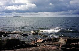
South America has the shape of a triangle, the base of which is located in the equatorial region, and the top is directed towards the south pole. The mainland is crossed equator in its northern part. Also crosses South America and southern tropic . Most of the area of the continent lies between these parallels. Therefore, the mainland receives a large amount of solar radiation throughout the year.
South America is washed by the waters of two oceans: Pacific and Atlantic . narrow Isthmus of Panama the mainland joins North America. In ancient times, animals moved along this isthmus, and people penetrated into South America along it. At the beginning of the $XX$ century, a Panama Canal , connecting the Pacific Ocean with the Atlantic and dividing the two continents.
wide in the south Drake Passage separates South America from Antarctica.
Example 1
The Drake Passage is the widest strait in the world - about $820$ km at its narrowest point.
Extreme points:
- northern - Cape Gallinas ($12°$ N, $72° $W);
- southern mainland - Cape Forward or Forward ($54°$ S, $74°$ W);
- southern island - Cape Horn ($56°$ S, $67°$ W)
Remark 1
(according to other sources, the southernmost island point is located on the Diego Ramirez Islands, southwest of Cape Horn - ($56° 30´$ S, $68° 43´$ W);
- eastern - Cape Kaabu Branco ($7°$ S, $35°$ W);
- western - Cape Parinas ($5°$ N, $81°$ W).
From north to south, the mainland stretches for $7326 $km, and from west to east - to west - $5000$ km at its widest point (around $7°$ S).
History of discovery and research
Remark 2
We can say that South America was discovered three times.
For the first time it was discovered by people who migrated here from North America along the Isthmus of Panama. But information about this was not known to European science.
In the Middle Ages, navigation became more active. Mighty European states, competing with each other, sought to capture new colonies, explore new trade routes.
In the $XV$$ century, two states dominated the seas - Portugal and Spain. To avoid conflict between them, the Pope of Rome proclaimed with a special bull the lands discovered to the east of the Vatican as the property of Portugal, and everything that was open to the west - to Spain.
Genoese sailor Cristobal Colombo , who was in the service of the Spanish king and went down in history under the name Christopher Columbus , suggested that if the Earth is spherical, then, sailing to the west, you can sail to India or China - the land of fabulous treasures and riches. In $1492$ the expedition of Christopher Columbus reached Antilles . Thus the way was opened New World a second time.
Being sure that he sailed to India, Columbus called local residents Indians . This name has stuck to this day. Christopher Columbus made two more expeditions to the New World, visited the mouth of the Orinoco, but until the end of his days he was sure that he had discovered only the unknown coast of India ( West Indies ).
At the end of $XV$, the Florentine traveler carefully examined the nature of the lands, discovered by Columbus. He came to the conclusion that these lands are not part of Eurasia, but represent a new continent. Later this continent was proposed to be called Amerigia or America . This was the third and last discovery of the continent.
First "researchers" new territories were Spanish and Portuguese treasure seekers. History has preserved the names of Pizarro, Cortes, Orellano. These, and others like them, lovers of profit have destroyed the richest culture indigenous peoples of the continent, looking for a ghostly land of gold - El Dorado . Their only merit is that they described the coast, compiled the first maps of the mainland.
Among scientists who studied the interior of South America, he made a huge contribution. He compiled the first geological map of the mainland, described the currents off the western coast, and substantiated the theory of altitudinal zonality in the Andes. Russian scientists N. G. Rubtsov and G. I. Landsdorf studied the nature of the interior regions of the Brazilian plateau.
Soviet scientist N. I. Vavilov studied the ancient centers of agriculture, found out the centers of origin of many cultivated plants. South America still holds many mysteries. For researchers, this is still undeveloped territory.
Discovery of South America
In the history of geography, the 15th century is usually regarded as a transitional period from the late Middle Ages to the era of the Great geographical discoveries.
From Western Europe there was a continuous flow of gold to the East, for the Europeans bought there much more than they sold. Moreover, the trade in spices and other oriental goods had to be carried out through the mediation of the Arabs, which aggravated the high cost of these goods. In the middle of the 15th century, a new obstacle arose in the way of the development of economic relations between Western Europe and the countries of the East - Turkish conquests. In 1453, the Turks captured Constantinople, and by the end of the 15th century, almost all the trade routes of Eastern Middle-earth were in their hands.
In the 70s and 80s of the 15th century, several expeditions were equipped in Portugal to search for the legendary islands of the Atlantic Ocean, but there is almost no information about these expeditions.
Random travel photos 
These voyages were the source of rumors, which subsequently gave rise to some researchers to dispute the priority of Columbus * in the discovery of America. In the 16th century there were rumors about the discovery by the Portuguese of some "gold" and "silver" islands. Such legends served as the basis for some Portuguese historians to assert that their compatriots discovered Brazil as early as 1447 and almost in 1342.
Ferdinand Magellan *** made circumnavigation. His ships departed from Seville on August 10, 1519; in November of the following year, Magellan passed the strait that now bears his name, and after a four-month voyage across the Pacific Ocean reached the Philippine Islands.
Attempts to refute the priority of Columbus meet with many reasonable objections. However, it is possible that some navigator of the 15th century. could accidentally reach the shores of America before Columbus, but it would hardly be correct to consider such an event as its discovery, because it did not play any historical role, it did not influence the geographical ideas of mankind, not to mention those colossal economic and political consequences, to who led the voyages of Columbus.

It was his first voyage across the Atlantic Ocean in 1492 that is considered to be the beginning of the Age of Discovery. The result of this voyage was the discovery of the islands of the Bahamas, Cuba and Haiti (Hispaniola). The second expedition of Columbus (1493 - 1496) led to the discovery of some islands from the Lesser Antilles group, Puerto Rico and Jamaica; in addition, the southern coast of Cuba (which Columbus took for part of the mainland) was examined. During the third voyage (1498), the northern coast of the mainland of South America was discovered with the mouth of the Orinoco and the island of Trinidad. finally, the last expedition of Columbus (1502 - 1504) resulted in a survey of the coast of the mainland from Honduras to the Gulf of Darien.
In 1499 - 1500, with the participation of the wealthy Spanish shipowners, the Pinson brothers, and the representative of the Florentine trading house in Seville, Amerigo Vespucci ** (see below), four expeditions were equipped to the northern shores of South America. One of them, under the command of Vicente Pinzon, explored the coast for 700 - 800 miles - up to Cape St. Augustine (S. Rock) - and opened the mouth of the Amazon. In 1501 - 1505, the Spaniards continued to sail off the South American coast.
In 1500, the Portuguese Pedro Alvaris Cabral, who was heading to India, was driven back by a storm to the coast of Brazil, which he named the island of Santa Cruz. In 1508, the Spaniards Juan Diaz de Solis and Vicente Pinson discovered the shores of the Yucatan and proved that Cuba is an island, and the next year they went south along the coast of South America to 40 degrees. S in 1515 - 1516 Solis discovered La Plata, mistaking it for the desired passage.

Amerigo Vespucci, sailing off the coast of South America, at first hoped to find Malacca and Cattigara there, but in 1503, in a letter to Lorenzo Medici, he expressed the opinion that the countries he visited should be considered the New World. This saying by Vespuccip has been published in various languages. The Lorraine geographer from San Die Martin Waldseemüller, also known by the Latin name Hylacomylus (1470 - 1527), in 1507 proposed to call the New World America. But for a long time this name was not generally accepted, and if it was used, it was only in relation to Brazil (which was often also called the Land of Santa Cruz).
The voyages of the Spaniards off the coast of South America (1500 - 1501) showed that in tropical latitudes high mountains covered with snow. Pedro Martir de Anguiera tried to explain this phenomenon, as well as some other natural scientific facts contained in the reports of the conquistadors. Thus, the growth of powerful trees, which struck the imagination of the first explorers of South America, this scientist pointed out that, since the latter are stony, more gold can be expected there, but for the same reason they are less fertile and less suitable for settlement.
Sailing across the Atlantic and Pacific Oceans gave an idea of the belts of calm, trade winds and westerly winds; Columbus discovered the equatorial current in the Atlantic, and Ponce de Leon (in 1523) discovered the Gulf Stream; Pedro Martir gave a diagram of the currents of the Atlantic Ocean. Since the expeditions of Columbus, magnetic declination has become known.
Voyages of Columbus
August 3, 1492 Three ships sailed from the port of Palos: Santa Maria, Pinta and Nina with 90 participants. The crews of the ships mostly consisted of convicted criminals. After the repair of the Pinta ship, weary days dragged on near the Canary Islands. 33 days have passed since the ships left the Canary Islands, and there was still no land. Soon there were signs of the proximity of land: the color of the water changed, flocks of birds appeared. The ships entered the Sargas Sea. Shortly beyond this sea, on October 12, the lookout saw a strip of land. It was a small island with lush tropical vegetation, which Columbus named San Salvador and claimed possession of Spain. Columbus was sure that he had reached Asia.
Columbus left several people on the island of Hispaniola, led by his brother, and sailed to Spain, taking as evidence several Indians, feathers of unseen birds and several plants. March 15, 1493 in Palos he was greeted with triumph as a hero.
Having immediately equipped a new expedition, Columbus set off from the city of Cadiz on a second voyage, which lasted from 1493 to 1496. Many new lands were discovered in the ridge of the Antilles (Dominica, Guadeloupe, Antigua), Puerto Rico, Jamaica, explored southern coasts Cuba, Hispaniola. But this time, Columbus did not reach the mainland. With rich booty, the ships returned to Spain.
The third voyage of Columbus took place in 1498-1500. on six courts. He sailed from San Lucar. On the island of Hispaniola, Columbus was expecting a heavy blow. The treacherous rulers of Spain, fearing that Columbus might become the ruler of the lands he had discovered, sent a ship after him with orders to arrest him. Columbus was shackled and brought to Spain. Columbus spent almost two years to prove his innocence. In 1502, he again embarked on his voyage to the west. This time Columbus visited many of the islands he had discovered, crossing from south coast Cuba Caribbean Sea and reached the coast of South America. From the fourth voyage, Columbus returned in 1504, his glory faded. In 1506 Columbus died in one of the small monasteries.
Amerigo Vespucci
At the very beginning of the 16th century, a native of Italy, a merchant Amerigo Vespucci, took part in one of the voyages to the shores of the West Indies. Having been off the coast of South America, he came to the conclusion that the land that Columbus discovered was not Asia, but an unknown vast land, the New World. He reported his guess in two letters to Italy. Word of this quickly spread. In 1506, a geographical atlas was published in France with a map of the northern part of South America. The author of the maps called this part of the New World the land of Amerigo. Cartographers of subsequent years extended this name to the Central and North America. So the name Amerigo Vispucci was assigned to a whole part of the world and illegally immortalized by cartographers.
Magellan
(real name Magallans) was born in Portugal around 1480. A poor Portuguese nobleman fought in North Africa where he was wounded. Returning to his homeland, he asked the king for a promotion, but was refused. Insulted, Magellan left for Spain, where he signed an agreement under which Charles I equipped 5 ships with supplies for 2 years. Magellan became the sole head of the expedition.
On September 20, 1519, the flotilla left the port of San Lucar at the mouth of the Guadalquivir. On September 26, the flotilla approached Canary Islands, on November 26 it reached the coast of Brazil near 8 S, on December 13 - Guanabara Bay, and on December 26 - La Plata.
Indians of very tall stature approached the wintering place. They were called Patagonians (in Spanish "Patagon" - big-footed). Since that time, their country has been called Patagonia.
September 21, 1520 at 52 S a bay or opposite was found leading to the west, after Magellan discovered Atlantic coast South America. Magellan walked south for several days through narrow straits until he saw 2 channels near about. Dawson: one to the southeast, the other to the southwest. Magellan sent one sailor to the southeast, another to the southwest. The sailors returned 3 days later with the news that they had seen the cape and the open sea. The admiral shed tears and for joy called this cape "Desirable".
The discovery and exploration of South America is closely connected with the name of the Spanish navigator Christopher Columbus. It was thanks to him that the world learned about new, previously unexplored lands. However, this discovery turned out to be accidental, since the main task of the Columbus expedition was to search for shortcut to India.
History of the discovery of South America
Until the 15th century, the territory of South America was inhabited by indigenous people - Indians, who had their own unique culture, traditions and customs. Their civilization developed in a closed territory, without any outside influence.
The long-term isolation of the American Indians was broken on October 12, 1492, when the expedition of Christopher Columbus accidentally stumbled upon one of Bahamas. After a month of wandering Atlantic Ocean his ships "Santa Maria", "Nina" and "Pinta" moored on the land, which the navigator mistakenly took for West Coast India. After a cursory exploration of the islands and coastline northern coast of South America, the navigator returned to his homeland.

Rice. 1. Christopher Columbus
Having reported his discovery to the king of Spain, Columbus received significant financial support, and returned to the West Indies with 17 ships - Western India- as he continued to count. The purpose of this expedition was simple - to search for gold in new lands. This is how Haiti was conquered and mastered. Later, Christopher Columbus made two more expeditions to the shores of South America, but he never realized his mistake.
The real discovery of South America as a new continent took place in the 16th century thanks to the Italian navigator Amerigo Vespucci. Having moored to the shores of the West Indies, an experienced sailor quickly realized that Columbus was mistaken.
TOP 4 articleswho read along with this

Rice. 2. Amerigo Vespucci
Vespucci dubbed the discovered and described lands the New World, and later the continent was dubbed in his honor - this is how the name "America" appeared. However, Christopher Columbus also did not go unnoticed - one of the South American countries, Colombia, was named after him.
Table “Discoverers of South America”
|
date |
Traveler |
Opening |
|
H. Columbus |
First expedition - Large Antilles and San Salvador |
|
|
H. Columbus |
Second expedition - Lesser Antilles and Puerto Rico |
|
|
H. Columbus |
The third expedition - the island of Trinidad and the northern coast of South America |
|
|
H. Columbus |
The fourth expedition - the Caribbean coast of Honduras, Costa Rica, Nicaragua, Panama. |
|
|
A. Vespucci |
Eastern shores of South America, "New World". |
Geographical explorations of South America
The discovery of America by Columbus forever changed people's view of the globe. This event became one of the most important in the history of all mankind.
Having learned that new lands were discovered by the Spanish navigator, a stream of lovers of easy money poured there. Travelers dreamed of countless treasures that could be found in the New World. Such people - invaders from Portugal or Spain - were called conquistadors.

Rice. 3. Conquistadors
In a blind pursuit of wealth, they ruthlessly destroyed local residents, robbed their settlements, devastated the occupied territories. However, along with this barbarism, new lands were explored: maps of the mainland and coast, descriptions of nature and relief were created.
A great contribution to the study of the mainland was made by one of the most famous explorers of his time - the German scientist Alexander Humboldt. For 20 years he most carefully studied South America: its flora and animal world, indigenous population, geological features. The book he wrote later became almost the only complete and reliable source of information about the New World.
What have we learned?
Studying one of interesting topics in geography of the 7th grade, we learned who discovered South America, how the process of conquest and exploration took place, and how the discovery of this continent influenced the idea of medieval people about the structure of our planet.
Topic quiz
Report Evaluation
Average rating: 4.3. Total ratings received: 554.