Zsd scandinavia map. WHSD Center: first impressions
The long-standing need to create a transport connection between the northwest and its central part was embodied in the large-scale construction of an intracity toll highway called the Western High-Speed Diameter.
How it all began
The history of the development of the project began back in 1990, when the government of the USSR, in its next decree on the prospects of state building, put it in the plan for the coming decade. For many years, the leaders of the now Russian state did not disregard the issue of improving and developing the transport infrastructure of the Northern capital.
Construction work began in 2005. The construction of the highway is ongoing, with the phased introduction of ready-made sections of the track into operation.
Expressway value
The result of many years of work will be a high-speed highway connecting the southern part of the city (Moskovsky and Kirovsky districts) with Vasilievsky Island and the Primorsky District. The new road will remove the main traffic load from the central part of St. Petersburg, as well as in the southern and northern parts of the city.
In accordance with the general plan, the Western high-speed diameter of St. Petersburg consists of three sections: North, South and Central. The total length of the transport system reaches forty-seven kilometers. Almost half of this length is occupied by bridges, overpasses and tunnels.

The uniqueness of construction projects
The presence of a large number was dictated by the peculiarities of the industrial infrastructure and landscape zone in the area of the highway. In order not to violate the integrity of previously erected facilities, as well as to demonstrate respect for the green area, the architects of the project decided to build a significant part of the route on overpasses.
Nothing of the kind has ever been built in Russia. The Western High-Speed Diameter became the leader in the field of innovative construction. St. Petersburg can rightfully be proud of its modern facilities, which will surely become the new landmarks of the Northern capital.
Some of the structures can be considered unique. This will be the cable-stayed bridge, under which the Korabelny fairway passes. The length of the central span of the said structure is more than three hundred meters. Another bridge, crossing the Petrovsky fairway, has a main span of two hundred and twenty meters. At the intersection of the Sea Canal, work is underway to erect a four-hundred-meter bridge structure with two tiers.

Effective sections of diameter
The first fragment of the Southern section was inaugurated in October 2008. It was fully commissioned four years later. The southern section originates from and connects with a traffic interchange on the embankment of the Yekateringofka River.
The length of the Southern Highway is eight and a half kilometers. Overpasses and bridges occupy almost two-thirds of the way. This is the most critical section of the diameter, maintaining the intensity of the continuous flow of large-sized transport in the direction of the Big Sea Port.
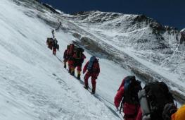
The Western High Speed Diameter was continued by the opening of a working movement in the Northern Section in August 2013. The ceremony was attended by the President of Russia. The length of the new track was over twenty-six kilometers, which is more than half of the total length occupied by the Western High-Speed Diameter. The traffic pattern runs from Primorsky Prospekt to the international motorway E-18 called "Scandinavia".

Central section of the path
As for the Central Section, intensive work is currently underway to build it. The western high-speed diameter on Vasilievsky Island will be laid along the border of the entire territory, connecting it with the Admiralteisky and Primorsky districts of St. Petersburg. The total length of the route is about twelve kilometers. This is the most technically difficult part of the project, as it is planned to build ten artificial structures. According to preliminary calculations, the launch of the Central Line is expected by the beginning of 2016.

Economic and technical indicators of the project
The Western High Speed Diameter represents the largest European example of public-private partnerships. As a result of the merger of cash flows, a budget exceeding two hundred and ten billion rubles was formed. Half of them are budget funds, and forty percent are private investors' money. The remaining ten percent was raised through the issuance of government loan bonds.
On various sections of the route, the location of four to eight lanes is envisaged. The permitted maximum speed of road transport on the highway is 110 kilometers per hour. After the commissioning of all sections of the track, the expected throughput will be at least one hundred thousand vehicles.
Current fares
The Western High-Speed Diameter is a toll highway, the funds from which will be used to maintain the grandiose structure in an appropriate technical condition.
The existing diameter sections are divided into several tariff zones, where the fare depends on the type of vehicle and time of day. For cars and small trucks, the price ranges from ten to forty rubles. Owners of heavy trucks must pay between thirty and one hundred and thirty rubles.

Forms of payment
For the convenience of using the passage, motorists are offered several forms of payment. Those who rarely travel along the WHSD can buy a ticket for cash or pay with a bank card.
Another payment option is to use contactless smart cards, which can be borrowed from the operator serving the track. BSK can be anonymous or personalized. The design of the latter provides the user with a ten percent discount. It is enough to regularly replenish the account on the card, and movement on the road will be almost unimpeded.
When there are regular freight services through the Western High Speed Diameter, the transponder becomes the most acceptable method of calculation. A special electronic device is attached to the windshield of the vehicle and guarantees instant payment when entering the highway. Transponders can be rented from the expressway operator. Permanent use of an electronic means of payment provides a reduced fare with a discount of up to twenty percent.

The actively operating highway is designed to help make St. Petersburg the largest transport interchange in Europe. After the complete commissioning of the entire line of the Western High-Speed Diameter motorway, it can be safely nominated as a contender for the official title of the wonder of the world of the twenty-first century.
The traffic intersection in the northwestern districts of St. Petersburg is a large-scale structure and is called the Western High-Speed Diameter.

Travel on the WHSD is paid. The fare is set from the site, time of movement, type of transport. Drivers for vehicles of category B and C pay from 10 to 40 rubles, D and E - 30-130.
All the money received for travel is directed to the maintenance of this grandiose highway in proper technical condition.
In 1990, the project to create a traffic intersection was put into a ten-year implementation plan, however, in fact, construction began only in 2005. When there was an urgent need to unload the traffic collapse in the Northern capital.
The construction of the highway is carried out almost around the clock without stopping for a long period. Ready destinations are put into operation immediately.
Upon completion of the construction, the highway will connect the Moskovsky and Kirovsky districts with Vasilievsky Island. The central part of the city will be unloaded, and there will also be a reduction in vehicles in the southern and northern parts of the city.
Specific features of the WHSD construction
Most of the diameter is man-made structures created to preserve the integrity of the architecture and landscape along which it passes. To preserve green areas and objects, the architects developed a project on the flyovers.
Such a length of suspended structures and construction technologies have not yet been erected in Russia, so the structure can be classified as unique.
The WHSD will become a new attraction in the city, as it has already gained popularity among tourists. For example, the length of the central span of the cable-stayed bridge over the Ship Formator is more than three hundred meters.
The structure, located above the Petrovsky formator, consists of a 220-meter structure, and in addition, a 400-meter long bridle is being installed from two tiers on the Morskoy Canal.
According to the general plan, the WHSD includes 3 sections:
- Northern;
- Southern;
- Central.
The length of the WHSD is 47 kilometers and more than half is occupied by the bridge, tunnels and overpasses.

Southern section
At the end of 2008, the Southern section was opened, the construction of which was completed in 2012.
The length from the beginning of the Ring Road to the Yekateringofka River is 8.5 kilometers, 2/3 of which are flyovers. On the site there is an intensive movement of freight transport to the Big Sea Port.

There are 4 interchanges for the sections:
- st. Auspicious;
- st. Automotive;
- ring road area;
- River shore.


Northern section
In 2013, the Northern section was opened at the WHSD. The event was attended by the President of Russia V.V. Putin. The length of the section is 26 kilometers.
The structure connects Primorsky Avenue and the E-18 "Scandinavia" highway of international importance.


Central section
The diameter connects Vasilievsky Island with the Primorsky districts. The length of the section is 12 kilometers. This is the most difficult stage of the work, as it included the construction of 10 artificial objects.


In July 2017, the scheme for organizing the movement of the congress to the Makarov embankment was changed. The entrance to the WHSD is on the street. Cash and Morskaya embankment, the entrance from the Admiralteysky passage was closed. There were no changes at the exits from the WHSD.

Construction Feasibility Study
The construction budget is over 210 billion rubles.
The funds were raised in the following ratio:
- 40% are private investors;
- 50% state;
- 10% bond issue.
Specially developed alloy for structures makes line elements durable.
The WHSD road does not include at least 4 lanes. The maximum width is 8 lanes. Car traffic is 120,000 vehicles. Thus, with a minimum payment of 30 rubles, the proceeds will amount to 3,600,000 rubles.
In the future, it is planned to organize the movement of regular buses on the highway, to equip stops, and next to them on the slopes to install escalators and elevators for pedestrians.
Double-deck and screw bridges, a tunnel laid under the river, this is not only a beautiful sight, but also a functional connection between the districts, ensuring the comfort of all residents and guests through the installation of noise screens.
|
|

Scheme of the modern toll highway St. Petersburg
 The Western High-Speed Diameter is a modern highway 47 km long, which is a connecting link in the South-Western part of the Northern Capital, where the territory of the seaport of St. Petersburg adjoins the Ring Road, Vasilyevsky Island, as well as Kurortny District and the Scandinavia highway. The WHSD will give a powerful development to St. Petersburg not only as a large metropolis, but also as one of the largest transport hubs in Europe.
The construction of the WHSD road provides for the presence of unique bridge structures on it, which will serve not only as elements of the highway, but also for the formation of the sea façade of the city.
Such structures are represented by the following bridges:
A two-tiered bridge 420 meters long at the intersection with the Morskoy Canal;
Cable-stayed bridge located above the Korabelny fairway, the length of the central span of which is 320 meters;
Bridge over the Petrovsky fairway with a central span of 220 meters;
The total length of such structures in the central part of the Western High-Speed Diameter will be about 4.5 km. And the total length of bridges, tunnels and overpasses is 21 km, which will be 50% of the length of the route, which will facilitate traffic on the busy, dense roads of the city.
By the way, these bridges are unique and have no analogues in Russia.
Exits and junctions on the Northern section (work not completed)
- Primorsky prospect
- Bogatyrsky prospect
- Shuvalovsky prospect
- The road to Kamenka
- Intersection with the ring road in the area of the automobile factories Nissan and Hyundai
- Intersection with the E-18 "Scandinavia" highway

Stages and terms of construction of the St. Petersburg WHSD
The construction of the Western High-Speed Diameter in St. Petersburg has been underway since 2005. Construction is going on very intensively. Each year was fruitful in the implementation of the set goals in construction. Proof of this is the following data: In October 2008, the first stage of the diameter was already launched (there are 5 of them).
In September 2010, it became possible to move along the section of the third stage. Such a site had the following boundaries: this is the Hyundai car plant and the ring road. In October of the same year, traffic resumed along the second section of the road to Blagodatnaya Street. A year later, on December 29, 2011, traffic became partially available in the area of intersection of the Western High-Speed Diameter with the Ring Road (next to the Hyundai car plant).
Detailed information about the WHSD road on the official website
A map of the Western High-Speed Diameter interchange can be viewed on the official website http://www.whsd.ru/map.html, where, for convenience, open sections of the route and sections that are under construction are highlighted. In addition, on the official website you will find all the information you need, for example, about tariffs for travel on the WHSD highways, detailed information about the project, information on vacancies, contacts. In the "photo gallery" section you can see a photo of the general view of the track. The convenient site menu will allow you to quickly find answers to the most pressing questions, familiarize yourself with the traffic summary, tariffs and payment methods.
 WHSD northern section, Planernaya street
Planernaya Street, which belongs to the Northern section of the WHSD, due to the presence of an exit and entrance, makes it possible to make a route, the trajectory of which passes through the city center and the Primorsky District and leads to Beloostrov.
WHSD southern section
The southern section of the WHSD is perhaps the most important and integral part of the highway. This section is especially relevant for large-sized vehicles making a route to the Seaport of St. Petersburg, bypassing congestion and traffic jams.
WHSD central section
The construction of the central section of the WHSD is planned last, in 2014, since the largest number of artificial structures is concentrated here, the number of which is equal to 10, three of which are interchanges, and the length is 8.95 km.
Tariffs for travel on the WHSD (while the payment terminals have not been installed on the Northern section, you can travel for free)
The fare on the Western High-Speed Diameter will vary from 10 to 100 rubles Since the WHSD is a toll highway, the administration has developed certain tariffs for travel, which are valid from 01.01.2011 and are designed for one trip and vary depending on the type of transport and time of day. The cost of travel during the day for cars and motorcycles is 30 rubles, and at night from 23.00 to 06.59 - 10 rubles.
 For large passenger cars such as Hummer, buses and 2-axle trucks, the fare is the same as for the previous category. But, for transport with 3 axles (heavy trucks and large three-axle buses, and cars with single-axle trailers) the price will be 70 rubles during the day and 30 rubles at night.
Semitrailer tractors, road trains and cars with a 2-axle trailer pay 100 rubles for travel in the daytime and 50 rubles at night. You can pay for travel in cash or using a contactless smart card and transponder.
Before using the Western High-Speed Diameter, be sure to read the Rules for the provision of services for organizing travel on the Western High-Speed Diameter highway.
Toll roads are always indicated on road signs when turning onto the WHSD. Before traveling, we recommend that you familiarize yourself with the WHSD map to determine the required exits and entrances. You can assess the current situation at payment points using online broadcasts from cameras. We also recommend using navigation services.
On the WHSD there are 2,260 standard road signs, 249 displays and variable information signs (TPI and RFI) and 371 custom design signs (SPTA)
WHSD toll collection points
There are 16 Toll Points (Toll Points) on the Western High-Speed Diameter. When approaching the PVP, observe the Road Traffic Rules, including the safe speed limit prescribed by road signs, as well as the distance.
Toll collection point (toll point) is a complex of specialized structures for a toll highway, equipped with systems for toll collection, access control and registration of the use of a toll road.
Fare payment
What is the procedure for paying the fare at the PVP?
Arriving at the PVP, the driver must comply with the current Traffic Rules, including the safe speed limit prescribed by road signs, the distance.
The cost of travel is automatically displayed on the monitor. The user makes payment in accordance with the tariff. The movement begins after receiving a check from the cashier-operator (when paying in cash or by credit card), raising the barrier and turning on the green traffic light.
With a manual method of payment - the user pays in cash or by credit card and receives a check, which he must keep for the entire trip along the WHSD. When paying with bank cards, you do not need to enter a pin code and sign the check.
When paying with a transponder, the user, when passing through the VFR, must follow the instructions of the road signs: stop in front of the barrier or, in the case of driving on the Fast Lane, slow down and continue driving, making sure that the barrier is fully open and that the traffic light is allowed. The fare will be paid automatically without the participation of the driver. For the convenience of transponder users, dedicated traffic lanes are open on the main runway of the WHSD. Gradually, the allocated lanes will appear at other Toll Points.
What to do if I didn't know that the road was toll /
no money to pay for travel?
In advance of the start of the toll road section, appropriate signs are installed (highway sign with three coins at the bottom), that is, the User can choose to use the services of the toll road or an alternative route. If the User, when passing through the toll collection point, regardless of the reason (lack of cash, faulty bank card, faulty BSK or transponder, etc.) did not make a payment, the Representative of LLC Expressway Operator-Sever draws up a protocol of absence of payment. The protocol on the absence of payment is signed by the Representative of Expressway Operator-Sever LLC and the User. Subsequent payment of the debt can be made by the User on the basis of the Protocol of no payment at the Sales Office or when the User passes through the Toll Collection Point. The period during which the User is obliged to pay the debt is 10 (Ten) days from the moment the User draws up the Protocol on no payment. In any case, the payment of the debt must be made by the User before re-driving through the Toll Station. If, after the expiration of the payment deadline for the Protocol on the lack of payment, the debt has not been paid, then measures of administrative, civil or criminal liability will be applied to the User in accordance with the current legislation of the Russian Federation. In addition, the User will be blocked from traveling along the WHSD road for an unlimited time.
We would like to draw your attention to the fact that the WHSD Toll Points provide for photo and video recording of all passing Users.
The WHSD or Western High-Speed Diameter is not only a city highway, but also a federal one. It unloads the transport network of the northern capital, connects Vasilievsky Island with other districts of the city, reducing the number of cars in St. Petersburg, and contributes to the improvement of the environmental situation in the city.
On a city-wide basis, the WHSD provides an increase in cargo turnover due to the creation of an approach to the Big Port, tax deduction from the operation of the highway, provides jobs for maintenance personnel and builders, and improves the mobility of the population.
Main sections of the WHSD
The total length of the highway is 46.6 km, almost half of the highway is located on artificial structures, there are 9 interchanges along it, the number of lanes on different sections varies from 4 to 8. The maximum vehicle speed allowed on the WHSD is 110 km / h ... There are 3 main sections of the highway:
A detailed diagram of all sites is available on the official website nch-spb.com in the "Operation" section.
Tariff zones
There are 5 tariff zones on the WHSD highway:
- Ring road (south) - Blagodatnaya st.
- Blagodatnaya-Makarov embankment street.
- Makarov embankment-junction with Shuvalovsky avenue.
- Interchange with Shuvalovskiy-KAD Avenue (north).
- Ring road (north) -E-18 "Scandinavia".

There is also a common tariff zone, which includes all 5 of the above, it connects the ring road (south) with the E-18 "Scandinavia". Depending on which zone the driver plans to cross and on which vehicle, such a fee will be charged from him for using the WHSD.