Ai Petri Crimea how to get there by car. Road to Ai Petri, scary? Not! It's amazing! The cost of the Ai-Petri cable car one way
One of the fascinating tourist routes in the Crimean mountains it consists of climbing the Ai-Petri plateau and Mount Ai-Petri along the Koreiz trail, crossing the yayla and descending to Yalta along the Taraktash trail.
It's hard to find a faster one affordable way get to the Ai-Petri plateau in general, and Mount Ai-Petri in particular, than the Koreiz trail. In Crimea, you rarely see this when the ascent to the top begins right from the Yalta-Sevastopol highway. The Koreiz trail is widely known among hikers and is marked on everything more or less detailed maps Southern coast of Crimea.
Route map:
Finding the beginning of the route is not difficult. In the place where the track and the road rising from Alupka intersect, there is a stop public transport which is popularly called Samotha. As a guide, you can use the sign "72 - Sevastopol, Yalta - 9".

|
|
| Koreiz trail: route map at the beginning of the trail |
Before you rise, look at the prospect that opens before you. There are two main landmarks - Ai-Petri itself (if you don’t know what it looks like, look for the cable car station at the top of the ridge - it can be clearly seen from the road) and the Small Ai-Petri rock triangle (Raven Rock). Both points must be passed.

|
So let's start climbing. The road going up and slightly to the left is exactly what we need.
The climb is small, the trail passes through a rare pine forest and a number of small unfinished houses.
I must say that the Koreiz trail is well marked, signs are painted on the stones along the road. Therefore, at first it is worth being more careful, choosing the marked paths and preferably sticking to the direction to the right. In addition to the main paths, the forest is dotted with abbreviations or, as they are called here, “Socrates”. Almost all of them will lead to the goal, but it is still better to use the markings for the first time, holding the Small Ai-Petri rock as a guide, if, of course, visibility allows.
Another notable point on our way along the Koreiz trail will be a gazebo where you can relax and have a bite to eat. After all, the second, most difficult part of the path lies ahead.

|
As is often the case on mountain routes, there are two options for the path: hard, but fast or easier, but also longer. Choosing the first option, you will storm the rise in the forehead, straight from the gazebo, rushing up and a little to the left. The steepness of the ascent will not allow you to linger on the path for a long time, the stones under the soles treacherously slip. On this trail you will see the bridges that are installed here by lovers of mountain biking - downhill from the mountain. Bridges, by the way, are a good guide.
By the way, be careful along the entire length of the upper half of the route, because extreme sportsmen rush down at breakneck speed, risking not only their own, but also your health.
If you prefer an easier route, then take the right from the gazebo and in a wide arc you will end up in the same place where the hard path leads - to the Crow Rock or Small Ai-Petri, from which stunning views open.

|

|
Having had plenty of fun with photographing and having a rest, we will begin the third stage of the ascent. Of medium severity, it will thank you with wonderful views of the Yalta mountain amphitheater and the panorama of the coast.

|

|
It must be said that most On the way along the Koreiz trail you will be brightened up by a dense pine forest, it will be easy to breathe, the beginner will not have time to turn his head from side to side. The higher, the thicker the pines, some cannot be covered by two adults at the same time.
It's not far to the top of Ai-Petri. The forest thins out, the ground becomes rocky, at the very top the surface of the mountain looks like a yail, which you will soon get to. Stones - different sizes - seem to be everywhere. There is also expanse for amateur photographers.
Well, here's the top. The last effort - and you are on Ai-Petri. If you plan to go back the same way, remember the place where you left, it will not be easy to find the way back later. As a guide, take the pine-plane, which, due to its unusual shape, is covered with tourists like flies.

|

|
| Pine-plane at the exit from the Koreiz trail to the top of Ai-Petri |
The entire ascent, depending on the degree of preparedness, will take 2.5 - 3.5 hours.
If you have not been tempted by the barkers of a huge number of eateries, and you have firmly decided to continue on your way, then you should turn right from the bazaar. Check the availability of water, if necessary - purchase.

|
A quite comfortable road through a beautiful open area will lead you to the village of Okhotnichie.
On the way to it, you will pass by antennas and an unfinished wind farm.
In the village itself, be sure to visit observation deck- the whole of Yalta will be in full view.
Do not miss the lonely standing benchmark - a geodetic sign, placed here back in the pre-revolutionary era (1913), on which there is a plate with information about the height, longitude and latitude of this geographical point.
Hunting - the last point before the very descent, where you can still buy something from provisions. In the village you will not miss the road, following which you will reach the turn to the right, to the Ai-Petrinsky forestry.
Another landmark will be several pieces of construction equipment, abandoned many years ago in the open.

|
Yayla ends, the forest begins, the road through which will lead you to a clearing at the edge of the mountains, where you will find a map of routes passing in these parts.

|
However, all the difficulties of the path will be forgotten when you see this miracle of nature with your own eyes, from a distance of ten meters. The work of the wind, which lasted for thousands of years, turned the faceless mountains into a grandiose and most beautiful monument to the forces of nature. Take a closer look, the rock of the Taraktash stone is layered like a pie, you can get fragile plates directly from the rocks with your hands. Under the feet of a pile of broken thin stone. The Taraktash trail passes through a shady gorge, where the camera works tirelessly, and the memory tries to capture all this splendor. From the numerous "windows" and breaks you can admire the panorama of Yalta and the Yalta mountain-forest nature reserve.
But here the small gorge ends and you have a long descent down the Taraktash trail. It will not be fast and easy, you will have to constantly change direction, winding along the serpentine and crossing fallen trees. But the breathtaking scenery of mountains covered with pine forest will not let you lose heart.

|
 |
 |
After an hour and a half of descent, a flat road will finally appear and you will again make your choice: go back a little and visit the Wuchang-Su waterfall, or keep your own, passing which you can once again enjoy the view of the Yalta mountains. Here is the track, you are leaving home with unforgettable impressions of the route you have traveled, and the fatigue from the hike will quickly pass.
It remains to be added that for an unprepared tourist, the entire route with halts and photo shoots will take about 9 hours.
olegman37
Everyone who comes to rest in the Crimea, and even more so in Yalta, asks a question and no less vivid desire to visit one of the highest points in the Crimea, namely Mount Ai-Petri, but the question always arises, how to get to Ai-Petri from Yalta, or otherwise big city: Sevastopol, Simferopol or Alushta.
The height of the mountain is 1234 meters above sea level, but this is not constant and is divided into three heights: the main one at 1234 meters and the western and eastern ones with a height of 1100 meters.
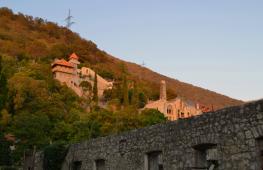
The mountain is located above the city of Alupka and the village of Koreiz.
However, it originates from Mount Ai-Petri, which is included in the zone of the city.
Interestingly, on south coast there is a mountain with an even higher elevation and this is Mount Roman-Kosh at 1545 meters above sea level.
There are legends that if at night it is on this mountain, and all weather conditions coincide, including with good visibility, then you can see the lights of Turkey's mosques on the other side of the Black Sea.
From Yalta, this can be done by cable car.
Interestingly, this cable car has the longest and safest flight line in Europe.
The route passes from the village of Miskhor, which is located 10 kilometers from Yalta and follows through the village of Miskhor, Pinery and further to Ai-Petri:
- The first lowest point is the village of Miskhor, located at an altitude of only 86 meters above sea level
- The second is Sosnovy Bor is already at an altitude of 304 meters
- The final station is the top of the mountain at an altitude of 1152 meters.
Travel time is only 15 minutes.
This is the fastest and most fascinating climb to the top.
Up to 40 people can fit in the lift cabin.
In Crimea, you can enjoy not only the heights, but also the beauty of the steppes, such as mud lakes, such as the healing properties of which are legendary.
on the video: the ascent to the top of Ai-Petri.
Cost and working time
The one-way lift is 300 rubles for an adult and 200 rubles for a child (under 14 years old), up to 6 years old one-way travel is free.
Opening hours from 09:00 to 17:00 for the ascent and from 09:00 to 18:00 for the descent.
Important: in winter, the cable car is the only way to get to the mountain, as all mountain roads and trails are very heavily covered with snow due to high altitude above sea level.
Other ways to climb the mountain
By car
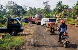
You can also climb the mountain by car, but only during the period of time when there is no snow, however, snow lies on the hill for almost the entire winter period. Some daredevils put chains on their wheels and storm the barrier, but this is a very dangerous occupation, given the height of the mountain.
In order to get to the mountain by car, you need to proceed to the city of Bakhchisarai along the Simferopol-Yalta highway. There will be a sign on the road where you need to turn.
It's very difficult to drive past.
on the video: climbing Ai-Petri by car.
The road will follow the Wuchang-Su waterfall.
You can also climb the mountain along the old Bakhchisaray highway, from the village of Sokolinoye to the village of Grape. However, during the summer period, the road is blocked due to the high risk of fires.
On foot

Just the same, from the Wuchang-Su waterfall, a hiking route begins, along the ladder you can follow the tops laid 100 years ago. These trails are suitable only in summer and early autumn. It is not recommended to explore them in winter.
Closer to us, the Iograf spur departs from the Main mountain range. Its continuation within the boundaries of Yalta is the Darsan hill, the watershed of the river valleys of the Vodopadnaya (Uchan-Su) and Bystraya (Derekoiki) river valleys. Walking along Yalta, you have crossed these rivers more than once.
Directly under our feet is the cone-shaped Mogabi mountain, along which we traveled, climbing Ai-Petri. Its top is almost 400 m lower than Shishko rock. For some reason, many people think that Mogabi - dormant volcano; Obviously, this idea is suggested by its correct conical shape. In reality, it is an outcast of the mountain range, of which there are quite a few on the South Coast. Mogabi hides from us that part of the coast where Livadia and Oreanda are located. To the west of this mountain, a view of the Miskhor resort area. Cape Ai-Todor with the Swallow's Nest is visible from behind the slope of Mogabi.
Alupka is spread out at your feet under Ai-petri, and if you look closely, you can even see the Vorontsov Palace and park. And even to the east, our favorite resort Simeiz is located, headed by Mount Koshka and Diva rock.
Turning to the north, you will see in the distance the mountain Bedene-Kyr with white domes - this military base. Well, below you, you can see the upper station of the Ai-petri cable car, the oriental bazaar, and countless cafes with oriental cuisine...
But we are more interested in the panorama of the sunny south coast, which attracts attention for a long time ... But then a small cloud covered the sun for a minute, and everything changed at once: otherwise the shadows from the mountains lay down, the sea turned green, bright colors faded. The panorama is the same, but you see it completely different...
From Ai-Petri you can watch a magnificent picture of the sunrise. But usually the excursion to Ai-Petri is designed for one day, and you can only see the sunset on Ai-Petri ... And to fully complete the picture of Crimean mountains visit the Grand Canyon of Crimea, better in the excursion program New Crimean Switzerland is an exclusive.

About the battlements of Ai-Petri and the red flag
In the summer of 1950, Nikolai Pavlovich Antsiferov, a researcher at the Moscow literary museum. He said that in 1907, as a young man, together with his friend, he climbed the teeth of Ai-Petri and on one of these teeth he saw the remnants of the inscription "Down with tsarism" pitted with bullet holes. Young people photographed her. After 43 years, Nikolai Pavlovich found an interesting photograph and now he was handing it over to the museum.
Several years passed before the museum staff managed to find out the origin of this amazing inscription. And it was like that. On an autumn morning in 1905, a scarlet banner fluttered on the top of Ai-Petri, and under it everyone saw the inscription "Down with tsarism." It was the time when the first Russian revolution was on the rise. And here, in the "blessed Taurida", so far from the working centers of Russia, next to the tsar's summer cottage in Livadia, the specter of revolution also appeared. Hunters to climb a rock to rip off the banner, the police did not find. Then they decided ... to shoot the banner and seditious words carved on stone. A machine-gun platoon went to Ai-Petri. The pole of the banner, beveled by the burst, fell, but did not fall into the abyss: the red flag caught on the crevices of the rock. Again and again the lead rain watered it and tore it to shreds. Each centimeter of the inscription on the rock was carefully beaten out with bullets. But for a long time fragments of the banner in the crevices of the Ai-Petrinsky spire were reddening, for a long time it was possible to distinguish the inscription...

Who then climbed to the top of the battlement, in one night managed to strengthen the banner and make an inscription, each letter of which was the height of a man?
After a long search, museum workers managed to find one of the participants in this bold demonstration. In 1957, they met him in Moscow: A. A. Teodorovich worked as an employee of the Institute of Medicinal Plants. Here's what he said.
One day, a small group of Swedish tourists appeared on the South Shore, who spoke Russian surprisingly well. In Miskhor they found a guide, whom! led them to the foot of the battlements. Having cut several steps in the rock and attached a hanging cradle, the "Swedes" set up a red banner and made an inscription.
The conductor of this dangerous expedition was a bricklayer from Miskhor, I. D. Ananiev (died in 1947), and the “Swedes” turned out to be members of the RSDLP (b), who emigrated abroad and illegally arrived in Russia in 1905 ...
Greetings! Not all drivers dare to climb the Ai-Petri plateau by car, there are those for whom the trip becomes entertainment. Undoubtedly, the route is memorable and picturesque - the higher you climb, the more you admire the panorama south coast Crimea.
I get a lot of questions about the situation on Ai-Petri in the 2020 season. It seems that the Crimeans spent the winter so well on Maslenitsa that she left the peninsula far and for a long time and was noted only on a few mountain peaks. I decided to collect all available information in in social networks and add it to this article. It will be about entertainment on the plateau, prices and the condition of the road.
Dear readers! The article was written a long time ago, but is still in demand, so I constantly update it and add relevant information. (Personal photos and photos from social networks for 2020 are used). Updated 01/20/2020
Road to Ai-Petri
There are four ways to climb Ai-Petri: on foot, in your own car, by cable car or with carriers. Each option has its pros and cons, but at least one must be used. For walking routes, there are schemes on the Web.
In January 2019, the Ai-Petri plateau was the most popular place for active rest. Hundreds of tourists posted their pictures on social networks from a snow-covered mountain: some on a sled, some on skis, and some in a kilometer-long traffic jam. IN new year holidays the movement was paralyzed, there were freaks who got up on summer tires (they had to be pulled out).
photo from the VK group “Weather on Ai-Petri”.

Dear, before traveling in winter, check the weather conditions on the Web! If you don't care about yourself, think about the kids! Rescue services cannot reach some areas.
count the capabilities of your car: 4x4, spikes or chains, full tank. Up-to-date information ingroup in VKontakte "Weather on Ai-Petri".

The mountain serpentine leading to the plateau is the longest and most winding in the Crimea. Depending on the weather conditions some sections or the entire road may be closed, which is warned by a sign at the beginning of the path or guards. There are landslides, landslides and avalanches.
Since 2019, the road to Ai-Petri has been served by the Krymavtodor enterprise. To ensure road safety in winter, the road is cleared of snow and sprinkled with a sand-salt mixture.
On January 4, 2019, 6 avalanches came down, the transport itself could not get out, they called in heavy equipment and augers to break through people who got stuck. Avalanches covered a lot of vehicles.
Previously, there was an unspoken rule for visiting Ai-Petri: ascending the plateau along a narrow serpentine before 12 noon, descending after 12 noon. Now autotourists ignore this rule and create problems for themselves, others and rescue services.
Road T 0117 leads to the Ai-Petri plateau, and then along the northern slope, through grand canyon Crimea, in the Bakhchisaray district. The second name is the old Yalta highway. Along the way there are springs, interesting rocks and the most famous waterfalls Crimea: (on the southern slope) and Silver Streams (on the northern slope). From the side of Bakhchisaray, from the Falcon road (January 2020) to Ai-Petri is much worse, there are many holes.
With all confidence we can say that the road to Ai-Petri is one of the most dangerous roads Crimea, so tired drivers and beginners have nothing to do there!
You can climb Ai-Petri by cable car or by transport that carries out transportation.The list of carriers on the Ai-Petri plateau is here:
https://vk.com/ai.petri?w=page-1728944_54122784Since August 2019, MUE Yaltagortrans has been carrying out transportation (during the warm season) from Miskhor and the Yalta bus station to the Ai-Petri plateau in a licensed taxi. The price of a one-way trip is 450 rubles. from a person.
“The departure of taxis as they are loaded will be carried out from the points of sale of subscriptions. In the area of the Ai-Petri plateau, dispatching and boarding of passengers will be carried out. In the future, directions and types of transportation by licensed taxis will expand.”
For those who do not know what the serpentine looks like on Ai-Petri, the route map.
What to do on Ai-Petri in snowy weather
In January 2020, there is much less snow, but there are enough people who want to get into the winter atmosphere.

From January 20, 2020, the cable car will be closed for annual scheduled preventive maintenance. Last day of work January 19th. It is planned that the cable car will resume operation in the spring.

For lovers hiking trails organized ascents. For example, a route of 5 km starts on the Koreiz trail (44.440463, 34.08323), past the Baba-Ali-Tekne spring (44.455722, 34.070383) with a transition to the Miskhor trail and ends at the upper station of the cable car. Along the picturesque path you will get from autumn to winter and be impressed by the picturesque landscapes.

For fans of extreme sports, the Ai-Petri tour company organizes individual jeep tours with a visit to the Forelevo trout farm (look for the official website on the Web), where a Russian wood-fired bathhouse operates, there is an opportunity to fish and taste delicious dishes from freshly caught Crimean trout .

Map ski slopes on Ai-Petri.


Prices for lifts for 26 km in January 2020:
- for a small one - 500 rubles.
- for a large one - 1000 rubles.
- a set of skis - from 500 rubles.
- board - from 500 rubles.
- large cheesecake (snowtube) — 600 rubles
- standard cheesecake - 500 rubles.
They ask for a document as collateral. The lift starts at 10 am.
Important! Message from GKU RK "CRIMEA-SPAS":
DESPITE THE WARNINGS OF RESCUERS, TOURISTS CONTINUE TO NEGLECT SAFETY RULES WHEN RIDING SNOWTUBE
The Minister of Emergency Situations of the Republic of Crimea, Sergey Shakhov, informed that tourists, despite the warnings of rescuers, continue to neglect safety rules when riding a snowtube, getting various injuries. Over the weekend, rescuers on patrol on the Ai-Petri plateau helped 4 tourists injured while snowtubing.

Away from the lift, local culinary specialists prepare pilaf, shish kebabs and shurpa for sale. You can bring food with you and have a picnic by renting a gazebo with barbecue facilities. The rental price is 1500 rubles. for a day.

The longest snow lies on the northern slopes of the plateau, it usually lasts until March-April.
View from the meteorological station. Silence and tranquility…. In the distance, the teeth of Ai-Petri are clearly visible, it is there that the upper station of the cable car is located, the most high point 1234 m. and Three-Eyed Cave.

From the observation platform, a clear expanse opened up - a turquoise sky with glimpses of azure, immersed in the sea surface of the Black Sea. Evergreen shrubs and trees frame Alupka and Koreiz with their thickets.


Around neglect and chaos. Private houses, sheds, cafes, shawls, construction sites. After 15 minutes you forget what devil you came here for.
"Highlanders" do not want to ennoble the territory because of unresolved land issues. Ecologists are sounding the alarm and calling for a halt economic activity on the territory of Ai-Petri, limit the capacity for the development of eco-tourism. But they realized it too late: many entrepreneurs have been working here for more than a dozen years. The circle has closed and now all hope is for the new government, which will make a rational decision, so that “the wolves are fed and the sheep are safe” ...
Due to the peculiarity of the relief, Ai-Petri is called yayla - a summer pasture. Since ancient times, settlements have been built on the plateau, but the biggest "contribution" was made by Homo sapiens.
Perhaps the only object that is in its place is a monument to the Crimean partisans of the Great Patriotic War, who died in battle in December 1941.

The road to Ai-Petri was of great importance during the Second World War. It was along it that the Nazis transferred troops and equipment towards Sevastopol. The partisans managed to blow up a section of the road and prevent the enemy plans from being realized, but they all died in an unequal battle.
At the cost of incredible efforts, the soldiers were able to protect their land, the memory of them should be passed on from generation to generation, and not disappear under scaffolding...
Approximately 35 km from the top of Ai-Petri, there is a parking lot and a hiking trail to the Grand Canyon of Crimea. I already talked about this route in my report.
What happens on Ai-Petri in January 2020.
Between the "highlanders" and the owners of the cable car there is a rivalry for their client. How events will develop, time will tell. The article will be updated.
Thank you for attention!