Santorini volcanic eruption. Santorini volcano eruption
Hello friends! Today is our review of the excursion to the Santorini volcano, to the terrible black islands in the caldera. Frankly, we weren’t planning on going there, but the price of 26 euros won us over - a cheap opportunity to get to the Nea Kameni volcano, the same one that everyone takes pictures of from the main island.
Excursions to the Santorini volcano: what options and prices
We did not plan to buy excursions. However, in one of the tourist offices where we bought ferry tickets, we saw an advertising booklet with interesting excursions to the Santorini volcano:
- option 1: excursion to the volcano only for 18 euros per person;
- option 2: excursion to the volcano and hot springs for 20 euros, from 11 or 14 hours for 3 hours;
- option 3: excursion to the volcano, hot springs and Thirassia island for 26 euros, from 10:45 to 16:15;
- option 4: excursion to the volcano and hot springs, watching the sunset on the ship with a glass of local wine - 35 euros, from 15:30 until dark.
We liked these options both in terms of price and content. The excursions start from the Old Port of Thira; you have to get to the port on your own.
You can book the same or similar excursion at any travel agency on the island.
There are excursions to the Santorini volcano that start from the New Port of Atina and include transfers from and back to the collection points. We did not specify where the collection points are, but we think there should be quite a few of them. So, excursions to the Santorini volcano with transfer:
- option 5: excursion to the volcano, hot springs and Thirassia island for 35 euros, from 10:30 to 17:30;
- option 6: the same thing, only at the end of the excursion they don’t go to New port, and to the port of Oia, watching the sunset in Oia and driving around the collection points - 38 euros; from 10:30, ending after sunset.
We chose between 2, 3 and 4 options and settled on the third for 26 euros per person. And this is what it looked like :)
Let's start, everyone! That is, to the port
Places that we must visit during the excursion to the Santorini volcano, on the map:
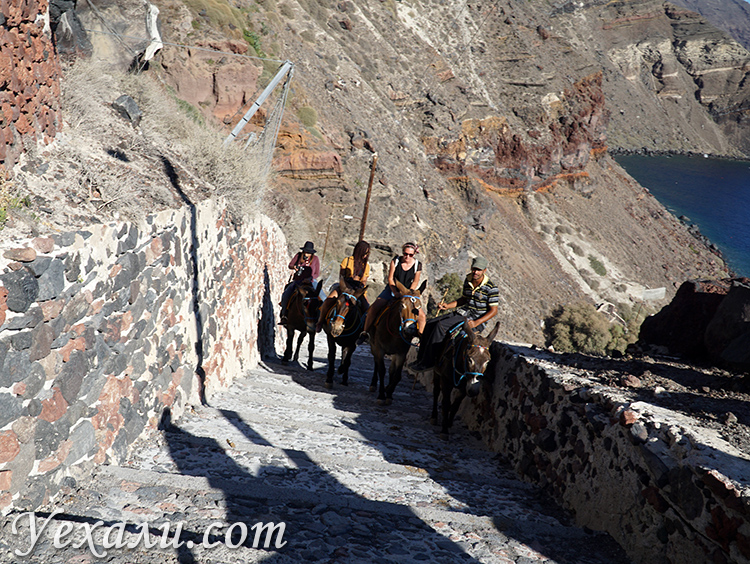
So, first you need to get to the Old Port of Fira. There are three ways to do this: on foot up several hundred steps, by cable car, or by donkey. We chose the first option and were right: along the way they open beautiful views. And, of course, there are many donkeys and mules ready to carry tourists in any direction. “Only five euros to the Old Port!” - the drovers offer on every corner. But why do we need them, we are going down!

The donkeys on the steps huddle against one wall, the tourists against the other :)

Funicular in Old Port Santorini is always in demand. But we at Uehali.com think it's boring!

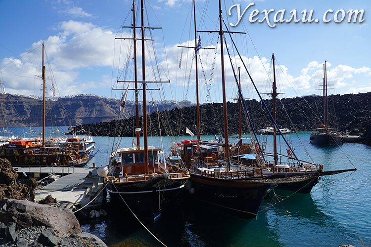
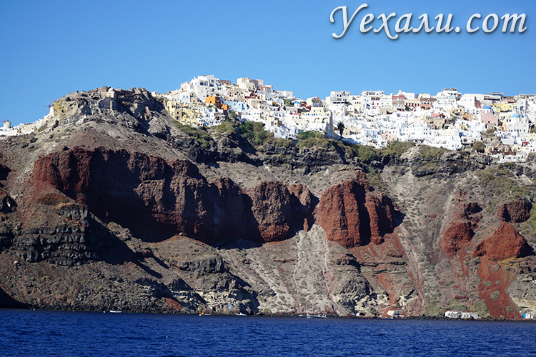
And here is the Nea Kameni volcano, to which we are now sailing!
After almost half an hour of descent - going down the steps is not as easy as one might think - we are in the Old Port. There are a lot of people, they all came to go on an excursion to the volcano.
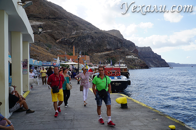
The most modest port we have ever seen.
At the office we were told where we would need to go to show the voucher (excursions to Santorini are fully paid in advance). The guide groups tourists and from half past ten begins to seat them on arriving ships. Well, it's starting, hurray!

I love excursions like this, where people from all over the world gather. And everyone speaks/understands English :)
We are on Nea Kameni. This is tough
The island of Nea Kameni is the main attraction of the excursion to the Santorini volcano. Since we use the word “volcano,” some clarification is in order. Many thousands of years ago, in this place there was a single island with a tall active volcano. And one day there was an eruption of unprecedented force. Lava soared up tens of kilometers, in fact, the entire volcano exploded from the inside. The mountain completely collapsed, and not only on the surface of the earth, but “from the roots” - in its place a pit several hundred meters deep was formed, and it was flooded by the sea. This is how the famous Caldera appeared.
If you look at the map, you will notice that the island of Santorini and the islands closest to it form a circle - once in their place there was land with a large mountain.
So in a strict sense, all these islands are part of one volcano. And in the everyday sense, a volcano is an uninhabited, lifeless and completely black island sticking out in the middle of the Nea Kameni caldera. That's what we came for.
The stop at Nea Kameni lasted about two hours.

There are trodden paths on the island; You could walk either with a guide or on your own.

We first walked on our own, and then joined the group to listen to the guide’s story.

You know, we were really scared. No, we were not afraid of an eruption when we arrived. We were scared to imagine how wild that prehistoric spectacle was, to which there were no witnesses left...

In some places, light smoke with the smell of hydrogen sulfide comes from under the surface.

Even such sparse, withered and dirty-gray vegetation causes bewilderment: how did something like this even appear here?

We smiled there just for the photo.

Still, no, this place is not romantic - Santorini...
We get dirty in our swimsuit, relax in Palea Kameni, moor at Oia
We are back on the ship and sailing to the hot springs to the neighboring island - Palea Kameni. It is also uninhabited (the church does not count), there is no vegetation. The guide on the ship is broadcasting through a bullhorn that you need to swim in the hot springs in dark swimsuits: they say there will be indelible color stains.
We half confirm: the stains actually appeared, and on green fabric. But then they washed off in the most ordinary way :) However, we do not recommend experimenting with white swimsuits.

And how (and for whom?) did they build a church there?

The yellower the water, the higher its temperature.
Next stop is the island of Thirasia. Time on the island is about two hours. The guide says that you can climb the stairs to the village, but we don’t need it. And no one, in my opinion, went.

And here is another inhabited island - Thirassia. Here excursion ships stop for lunch.

Guests are already waiting for guests on Tirassia: there are a dozen cafes at the pier, all with seafood of varying degrees of appetizing on display.

Lunch is not included in the excursion, only delivery to the cafe is included. Thank you, uncle, but we have lunch with us!
There are some semblance of beaches on the island, but swimming and sunbathing are inconvenient. In short, if not for this nice photo, one could consider it a stop for show.
This is the end of our excursion to the Santorini volcano! Then the ship proceeds to the port of Oia, where you can disembark if you want to take a walk through one of the most beautiful villages in all. That's what we did.
From the sea, Oya looks impregnable and harsh.

But the closer, the more welcoming :)
Advice to dear readers: If, by the will of fate, you find yourself in the port of Oia, do not spare 5 euros for a donkey, your legs and heart will later tell you “Thank you so much, master!” The climb to the top is steep and consists of more than 300 steps. When we saw the red-faced, gasping people at the very top, we felt sorry for them.
Excursions to Santorini are not like excursions in Pattaya, where you are picked up at your hotel and taken back to your hotel. Here you take care of your transfer yourself :)
In our next article you will find a selection where we sailed at the end of the excursion. Stay tuned, friends!
The study of deep-sea sediments of the eastern Mediterranean Sea has made it possible to reconstruct the conditions of a grandiose volcanic catastrophe.
In columns taken from the bottom Aegean Sea, discovered two layers of volcanic sediments located at levels from 80 to 170 centimeters below the upper limit of bottom sediments. Together with small particles to a height of up to 50 km. Volcanic bombs and pumice of various sizes are flying. This type of volcanic ejecta material is called tephra.
The study of the extracted soil cores made it possible to reliably distinguish the upper and lower tephra, construct maps of the areal distribution of these two volcanic layers and determine their thickness. The configuration of the area where volcanic sediments were found and the nature of the thickness distribution of the two ash layers leave no doubt that this ash was formed as a result of eruptions of the Santorini volcano.
The greatest thickness of the lower ash layer, reaching 22 cm, was found southeast of Santorini. The ash spread up to 400 kilometers north of Santorini and up to 1,000 kilometers west, almost to Sicily. All islands in the Aegean Sea, including Crete, located within a radius of 200 km from Santorini, were covered with a layer of aeolian ash several centimeters thick.
The upper horizon of volcanic sediments (upper tephra) also reaches its greatest thickness near Santorini. 130 km southeast of the volcano, its thickness exceeds two or more meters. The ash that makes up this horizon reached the coasts of Africa, Asia Minor and the Balkan Peninsula to be deposited there in a layer exceeding 1 mm. The maximum distance over which the ash of the upper tephra was transported was no more than 700 km. In the places of its greatest accumulation, it was discovered that the ash layer of the upper tephra consists of three coarse-grained horizons and three fine-grained ones with sharp contacts between them. This indicates that the upper ash layer was formed as a result of three successive eruptions of Santorini, of which the first was the most powerful and ash-rich.

Based on this, it was concluded that Santorini twice took the form of the round island of Strongyli and twice disintegrated. The first time this happened in the late Pleistocene, 25 thousand years ago, when the lower layer of tephra was deposited on the seabed, and the second time, in the Minoan era, approx. 3400 years ago, when the top layer of tephra was deposited.
The further spread of volcanic sediments depends primarily on the direction and speed of high-altitude winds. After analyzing air currents in the eastern Mediterranean, scientists came to the conclusion that the distribution of lower tephra material indicates its transport by high-speed winds, which indicates a volcanic eruption in winter.
The upper tephra was deposited under conditions of lower wind speeds. This is consistent with the meteorological pattern of summer northwestern trade winds with relatively low speeds. The fact that the eruption occurred in the summer, before the harvest, is confirmed by the fact that there were almost no food reserves left in the jars found during archaeological excavations on Santorini.
The shape of the tephra fallout area allows us to conclude that the cloud, which covered the whole of Crete, some areas of the Peloponnese and Asia Minor, was transported in the southwestern direction. A meter-thick layer of tephra from that time was discovered on the island of Rhodes. A cloud of volcanic gases, vapors and dust should have covered an area much larger than the one where the tephra fell.
The lower layer of tephra dates back to approximately 25 thousand years ago. The date was determined based on the age of microorganism shells found in the soil cores.
The upper ash horizon turned out to be much younger. Although there is a fairly large scatter of figures, it is still certain that the upper tephra was formed less than 5 thousand years ago. The formation of the upper ash horizon was caused by the eruption of Santorini and is dated, quite reliably, by determining the absolute age of a carbon isotope in a piece of wood found under 30 meters of ash. Radiocarbon dating showed that this piece was separated from the tree between 1510 and 1310 BC. e. Around this period of time, a catastrophic volcanic eruption occurred. And then the central part of Strongile again sank into the depths of the sea, forming a lagoon-caldera.
The ash from the Santorini caldera and from the upper layer of bottom sediments of the Eastern Mediterranean are completely identical.
The catastrophic volcanic eruptions that took place on the islands of Indonesia can give an idea of the events that took place 35 centuries ago in the Aegean Sea. In 1812, a new volcano was born on the island of Sumbawa, named Tambora. Over the three years of its activity, it grew to a height of four kilometers, and on April 15, 1815, a terrible explosion occurred, shortening the volcano from 4000 to 2851 meters. Clouds of ash covered the sky over an area with a radius of up to 500 kilometers: there was complete darkness here for three days. At the site of the explosion, a caldera 700 meters deep and six and a half kilometers in diameter was formed.
The eruption of Krakatoa occurred in August 1883 in the Sunda Strait. On August 26, residents of the island of Java, located 160 km from Krakatoa, heard a noise similar to thunder. At 2 p.m. A black cloud about 27 km high rose above Krakatoa. At 5 p.m. The first tsunami occurred. Before noon on August 27, several more tsunamis occurred. The explosions continued throughout the night, but the most powerful of them occurred on August 27. Gases, vapors, debris, sand and dust rose to a height of 80 km and dispersed over an area of over 827,000 km, and the sound of explosions was heard in Australia and off the island of Madagascar off the coast of Africa.
Hot ash and debris covered many hundreds of square kilometers. The wave caused by the explosion traveled around the entire globe. Its speed reached 566 kilometers per hour, and its height was 35 meters.
Explosions occurred throughout the autumn of 1883, and only on February 20 of the following year the last eruption occurred. During the eruptions, at least 18 km of rocks were thrown out, two-thirds of which fell in an area with a radius of 15 km from the explosion site. The sea north of Krakatoa became shallow and unnavigable for large ships. As a result of these explosions, only the southern half of the cone was preserved, and in place of the rest of the island, a depression with a diameter of about 7 km was formed in the ocean.
The crater created by the Santorini explosion is much larger and deeper than the crater created by the Krakatoa explosion. This means that the eruption of Santorini-Strongyle was even more powerful. During it, 70 cubic kilometers of rock were thrown out, that is, three to four times more than during the Krakatoa explosion.
Before the catastrophe that formed the upper tephra, Santorini represented a complex group of volcanic cones fused with each other, located mainly along its periphery. First arose large island Thira with a volcanic cone height of about 1600m. Gradually big Island merged with small islands located to the south.
After the disaster, a collapse caldera appeared, and most of The islands collapsed into the water. It is possible that the interior of the Santorini archipelago, even before the disaster, was partly a lagoon or a flat area formed due to the removal of volcanic products from the volcanic mountain range that framed the island. This point of view is supported by an analysis of volcanic emissions that immediately preceded the disaster. Geological observations indicate that the first manifestations of volcanism did not foreshadow disasters. Geologists divide the pumice emissions accumulated during the eruption into three layers. The lower, “pink” pumice erupted at a lower temperature. During the period of its formation, one or several vents were active in the northern part of the island. Middle group layers of pumice found in the south and east of Thira are distinguished by pronounced irregular bedding. This indicates a series of weak to moderate explosive eruptions separated by quiet intervals. The absence of fragments of ancient lavas indicates the activity of former vents. The release of huge masses of gas-rich magma inevitably caused the roof of the underground reservoir to collapse. This process could have begun during the eruptions, but was most pronounced shortly after their end.
The oldest population of Santorini, which appeared here ca. 3000g. BC e., was pre-Greek. Presence of influence Minoan Crete was established during excavations on Akrotiri, when from under a 40-meter layer of volcanic ash an entire village of two or three storey houses, decorated with frescoes that resemble the wall paintings of Minoan palaces, was dug up.
During excavations in the harbor of Akrotiri, a city destroyed by an earthquake was discovered. According to scientists, its area was one and a half square kilometers. Nearby, a residential structure, vessels from the Minoan period, fragments of a loom and large cinder blocks were discovered under a layer of ash. The frescoes were discovered under a multi-meter layer of ash. They depicted plants, birds, the landscape of the island before the eruption, gracefully walking antelopes, a bowed palm tree, boys boxing in special gloves, a procession of women with sacred gifts and an ape-like creature painted blue. The city found on Tire is not inferior in size and splendor to Knossos, the center of the island of Crete. The Santorini volcanic massif was surprisingly well adapted for creating an impregnable military fortress there, so it was on Tire that it was most advisable to keep a navy in case of attack by enemies and in order to extend its power to remote territories of the Mediterranean.
Akrotiri turned out to be empty; it was possible to find out that the evacuation of people took place long before the eruption - grass had time to grow on the walls of abandoned houses before they were covered with ash. The volcano explosion destroyed northern part city, covered the southern part with a multi-meter layer of ash, and some blocks went under water, to the bottom of the lagoon. Their remains were found at a depth of 20 meters.
F. Fouquet at one time discovered that despite the enormous force of the eruption and the proximity of the caldera, Minoan buildings on the island of Thira were preserved under a layer of tephra in relatively good condition. On this basis, he concluded that the eruption was not preceded by any strong earthquakes, and that it began with a sudden powerful release of ash and pumice that covered the Minoan settlements. Therefore, by the time the island collapsed, part of the settlements around the future caldera had already been buried by a thick layer of tephra.
In 1939, archaeologist Spyridon Marinatos, based on the results of excavations of a Minoan villa at Amnisos on the northern coast of Crete, concluded that the Minoan civilization was destroyed by an eruption in the nearby volcanic island Santorini. Layers of ash and volcanic pumice were discovered in Amnisos, Marinatos suggested that the walls of the villa collapsed from the impact of a huge tidal wave caused by a volcanic eruption. The fact that Thera erupted during the Bronze Age was beyond doubt: ceramics from the Minoan period had already been discovered in the debris of volcanic origin. In 1967, streets lined with houses were opened under a thick layer of volcanic ash and tephra. Minoan era. In some houses, beautiful colored frescoes and intact ceramics were discovered. In the late 1980s, it became apparent that the eruption occurred approximately 150 years before the destruction of Knossos and the great Minoan palaces.
According to archaeological data, all the Cretan palaces of the Minoan era on the northern and eastern shores of the island were destroyed simultaneously at the end of the 15th century. BC. The coastal settlements of Crete were abandoned suddenly, the population took refuge in impregnable mountain shelters in the center of the island. After this event, some palaces were subsequently reoccupied, but only partially; others were abandoned forever. During excavations of the palaces of Crete, archaeologists discovered pieces of pumice, as well as sintered pieces of other volcanic rocks mixed with sulfur.
Until recently, there was fairly widespread support for the hypothesis that the destruction of all cities and large settlements on Crete was caused by tsunamis, earthquakes and air shock waves generated by the explosion of Santorini. This was one of the main reasons that undermined the power of the state to such an extent that it became an easy prey for its neighbors.
The hypothesis is now being refuted with the same enthusiasm with which it was previously supported. Opponents argue that a single natural disaster could not lead to the disappearance of an entire civilization.
Volcanic emissions cover the island to a height of 30-35 meters. And in some places they reach hundreds of meters. The wind scattered tens of millions of tons of ash and pumice throughout the Aegean Sea and even carried it into North Africa, Asia Minor and Macedonia. Anafi Psara, Kos, Milos, Naxos and other Cyclades islands were covered with a layer of ash more than ten centimeters thick. The same layer of ash fell on Crete, in its central and eastern parts, the most densely populated areas of the island. This is quite enough to seriously damage fruit trees, destroy crops and grass in pastures and, thereby, cause mass deaths of livestock. Under the threat of famine, the surviving population of Crete was forced to leave the fertile valleys of the central and eastern parts of the island and go to the regions of western Crete.
During the eruption of the Laki volcano in Iceland in 1783. volcanic ash that covered the entire country caused mass deaths of herbivores from starvation. A mixture of volcanic gases and ash formed a bluish smog that enveloped Iceland, causing great damage to grain and feed crops and leading to hunger and lack of food. The consequence of all this was the death of half the cows, three quarters of the sheep and horses, and the population of Iceland decreased by a fifth.
During the eruption of Mount Katmai in Alaska in June 1912. pyroclasts that fell in the vicinity of the city of Kodiak, 160 km southeast of the eruption, formed a layer 25 cm thick and completely drowned out small vegetation. All streams and wells here were filled with ash. The livestock had to be taken out, and it was possible to return it only after 2 years, when the pastures were revived.
The explosion on Santorini caused a powerful earthquake. But if at the epicenter the strength of the earthquake exceeded 10 points, in Crete it decreased to 8 points. However, great damage to Crete was caused not only by the tsunami and volcanic ash, but also by the blast wave that came to the island after the earthquake that followed the Strongyle explosion.
During the eruption of Krakatoa, the roar of the explosion was heard over an area equal to 1/13 of the globe. The air shock waves broke glass in houses as far as 150 km away, and in some cases damaged houses as far away as 800 km from Krakatoa. This means that on the Cyclades Islands and Crete, located 100-150 km from Santorini, the blast wave should have caused significant destruction. It is possible that the destructive effect of the air wave was even greater than the earthquake. Disasters also struck neighboring lands. This primarily applies to Egypt.
The Minoan eruption was not the last page in the history of Santorini. Vulcan was silent for 1200 years.
In 197 BC. e. A small island formed by lava appeared in the Santorini lagoon. The Roman philosopher and naturalist Seneca, in his work “Questions of Natural Science,” speaking about the forces shaping the face of the planet, included among them “air pressure,” which “can scatter the earth over a large area, erect new mountains, create in the middle of the sea never before seen islands." And he cited Santorin as an example: “Who can doubt that Thera, Therasia and this new island, which appeared in the Aegean Sea before our eyes, gave birth to air?
In 46 AD e. Another volcanic island was born. In 60 a new eruption merged the islands together. Palia Kameni was the first island to form after the Minoan eruption.
Masudi reported that in 535. A strong earthquake occurred in the Nile Delta, the earth sank, and the sea poured onto the land. At the same time, there was a significant change in the coast of Crete, the surrounding islands and the underwater relief of the Aegean Sea.
In 726, another eruption at the bottom of the lagoon increased the area, and then the volcano subsided. Several explosions scattered volcanic material several kilometers around. The viscous magma that later filled the crater appeared as a black tongue of lava on the northeastern coast of Palea Cameri. The chronicler Theophanes recorded the eruption of 726: “In the summer of this very year, from the depths of the sea between the islands of Thira and Tirassia, heat began to bubble from a fiery furnace. It bubbled for several days, and increased all the time, and soon became a pillar of fire and smoke "became like fire, and from the thickness of this continuous fiery curtain huge pumice stones flew throughout Asia and the island of Lesbos and Abydos and to all parts of Macedonia, which was located beyond the sea."
In 1452 he woke up again, increasing the area. The destruction of Palia Kameni probably happened between 1457 and 1458. The last time this volcano showed its activity was in 1508, completing the formation of the island of Palea Kameni.
Underwater eruptions that lasted three years, from 1570 to 1573, about two and a half kilometers northeast of Palea Kameni gave birth to the island of Mikra Kameni.
On September 14, 1650, a powerful eruption of an underwater volcano began on the northeastern side of the island of Thira. It was accompanied by earthquakes that did not stop day or night.
An unusually strong volcanic process occurred in the center of the ring in 1707, it was not interrupted for five years. In 1707, two volcanic cones appeared, called Aspronisi and Makronesi. Then, within five years, they united and Nea Kameni arose. The eruptions from 1701 to 1711 were very interesting from a geological point of view, because it was one of those rare cases when it was possible to observe a volcano appearing in the sea. On May 21, 1711, three days after the violent eruption, a white island could be seen appearing. It continued to grow, and after a few days, the people of Santorini discovered black lava, pumice, and marine life still living on it. The island grew slowly, reaching a width of 600 meters and a height of 80 meters. On June 5th a fire was seen, after which a new black island appeared in the north. On September 12th, the black island became so large that it merged with the white one. Nea Kameni was 910 meters long in the south, 1650 in the west and 1440 in the east. The height of the island reached 106 meters.
Jesuit Gori observed the eruptions of 1707-1711 from Skaros Castle. "And between this small island and the Great Kammeni, on the 23rd of May 1707, in the middle of the day, the New Island, of which I will now speak, first appeared on the surface of the earth. Be that as it may, the fishermen discovered the island early in the morning, but unable to understand what it was, some took it for a sunken ship, castaway and drifting on the sea. As soon as the fishermen realized that it was a new island, they became frightened and quickly rushed ashore, spreading rumors throughout the island, which were readily believed, since all the inhabitants knew, and some even saw, what happened in 1650."
1712 "At that time White Island, which seemed higher than Lesser Kameneni, and could be seen from the first floor of Skaros Castle, now began to sink and sink so that it was already difficult to see from the second floor."
Volcanic activity in the lagoon resumed in 1866, when eruptions began in Vulcan Bay on the shores of Nea Kameni. As a result of the eruption of 1866-1870, the area of Nea Kameni almost quadrupled. In 1925-1926 and 1928, a new underwater eruption further increased the area of Nea Kameni; The eruption of 1939-1941 contributed to the growth of the island. In 1945, a volcano created the new island of Daphne. This island grew rapidly and connected Mikra-Kameni and Nea-Kameni. Last eruption on Santorini, which occurred in 1950-1956, once again increased the size of Nea Kameni.
The most powerful (Minoan) eruption of Santorini was not known either in the classical era or in the Middle Ages. Just studying geological structure The islands of Thira, begun at the end of the 19th century, and oceanological research in the Eastern Mediterranean made it possible to establish this enormous geological phenomenon.

The eruptions of Santorini, which occurred in the Middle Ages, were described in detail by the Abbot of Pegu in 1842. He was the first researcher to understand that the space between the islands of Thira, Thirasia and Aspronisi from the Santorini group is a giant caldera submerged by the sea, formed as a result of the collapse of a once-existing single volcanic island.
Since ancient times, volcanoes have attracted and at the same time frightened our ancestors. Most people, when they hear the word “volcano,” imagine high mountain conical in shape, which periodically spews tons of ash and lava into the sky. However, this is only one of many types of volcanoes found in nature - there are also underwater, fissure and dome-shaped structures that differ not only in shape, but also in behavior.

Greece is home to more than half a dozen majestic volcanoes - some active, others dormant. If you are looking for an unforgettable summer vacation and memorable adventure, then traveling to one of them is a great option. Spectacular views, pure water and the variety of natural landscapes distinguish the volcanic resorts from the rest of Greece.

The volcano of the same name on the Santorini islands is one of the most famous not only in Greece, but throughout the world. In 1600 BC. e. its most powerful eruption occurred, as a result of which the city of Akrotiri was completely destroyed, and only 3 remained of the large archipelago of islands - Thira, Terasia And Aspronisi. Historians believe that the legends about this natural disaster could form the basis of stories about Atlantis.

Thira Island, which became the epicenter of the eruption, since ancient times belonged to the Cretans, who were skilled sailors and traders. On the very slope of the mountain they built their capital, and at the foot of the island - a harbor for the merchant fleet. In 1628 BC. e. A strong earthquake began on the island, which forced the inhabitants of the island to leave their homes and sail away from Thira. A few hours later, a column of black smoke began to escape from the crater of the volcano, and lava flows covered the slopes of the mountain. A powerful explosion tore the top apart, and the shock wave caused a strong tsunami, which wiped out coastal settlements and the harbor with the remains of the fleet. The central part of the island, under its own weight, fell into the depths of the sea, forming a large lagoon with steep banks.

Last time Santorini volcano woke up in 1950, but this eruption was only a faint echo of the Minoan catastrophe. The depleted depths of the volcano are unlikely to ever harm people, but they serve as a good reminder of the vulnerability of human civilization.

Total for Methana Peninsula There are more than 30 small volcanoes, but the largest of them stands out noticeably in the relief. Volcanic activity here began more than 1 million years ago, and the last recorded eruption occurred about 300 years ago. In 1922, seismologists predicted a new eruption, but this event never happened.
There are many hot springs near the volcano and gas emissions are observed, which indicates its deep activity. Historians believe that the cult of the ancient Greek seers, the Pythia, is associated with the sources of underground gases. According to research, some components of gases tend to oversaturate the human body with harmful substances, causing oxygen starvation and hallucinations, which ancient people mistook for prophecies of the gods.

Methana Peninsula was inhabited by people from about the 10th millennium BC. e. The first formed settlements, bearing traces of civilization, appeared here in the 6th millennium BC. e. Excavations took place here in different time, discovered ancient sanctuaries and art objects dating back to 1500-1200 BC. e.
In the works of Ovid, Strabo and Pausanias one can find reliable descriptions of the eruption of several volcanoes in the northwestern part of the peninsula. Additionally they mention gas and hot water Methane sources. Today, Methana is famous not only for its beautiful volcanic landscapes, but also for its healing mud and thermal waters.

Milos Island, which is part of a volcanic island arc, is known throughout the world thanks to the discovery of a statue of Venus or Aphrodite de Milo. It is also home to an ancient volcano whose last major eruption dates back to 90,000 BC. e. During Roman rule, another natural disaster occurred on the island - the volcano gave rise to a strong mudflow, burying the whole city. Thanks to the volcanic past, deposits of barite, bentonite clays and silver accumulated in the sediments of the island, which contributed to the development of trade relations between Milos and other cities and countries.

Today, only a crater barely visible in the relief remains of the Milos volcano. Sometimes the depths of the earth make themselves known through small gas emissions or hot springs.
In addition to the remains of a volcanic crater, Milos is famous for its sandy beaches– there are more than 70 of them on the island.

Second most famous volcano greece located on a small island of Nisyros. This tectonic structure is one of the youngest formations, as it appeared only 160,000 years ago. Despite the fact that the volcano is now showing some activity, tourists are quite rare here, which allows you to take a good and leisurely look at it.

The last major eruption, which occurred in 1888, left behind a crater with a diameter of 25 meters. Now in the crater itself and around it you can observe a “lunar landscape” - the desert area is covered with multi-colored secretions of fumaroles and the remains of matter erupted from the deep parts of the volcano.

The influence of volcanoes on the development of Greek culture
A volcanic eruption, accompanied by streams of fire, columns of smoke and clouds of ash, was perceived by ancient people as a punishment from the gods. The main goal of any person’s life was to win over a higher power to his side, to appease him with rich sacrifices and constant prayer.
Patron of volcanoes in mythology Ancient Greece was Hephaestus. He controlled not only the forces of nature, but was also a skilled blacksmith. According to Homer's legends, Hephaestus was the son of Hera, the wife of Zeus. The goddess, annoyed by her husband's betrayal, gave birth to Hephaestus herself, from her thigh. The boy was born very weak, and also limped on both legs. Upset by this state of affairs, the goddess did not find anything better than to throw her son into the depths of the sea, hoping for his death. But the sea took Hephaestus into its arms. The second mother for the blacksmith god was Thetis, the patroness of the seas.
Hephaestus spent his youth and early youth on seabed where he did what he loved. The forged products that came out from under his hammer were distinguished not only by their beauty, but also by their reliability. One day, when Hephaestus learned about his mother's actions, he forged a beautiful golden throne and sent it as a gift to Olympus. Hera gladly accepted the offering, but as soon as she sat on the throne, invisible bonds tied her. Zeus, through his messengers, begged Hephaestus to free the goddess, but he remained adamant. Finally, Dionysus managed to get the blacksmith drunk and deliver him to Olympus in this form. Seeing his mother chained to the throne, Hephaestus had mercy and forgave her. Since then, the son of Hera took an honorable place in the host of gods, although he continued to engage exclusively in physical labor.
In Roman mythology, which adopted most of the features of antiquity, Hephaestus corresponded to the god Vulcan. According to myths, he caused earthquakes and eruptions by working hard with a hammer in his forge.
The activity of volcanoes often caused the death of entire cities and the collapse of civilizations. People were attracted by the beauty and grandeur of volcanic structures, and often they were not even aware of the danger that lurks several kilometers below them. This is how the developed Mycenaean-Minoan civilization, consisting of many ancient cities and settlements, sank into oblivion. Modern historians believe that it was this incident, which occurred 1600 years before the beginning of the new era, that underlies the legends of Atlantis.
Island arcs of Greece, on which active and extinct volcanoes, are interesting objects for tourist routes. White and black sand beaches, hot springs and healing mud perfect for people who want to relax profitably. In addition, by choosing a holiday near a volcano, you will get a unique opportunity to see with your own eyes all the greatness of nature.
Sanctuary of Apollo at Bassae.
Athens. Standing Attalus
The Stoa of Attalus - a long gallery - portico was built by the king of Pergamum, Attalus II (159-138 BC), as a gift to the Athenians. Attalus spent a lot of time in Athens, studying philosophy and other sciences. The Stoa is a large two-story complex portico with a double colonnade and rows of shopping arcades behind the colonnade. The building was made from local materials: marble for the façade and columns, and limestone for the walls. The building was 116 meters long and had 42 retail spaces. From that time on, the Stoa became the largest commercial building in Athens, until it was destroyed by the ancient Germanic tribe of the Heruli in 267 AD. e. Its remains were used to strengthen the city walls of Athens.
Sithonia. Romance of travel for two
Covered in divine legends, hospitable Greece is rightfully known as an oasis of serenity, tranquility and pristine nature. Two hearts looking for romantic solitude will find it here on the Sithonia peninsula, on the shores of the Aegean Sea. In this wonderful land, where the gentle sun gently touches the skin and the turquoise waves refresh with coolness, it is so easy to feel like “celestials,” carefree and happy. On amazing sandy shore or in a picturesque cove, on a flowery mountainside or on a spacious terrace, lovers will not leave the feeling that the idyllic beauty of Greece was created exclusively for the two of them.
Crete. Spinalonga Island.
Greek Islands. Kythira Island
This island, with an area of 278 km, is separated from the mainland (Peloponnese Peninsula) by a narrow strait of about 7 nautical miles. The harsh landscape of the island is very unique and in many ways different from the landscapes of the seven islands Ionian Sea. The inhabitants of the island, until recent times, were characterized by increased isolation.
On the island of Santorini in the Aegean Sea there is the Santorini volcano of the same name. Now there is a small trace left of it, an ancient caldera, but previously there was a huge volcanic cone here: 
Santorini is an active shield volcano on the island of Thira in the Aegean Sea, the eruption of which led to the destruction of Aegean cities and settlements on the islands of Crete, Thira and the Mediterranean coast. The eruption dates back to 1645-1600 BC. e. (according to different estimates).

The collapse of the caldera is associated with intense seismic activity, volumetric pyroclastic flows and a tsunami that washed away all coastal settlements. During the eruption, the Santorini volcano completely emptied its interior, after which its cone, unable to withstand its own weight, collapsed into an empty magma reservoir, into which sea waters poured in after it. The resulting giant wave, about 18 meters high (wikipedia says up to 100 m), swept across the Cyclades archipelago and reached north coast island of Crete The tsunami destroyed all settlements on the islands of the Aegean Sea, and also affected the shores of Egypt and other countries of the Mediterranean Sea, stopping the development of mankind for a long thousand years.

After the eruption of Santorini, many other events took place in the center of the resulting caldera. Some of them affected the archipelago in the 19th and 20th centuries. In particular, the last major eruption occurred in 1950. Today, Santorini exhibits constant seismic activity, and fumaroles and hydrothermal vents are still active on some of its islands.
Largest in ancient history The Minoan eruption on the island of Thira, or Thira, occurred in 1628 BC. e. (dendrochronological date). The next - the most powerful - happened in 1380 BC. e. (date approximate). The last one happened in 1950.
From what I've heard, dendrochronology can date events only a few hundred years ago. There are simply no thousand-year-old trees in the right quantity in the right place.
Geologists have discovered how the explosion of a supervolcano caused the “great flood” on Crete
Before the eruption of the supervolcano, the modern archipelago of Santorini was a single island. Scientists found that the eruption occurred almost instantly by geological standards - in just 100 years, the magma chamber under the island was filled with “fresh” molten rocks, which heated up local magma reserves, causing it to expand and literally tear the island apart.
An unusual “channel” in the northwestern part of the archipelago, which scientists discovered underwater, told them about what happened to the island and the surrounding ocean during the eruption and in the first days after the disaster.

For example, the unusually deep walls of this channel and its structure indicated that the walls of the supervolcano on the island of Santorini collapsed even before sea water rushed inside its exploding vent. This means that the tsunami, which was supposedly caused by the destruction of the island and the fall of its “debris” into the Aegean Sea, was generated in a completely different way.
Scientists have no doubt that this tsunami really existed - traces clearly indicate its occurrence sea water and sand in the Minoan palaces of Crete, where she could get only if the height of the waves near the shore exceeded ten meters.
Scientists found traces of this event in the center of the former volcanic crater, and a few hundred meters from the shores of the archipelago.
As shown by the analysis of rocks in the central part former island, in the first stages of the eruption, part of Santorini exploded due to the fact that in the central part of the island there was a lagoon with sea water, which became the first “victim” of hot magma rising from the bowels of the Earth. This explosion led to the fact that the southern part of the former island was literally instantly flooded with powerful outpourings of magma, whose volume exceeded 16 cubic kilometers.
They eventually “slipped” into the Aegean Sea, covering the bottom of southern shores Santorini with a 60-meter layer of new rocks, and caused a powerful tsunami, the wave height of which at the former island exceeded 35 meters, decreasing to about ten meters when they reached the shores of Crete.
Almost immediately after this, the walls of the volcano collapsed, after which the sea broke through the “dam” of volcanic ash, which formed near the north-eastern channel at the bottom of the modern sea. Its waters began to fill the resulting basin, filling it completely with water in just 40 minutes if the depth of the channel was the same as it is today. Such a rapid course of such geological disasters, as scientists note, suggests that supervolcanoes, especially their island variety, should be given special attention.
As you can see, scientists and historians blamed the death of the Minoan civilization on this (in the past) volcano. They say that it was destroyed by a flood, a tsunami from the eruption.

Irregularly shaped failure of the volcano cone.


And it looks like a flooded quarry


Calcareous hills are adjacent to tuff hills


Central Island

Santorini is part of the Cyclades group of islands
List of minerals found on the islands:

But there are no samples analyzed for metals.
I propose to see the excavations and remains of the structure of the Kroto-Minoan culture, which was destroyed by this volcano:

According to the first signs, the territory is quite far from the sea, respectively, higher than 10m above it

The fact that it was destroyed by a flood or mudflow is beyond doubt among archaeologists. But could a wave 10m high reach these buildings? If the volume of water was large, then its inertia could drag the mudflow here too.

Excavations of this complex from above


During excavations

After. Already glued and restored jugs
It is possible that the entire coast Mediterranean Sea suffered from this cataclysm. And traces of destruction and flood along its entire coast are the consequences of this event.
Sources: