Ruins of ancient buildings and piers. Vyborg Bay
The Vyborg skerries are the name given to the coast of the Gulf of Finland along with numerous islands (including the Vyborg Gulf), stretching from Primorsk to the Russian-Finnish border. The word "skerries" (skar) is of Swedish origin. This is what they call a fancifully cut coastline seas or lakes with groups of small rocky islands. Skerries are typical for Sweden, Finland and the Scandinavian countries in general.
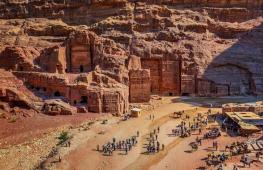
The Vyborg Bay is part of the Gulf of Finland, as if embedded deep into the continent. Through the Saimaa Canal, the waters of the bay communicate with the system of inland lakes of neighboring Suomi. The water here is less salty than in the Gulf of Finland: it is diluted by numerous fresh springs. The waters of the Vyborg Bay are replete with islands. There are some that are so large that entire settlements can easily be accommodated on them, such as the island of Tverdysh, on which part of Vyborg is located. Many and small, no more than ten meters in length. Vyborg Bay is an area of intense shipping, and in addition, it is popular with owners of small vessels: yachts and boats. For twenty years now, the international regatta “Sails of Vyborg” has been taking place in the waters of the bay. Large vessels heading to Vyborg sea port, as well as to the ports of Vysotsk and Primorsk, you have to move along a very complex fairway, maneuvering between numerous islands.
From Vyborg to Primorsk
Recently, Vyborg, the only city in Russia with preserved medieval architecture and unique monuments northern modernity, has become the last outpost of free access in the North-West of the region: as soon as you cross the Saimaa Canal, the border zone begins. During the perestroika years, the city gained a lot, but also lost a lot. Favorite ones have already been trampled here tourist routes, but safety historical monuments leaves much to be desired. Vyborg still remains a place of pilgrimage for residents from neighboring Finland.
The Vyborg skerries seem to be divided by Vyborg into two almost equal parts: the city is the “deepest” point of the Vyborg Bay. To the west, the least developed coastal areas stretch all the way to the border. And from ancient Viipuri to Primorsk the line of Vyborg skerries is called the Golden Coast. This stretch of coast has such a pretentious name not only because it has stunning scenery and unexpected landscapes. Currently, the lands of the Golden Coast are among the most sought after on the country house construction market in the Vyborg region. And once upon a time it was a strip of continuous children's health resorts and sanatoriums.
If you move from Vyborg towards Primorsk, then along the way you will meet settlements that had a variety of “specializations” in Soviet times, which have survived to this day. In Sokolinskoye there is a wonderful tuberculosis sanatorium and summer cottages for artists. Zimino was initially a sanatorium zone for the proletarians of the Vyborg Shipyard, then it became simply a sanatorium-type boarding house. A local landmark is the famous oriental-style gazebo for meditation by Kuzmich from Rogozhkin’s “Peculiarities of the National Hunt.”
Vysotsk is a city of maritime border guards, a traditional open-air children's art school and the last refuge of Stanislav Rostotsky. By the way, the updated drakkars from the film “And Trees Grow on the Stones”, along with the dominant of St. Olaf, the Round, Clock towers and the Town Hall tower are still the hallmark of Vyborg. Uuransaari Island (now Vysotsky Island) was recaptured by Peter I during the Northern War. By order of the emperor, the construction of fortifications began here, the remains of which have survived to this day. The city, with just under two thousand inhabitants, was better known as Trongsund (Swedish: Trangsund) until 1918. During the period of twenty years of Finnish independence, it was renamed Uuras (Finnish: Uuras).
The Sovetsky settlement is the first raider-perestroika redistribution at the Vyborg Pulp Mill and the business berth of LUKOIL. By the way, the plant itself was built by the Finns in the late twenties of the last century. When its reconstruction was required in post-Soviet times, the Finns and Swedes again came to the rescue.
Landyshevka (under the Finns Ala Kiriola) - a pioneer summer and the estate of a branch of the famous Nobels. Glebychevo and Pribylovo (Finnish: Makslahti) are a ceramic factory and the legendary Guards Helicopter Regiment of the Russian Air Force. Cosmonaut German Titov served here and historian and dissident Roy Medvedev taught here for six years. In the area of Glebychev and further to Primorsk, the fortifications of the Mannerheim Line are perfectly preserved.
And finally, Primorsk (formerly Finnish Koivisto and Swedish Björke; all names are translated the same: “Birch”) - a scientific base, an oil terminal (the end point of the Baltic pipeline system), a beautiful Lutheran cathedral (now the House of Culture and local history museum), which mysteriously lost its multi-register organ. The purchase of an organ for the church in Germany was sponsored by Emperor Nicholas II, who often vacationed on the nearby Beryozovy Islands. One of the legends is associated with the seaside church, according to which, during the advance of Soviet sailors, the pastor’s daughter chained herself to the bell tower and shot back to the last bullet. And in the early 1990s, a small monument made of local stone appeared next to the temple: a sail and a cross - a memory of all those who died and a sign of reconciliation.
Islanders
Finnish archaeologists who studied the territories of the settlements of Koivisto, Hyarkala (before perestroika there was a wonderful pioneer camp “Olympian”), Manola, found stone axes there even before the start of the Winter War, and in modern Ermilovo (near Primorsky) a stone hoe. The finds were dated to the Stone Age.
Actually, before the Swedes gained a foothold on the Gold Coast, Karelians had lived on these lands since ancient times. And not only them. The islands and the coast were a real trade crossroads, so trade strongholds were created here, multicultural, mixed ethnic composition settlements. So today's Primorsk began as a trading settlement called Berezovskoye. The first chronicle mention dates back to 1268. But even earlier, on the strait located somewhat to the south small island Ravitsa (in translation from Karelian Nourishing) was a medieval market place. Residents delivered food from the shore to the island in exchange for handicrafts brought by shipbuilders. Warehouses of Novgorodians, Karelians and merchants of the Hanseatic League were built on numerous islands. And only later did the trading people from the islands move to the shore.
In the 14th century, fishermen and sailors became the owners of the islands. Most large islands sheltered farmers. Island communities, villages, hamlets and even small towns. By the middle of the 20th century, almost all habitable islands were inhabited. After all, it was natural for the Finns to use various watercraft as public and personal transport: boats, cutters, steamers.
To this day, on the islands of the Vyborg Bay you can find the remains of military fortifications, foundations of old buildings, stone roads, and good-quality berths. Due to little exploration, the island part of the bay attracts a huge number of tourists and local historians. The local population has maintained the tradition of collecting autumn gifts on the islands - mushrooms and berries. In addition, the islands attract lovers sea travel on boats or yachts. And of course, the Vyborg skerries are a place of pilgrimage for fishermen. In summer, pike, pike perch, bream, perch, roach, rudd, and eel are caught here. In winter, burbot and smelt appear. Lucky people get their hands on Baltic salmon.
It is necessary to take into account the special way of life that has developed in the lands of the Swedish crown. The fact is that the northern Europeans never had the final enslavement of the peasants, as in Russian Empire. The feudal lords were content with quitrents and other duties; at the same time, peasants and ordinary people remained free people and often acquired land themselves, becoming landowners. Hence such a popular farm way of life, which has developed not only on the mainland of the Karelian Isthmus, but also on the islands.
Vyborg estates
As a result of the Northern War of 1700-1721, the territory of the Karelian Isthmus was annexed to Russia. In 1811, the Vyborg province became part of the autonomous Grand Duchy of Finland. The proximity to the capital of the empire left its mark on the composition of landowners, the appearance, way of life and life of Vyborg estates. Their owners were representatives of the highest nobility of the Russian Empire and those close to the imperial court. In the 18th century, new estate construction began, adopting the motif of expensive decorations and interiors of St. Petersburg. A striking example is the Monrepos estate. Unlike those who settled in the rich and luxurious south, the Vyborg founders of the “noble nests” were mostly merchants or officers, so luxurious palace and park ensembles cannot be found here.
The world of the Vyborg estate was created by the labor of peasants, and most of By the end of the 19th century, the land was already in their ownership.
Mon Repos. Perhaps Mon Repos would have remained a nameless manor, the monarch's payment to the vassals for their diligent service, if not for a number of happy accidents that marked this territory on the shores of the Vyborg Bay. The first owner of Mon Repos after Peter's Victoria was Pyotr Alekseevich Stupishin, from 1780 - the Vyborg governor, holder of the Order of St. Anna I degree. A number of crown estates were administratively subordinate to Stupishin, the income from which was transferred to the treasury. Stupishin chose one of them, the Lille Ladugard estate on the island of Linnansaari, for his summer residence. The territory was cleared of stones and leveled, an access road to the manor house was built, a linden alley was planted, and a dam was erected. Improvement included draining low-lying meadows, building wells, filling fertile soil, and planting plants. A large amount of construction work was carried out by soldiers of the local garrison. Several residential buildings were erected, including manor house, a number of outbuildings. But the death of the Vyborg governor interrupted the grandiose arrangement of the family nest.
And the heyday of Mon Repos and its world fame as a unique rocky and romantic park are now forever associated with the name of the Nikolai family. He owes it the name “My Repose” (that’s how “Mon Repos” is translated). We should not forget that Mon Repos was never a ceremonial park: nevertheless, it was an entourage estate with meadows, cows, pastures, vegetable gardens and greenhouses and a completely rural way of life.
Kaislahti. Kaislahti means "Reed Bay" in Finnish. In the 30s of the 17th century, a German officer, quartermaster Gerhard Leffe took possession of the empty lands of a disabled cavalryman. Then he bought part of the land from local peasants, and a quarter of the village land, which belonged to the Dominican monastery, Vyborg castle and the priest’s estate in the Middle Ages, became his property. Thus a large estate was formed. Then the owner of the estate was a major, whose name has now been forgotten. During the Northern War, Russian troops destroyed the estate: it was then that a legend arose about the ghost of a nameless major, who, with a sword and a cocked hat, searches for his lost family at night. In subsequent centuries, the estate passed from hand to hand to various military and civilian ranks as a reward for service, was given away for debts and was revived by zealous owners, and even became the residence of the Minister of Finance Lars Gabriel von Hartmann.
Now the only reminders of the former Kaislahti manor are the old birch alley and the ruins of a brick factory, a steam sawmill, a stable and a cowshed. Since 1948, Kaislahti has become the Soviet village of Popovo.
Sahlgren's estate. On Boat Island (formerly called Venajansaari, translated as “Russian”) this estate, built by the famous Vyborg architect Uno Ulberg, is still perfectly preserved, although no one has been involved in its conservation or restoration. Now it is privately owned. It is curious that Russians are well aware of this red brick villa-estate: in the series about Sherlock Holmes “The 20th Century Begins” directed by Igor Maslennikov, the estate “played the role” of the lair of the German spy von Bork.
Nobel estate. In 1894, the southern part of Ala Kiriola (now Landyshevka) was acquired by Edla Nobel, the widow of Ludwig Nobel. Ludwig Nobel is a Swedish and Russian engineer, inventor, entrepreneur and philanthropist, the elder brother and business partner of the famous founder of the Nobel Prize, Alfred Nobel. By the beginning of the 20th century, the Nobel estate was expanded by purchasing several neighboring manors.
The elder Nobel was fluent in five languages, was the founder of the Russian Technical Society, and the initiator of the introduction of the metric system of measures in Russia. He gave money for research to the Academy of Sciences and the Russian Technical Society, financed a school for railway masters and a school for workers. After his death, the Branobel partnership decided to establish a student scholarship in his name at two St. Petersburg institutes - Mining and Technological. After the death of Ludwig Nobel's widow, her youngest daughter Marta lived in the estate with her husband, doctor Georg Oleinikov. On the contrary, on the island, two hundred meters from the shore, a garden was laid out, later called Doctor’s. There, grapes, peaches and corn were grown in greenhouses.
In the summer of 2010, the great-grandson of the brother of the founder of the Nobel Prize, Pyotr Oleinikov, visited the estate, who arrived with his wife Anna. Today the Nobel clan numbers about 300 people.
Vyborg Bay (Finnish: Viipurinlahti, Swedish: Viborgska viken) is a bay protruding deeply into the shore in the northern part of the Gulf of Finland. Baltic Sea. The bay ends at the city of Vyborg in the northernmost part, connecting through the Saimaa Canal with the system of inland lakes in Finland. It got its name from the city of Vyborg.
In the waters of the Vyborg Bay there are dozens of islands - both large and small.
The entrance to the bay is blocked by ¾ of the width by the long and narrow Kieperort peninsula. On the other side of the peninsula, the bay widens greatly towards the southeast and is covered with many islands; in the Tronzund Strait (Finnish Uuras or Swedish Trangsund - narrow strait) between the islands of Vysotsky and Krepysh they stop at anchor for loading and unloading large ships, and less significant ones go all the way to Vyborg and further, to the entrance to the Saimaa Canal.
To the west of the Vyborg Bay, a strip of real skerries begins. In the northern part of the bay is the Lohaniemi Peninsula.
One of the most romantic hikes on sailing yacht, hike along the Vyborg Bay. During the hike you can visit many islands, get acquainted with the history of these beautiful places, see the remains of fortresses and military structures different years. Rarely in the waters of Vyborg Bay strong winds, since numerous islands with their vegetation create natural barriers for it. The water is clean, but tastes a little salty; you can cook food, but tea and coffee take on a peculiar taste of sea salt.
The coast of the Gulf of Finland, together with numerous islands, stretching from Primorsk to the Russian-Finnish border is called the Vyborg skerries. The word "skerries" is of Swedish origin. This is the name given to the rugged coastline of a sea or lake with groups of small rocky islands. Skerries are typical for Scandinavian countries.
The Vyborg Bay is part of the Gulf of Finland, as if embedded deep into the continent. Through the Saimaa Canal, the waters of the bay communicate with the system of inland lakes in Finland. The water here is less salty than in the Gulf of Finland: it is diluted by fresh springs. The waters of the Vyborg Bay are replete with islands. Some are so large that entire settlements can easily be accommodated on them, for example the island of Tverdysh, on which part of Vyborg is located. Many and small ones. Vyborg Bay is a shipping zone and is popular among owners of small vessels. Large ships heading to the Vyborg seaport, as well as to the ports of Vysotsk and Primorsk, have to move along a complex fairway, maneuvering between numerous islands.
From Vyborg to Primorsk
As a result of the Northern War of 1700-1721, the territory of the Karelian Isthmus was annexed to Russia. Later, the Vyborg province became part of the autonomous Grand Duchy of Finland.
Recently, Vyborg, the only city in Russia with preserved medieval architecture and unique monuments of northern modernism, has become the last outpost of free visits in the North-West of the region: once you cross the Saimaa Canal, the border zone begins. During the perestroika years, the city gained a lot, but also lost a lot.
The Vyborg skerries seem to be divided by Vyborg into two almost equal parts: the city is the “deepest” point of the Vyborg Bay. To the west, the least developed coastal areas stretch all the way to the border. And from ancient Viipuri to Primorsk the line of Vyborg skerries is called the Golden Coast..
If you move from Vyborg towards Primorsk, then along the way you will meet settlements that had a variety of “specializations” in Soviet times, which have survived to this day. There is a tuberculosis sanatorium in Sokolinskoye. Zimino is a recreation center of the Vyborg Shipyard.
Vysotsk is a city of maritime border guards, a traditional plein air children's art school and the last refuge of Stanislav Rostotsky. Uuransaari Island (now Vysotsky Island) was recaptured by Peter I during the Northern War. By order of the emperor, the construction of fortifications began here, the remains of which have survived to this day.
The village of Sovetsky is the Vyborg pulp mill and the business pier of LUKOIL. The plant itself was built by the Finns in the late twenties of the last century. When its reconstruction was required, the Finns and Swedes again came to the rescue.
Landyshevka is the estate of a branch of the famous Nobels. Glebychevo and Pribylovo. In the area of Glebychev and further to Primorsk, the fortifications of the Mannerheim Line are perfectly preserved.
To this day, on the islands of the Vyborg Bay you can find the remains of military fortifications, foundations of old buildings, stone roads, and good-quality berths. The island part of the bay attracts a huge number of tourists and local historians. The local population has maintained the tradition of picking mushrooms and berries on the islands. The islands attract lovers of sea travel on boats and yachts. Vyborg skerries are a place of pilgrimage for fishermen. They catch pike, pike perch, bream, perch, roach, rudd, and eel. Baltic salmon comes across.
The proximity to the capital of the empire left its mark on the composition of landowners, the appearance, way of life and life of Vyborg estates. Their owners were representatives of the highest nobility of the Russian Empire and those close to the imperial court. In the 18th century, new estate construction began, adopting the motif of expensive decorations and interiors of St. Petersburg. An example is the Monrepos estate.
Kaislahti. translated from Finnish means “Reed Bay”. In the 30s of the 17th century, a German officer, quartermaster Gerhard Leffe took possession of the empty lands of a disabled cavalryman.
Now the only reminders of the former Kaislahti manor are the old birch alley and the ruins of a brick factory, a steam sawmill, a stable and a cowshed. Since 1948, Kaislahti has become the Soviet village of Popovo.
Sahlgren's estate. On Boat Island (formerly called “Russian”) it is still perfectly preserved.
Nobel estate. In 1894, the southern part of Ala Kiriola (now Landyshevka) was acquired by Edla Nobel, the widow of Ludwig Nobel. On the contrary, on the island, two hundred meters from the shore, a garden was laid out, later called Doctor’s.
Coordinates: 59°53′ N. w. 26°06′ E. d. / 59.883333° n. w. 26.1° east d. ... Wikipedia
In the eastern part of the Baltic Sea, between the USSR in the east and south and Finland in the north. The area is about 30 thousand km2. Length 390 km, width at the entrance 70 km, greatest 130 km (near Narva). North the coast is heavily indented, rocky, with many islands... ... Great Soviet Encyclopedia
Fin. Suomenlahti, est. Soome laht, Swedish. Finska viken ... Wikipedia
The eastern part of the Baltic Sea, protruding deeply into the mainland. In the northeast, the bay washes Finland and partly the S. Petersburg province, and from the east and south the provinces of St. Petersburg and Estland. S Z. maritime border The bay is considered to be a line connecting Cape Gangaeudd... ... Encyclopedic Dictionary F.A. Brockhaus and I.A. Ephron
The Black River originates from the confluence of two rivers, Roshchinka and Gladyshevka. Length 4 km. It flows into the Gulf of Finland, forming a wide shallow bay. There are perches, roaches, salmon and trout. On the right bank is the village of Molodezhnoe, on the left... ... Wikipedia
- (Finnish Viipurin lääni, Swedish Viborgs län) administrative territorial unit within the Russian Empire from 1744 to 1917. In 1719-1744 there was a Vyborg province of St. Petersburg province. In 1812 it was transferred to ... Wikipedia
Russian-Swedish War (1788 1790) ... Wikipedia
Soviet-Finnish War 1939-1940 (Winter War)- Soviet-Finnish War of 1939-1940 (Soviet-Finnish War, in Finland known as the Winter War) armed conflict between the USSR and Finland from November 30, 1939 to March 12, 1940. Its reason was the desire of the Soviet... ... Encyclopedia of Newsmakers
On the other side of the peninsula, the bay widens greatly towards the southeast and is covered with many islands; in the Trongsund Strait (Finnish Uuras or Swedish Trångsund - narrow strait) between the islands of Vysotsky and Krepysh, large ships stop at anchor to load and unload, and smaller ones pass all the way to Vyborg and further, to the entrance to the Saimaa Canal.
To the west of the Vyborg Bay, a strip of real skerries begins. In the northern part of the bay is the Lohaniemi Peninsula. Zashchitnaya Bay is distinguished by the Gvardeysky and Tverdysh islands in the northern part of the bay.
| Vyborg Bay | |
|---|---|
| Characteristics | |
| Bay type | bay |
| Location | |
| 60°42′27″ n. w. 28°43′06″ E. d. | |
| Higher water area | Baltic Sea |
| A country | |
| The subject of the Russian Federation | Leningrad region |
| Area | Vyborg district |
Vyborg Bay |
|
Vyborg Bay |
|
Notes
Björk landing operationBjork landing operation June 20 - 25, 1944 - a landing operation of the Soviet Baltic Fleet to capture the islands of the Bjork archipelago during the Vyborg-Petrozavodsk operation in the Great Patriotic War.
Voytyuk, Ivan DenisovichIvan Denisovich Voytyuk (November 9, 1911, Volynka, Tomsk Province, Russian Empire - July 4, 1944, Vyborg Bay, Leningrad Region, USSR) - Soviet journalist, war correspondent for the Komsomolskaya Pravda newspaper, writer.
Vseslav (battleship)"Vseslav" is a 74-gun sailing battleship of the Russian Baltic Fleet. One of nineteen ships of the Yaroslav class. It was laid down on September 19 (30), 1782 at the Solombala shipyard in Arkhangelsk, and launched on May 12 (23), 1784. Construction was carried out by shipwright Mikhail Dmitrievich Portnov.
The ship took part in the war with Sweden of 1788-1790 and the war with France of 1792-1797.
Vyborg naval battleThe Vyborg naval battle is a battle during the Russian-Swedish War (1788-1790), which took place on June 22 (July 3), 1790 in the Vyborg Bay of the Baltic Sea. The Swedish fleet under the command of King Gustav III of Sweden and Grand Admiral Prince Charles, Duke of Södermanland, blocked in the northern part of the bay by two squadrons of the Russian Baltic Fleet under the overall command of Admiral Vasily Chichagov, barely broke through the encirclement and retreated to Sveaborg, suffering heavy losses - 7 linear ships, 3 frigates, 4-5 thousand (according to some estimates - 6-7 thousand) personnel.
The Battle of Vyborg immediately preceded the Second Battle of Rochensalm on June 28 (July 9), 1790, which ended in a catastrophic defeat of the Russian fleet and forced Russia to end the almost won war with Sweden on status quo terms.
Gorokhovka (river, flows into the Gulf of Finland)Gorokhovka (Finnish: Rokkalanjoki) - a river in Russia, flows through the territory of the Vyborg region Leningrad region. It is formed by the confluence of two rivers - Aleksandrovka and Kamyshovka; the length of Gorokhovka and Aleksandrovka is 30 km. The general direction of the Gorokhovka flow is to the west. The villages of Chernichnoe and Tokarevo are located on the river, and it flows into the Vyborg Bay in the village of Sovetsky.
Drema (river)Drema, Korpelanjoki - a river in Russia, flows in the Vyborg district of the Leningrad region. The river flows into the Vyborg Bay in the Malaya Guba Bay area. The length of the river is 18 km, the drainage basin area is 45.7 km².
ProtectiveProtective Bay is a bay located on the edge of Vyborg Bay in the Leningrad Region Russian Federation, entirely within the city of Vyborg.
The bay is connected to the rest of the bay by the Fortress Strait and the Gvardeysky Strait, which separate the islands of Gvardeysky and Tverdysh. The Vyborg Bay itself is part of the Gulf of Finland of the Baltic Sea. On the shore of the bay there is a rocky landscape park called Mon Repos, and on the Castle Island in the Fortress Strait is the Vyborg Castle.
In the Middle Ages, a branch of the Vuoksa River flowed into the Protective Bay, which gradually dried up. It completely dried out by 1857. Built in 1845, the Saimaa Canal was opened as a replacement in 1856. It connects the Protective Bay with Novinsky Bay. Until 1944, the Finnish name “Suomenvedenpohja” (Finnish Suomenvedenpohja, “north of the waters of the Gulf of Finland”) was used, but after the Soviet-Finnish wars the bay received modern name. The translation of the old name - "Northern Bay" - is sometimes used as a common name for Protective Bay and Raduga Bay.
KiperortKiperort is a peninsula on the northern coast of the Gulf of Finland, in the Vyborg district of the Leningrad region, in the western part of the Karelian Isthmus. Northern part The peninsula is occupied by the protected area “Vyborgsky State Natural Complex Reserve”.
Cyrus John (battleship, 1786)"Cyrus John" is a 74-gun sailing battleship of the Russian Baltic Fleet. One of nineteen ships of the Yaroslav class. It was laid down on June 20 (July 1), 1785 at the Solombala shipyard in Arkhangelsk, launched on May 14 (25), 1786. Construction was carried out by shipwright Mikhail Dmitrievich Portnov.
The ship took part in the war with Sweden in 1788-1790 and with France in 1792-1797.
Nikolaev, Nikolai Ivanovich (Hero of the Soviet Union)Nikolai Ivanovich Nikolaev (1914-1944) - guard captain of the Workers' and Peasants' Red Army, participant in the Great Patriotic War, Hero Soviet Union (1944).
Pobedoslav"Pobedoslav" is a 74-gun sailing battleship of the Russian Baltic Fleet. One of four ships of the Tsar Constantine class. It was laid down on January 26 (February 6), 1777 at the St. Petersburg Admiralty, launched on June 26 (July 7), 1782. Construction was carried out by shipwrights V. Selyaninov and I. V. Yames. When the ship was launched, Catherine II was present, who gave the ship the name “Simon Relative of the Lord,” but in the lists it was listed as “Pobedoslav.”
The ship took part in the war with Sweden of 1788-1790.
Breaking through the Mannerheim LineBreaking through the Mannerheim Line (sometimes referred to as the Battle of Summa) was an offensive operation of Soviet troops during the Soviet-Finnish War of 1939-1940 with the goal of breaking through the Mannerheim Line and further advancing towards Finland.
Svyatoslav (battleship, 1781)Svyatoslav is a 66-gun sailing battleship of the Baltic Fleet of the Russian Empire. One of the Asia-class ships. It was laid down in 1776 in Arkhangelsk and launched in 1781. During his service, he took part in ensuring “armed neutrality” and the Russian-Swedish war of 1788-90. Dismantled in Kronstadt after 1800.
Seleznyovka (river)Seleznyovka (Finnish: Rakkolanjoki) is a river in the Vyborg district of the Leningrad region and Finland. Length - 53 km (in Russian territory - 20 km), drainage basin area - 623 km², average slope - 0.94 m/km (in the Russian part 1.27 m/km). The source is near the Finnish city of Lappenranta, the mouth is in the Vyborg Bay of the Gulf of Finland.
Seleznyovskoe rural settlement (Leningrad region)Seleznyovskoe rural settlement is a municipal formation within the Vyborg district of the Leningrad region. The center is the village of Seleznevo.
Stone pier of the "Advanced Pilskaya Battery" on Chernova Island (Mustasaari). Vyborg Bay.
Vyborg Bay is a bay that protrudes deeply into the shore in the northern part of the Gulf of Finland in the Baltic Sea. It got its name from the city of Vyborg, located in the northernmost part of the bay.
There are quite a lot of different ancient (and not so ancient) buildings in the bay. Let's stop at some of them.
Cape South Spear (Keihasniemi)
Judging by the Finnish map, along the entire north-eastern coast of the peninsula, from Cape Keihasniemi itself, now South Kopje, there were land, on which numerous buildings were located. The shore is lined with granite; closer to the tip of the cape there is a long granite pier. A little to the east there is a small, also made of stones, closed harbor with a small passage for boats. From the pier, steps lead to the shore, where a path leads past the foundations of destroyed buildings.
Pier at Cape South Spear (Keihasniemi)
There are decent gaps between the blocks, but in places where they fit tightly, the blocks are fitted along a curved plane.
Closed harbor at Cape South Spear
During the summer:
Tura Tower on Verkholaz Island (Korkeasaari)
Externally, the tower really resembles a classic chess tour. Its history is unknown to us. On some maps it is marked as a monument of the 14th century. The arrangement of the windows suggests that perhaps earlier a spiral staircase ran upward along the inner wall of the tower.
It is clearly visible that the tower was rebuilt and repaired many times - some of the seams between the stones were sealed with modern mortar, and a concrete platform on metal rails is visible at the top. The stones of the upper tier are fastened with metal brackets.
Ruins of the Suur-Merijoki manor
Mexican style
Estate foundation. It can be seen that the brick walls were lined with granite
For what purpose was it necessary to cut and move such facing slabs? A strange combination of brick and granite.
Estimated composition of the megalithic complex of the Vyborg Bay.
Already discovered objects.
1. Ring complex in Mon Repos Park.
2. Northern rock reflector in Mon Repos Park.
3. Ring complex in Zimino on the Lohaniemi Peninsula.
4. Ring complex on the islands of Big and Small Shield and Neighbor.
5. Southern terrace reflector on the islands of Big and Small Shield and Neighboring.
6. Western terraced reflector on the Keihasniemi Peninsula.
7. Western reflector wall on the Keihasniemi Peninsula.
Proposed objects of the megalithic complex of the Vyborg Bay.
1. Ring complex on the Ala Somme peninsula southwest of Sokolinskoye village.
2. Ring complex in the north-west of the Keihasniemi Peninsula on the isthmus in
side of the village of Podberezye.
3. Ring complex south of the village Podberezie.
4. Ring complex in the Vysotsk area on the islands of Krepysh and Peredovik.
5. Ring complex in the area of Shcherbakovo.
6. Southern and northern reflectors about. Vysotsky.
Destroyed objects of the megalithic complex of the Vyborg Bay.
1. Ring complex in Vyborg opposite the Annensky fortifications.
2. Ring complex in the area of the Sorvali cemetery.(?)
3. Southern terraced reflector of the rocky foundations of Mon Repos Park and the southern
coast of Tverdysh Island (?)