Ustyurt Plateau: location, description. Ustyurt Plateau: nuclear test site and paradise for ufologists Where is Ustyurt located
The fourth day of our journey began at the Jipek Zholy hotel, where we checked in at three o’clock in the morning and prepared a report on the rally. After sitting at the computer until the morning, we went to the Ustyurt plateau. Due to the terrible off-road conditions, our guide recommended leaving the Suzuki SX4 in Nukus and driving a military Mercedes 290GD, which was “borrowed” from the ranks of Uzbek military equipment.
On the fourth day, we managed to go to a small market in Kungrad, visited several picturesque places in Ustyurt, looked at an abandoned fishing village, Lake Sudochye, canyons and the Aral Sea itself.
1. During the day we had to cover about 450 kilometers of road, of which 150 were of disgusting quality, in the end it took us about 12 hours to complete the entire route! Before the trip, we purchased food at the market in Kungrad.
2. Many residents happily took pictures and posed, but there were also those who began to wave their hands at us.
4. We hit the road. After Kungrad, we drove about 10 kilometers along the bottom of the Aral Sea, which left here in the 60s.
5. Then the ascent to the plateau began. With us in the second car were oceanologists - scientists from the Institute of Oceanology of the Russian Academy of Sciences, who are working on the problem of the drying up of the Aral Sea and were going to take regular water samples. Among them was Doctor of Geographical Sciences Pyotr Zavyalov, who has been working on this disaster for more than 9 years. In stories about the Aral Sea, we used his materials and articles.
6. Today, the Aral Sea continues to dry up. There was once water at this level...
7. The Ustyurt plateau is located between Mangyshlak and the Kara-Bogaz-Gol Bay in the west, Aral Sea and the Amu Darya delta in the east. The plateau is a desert with an area of about 200,000 km².
8. From the Aral Sea side, the plateau is indented by hundreds of dirt roads, which can only be driven by a serious SUV. There is no connection here, and we didn’t meet anyone all day. Driving here in one car is extremely dangerous - in case of a breakdown, there will be no place to wait for help. There have been cases when people died of thirst in the summer or froze in the winter, the weather on the plateau is windy and peculiar, the temperature in winter can drop to -60 degrees!
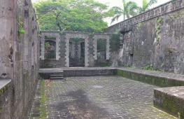
9. Drying Lake Sudochye and the remains of the abandoned fishing village of Urga. This was one of the places of exile of the Old Believers. In the 60s, the village was abandoned due to the beginning of the Aral disaster, and now all that remains of it is a small Russian cemetery, ruins of houses and a small factory. Now there are trailers of an artel of fishermen who rent part of the lake from the state.
10.
11. Our transport. This is a three-door Mercedes Gelentvagen, an army version. In 1995, he was “written off” brand new from the army of Uzbekistan and now he brings his owner $200 a day.
12. Christian cemetery.
13. Some kind of scribbled stone on one of the hills near the village.
14. Fishermen's boats.
15. And here are the fishermen themselves, who gave us green tea and treated us to stew.
16.
17.
18.
19.
20. In the 40s of the 20th century, the USSR began implementing an ambitious project to withdraw water for irrigated agriculture from the Amu Darya and Syr Darya rivers. Very quickly, the economy of the Central Asian republics soared to unprecedented heights. But after 20 years, success turned into ecological disaster. Today the amount of water in the Aral Sea is approximately 1/4 of its original volume.
21. According to Pyotr Zavyalov, now the Western Aral Sea is like a powerful chemical reactor. Under conditions of abnormally high salinity - in some parts of the sea it reaches 200 g/l (for comparison, the salinity Dead Sea about 300 g/l), calcium and magnesium carbonates, gypsum and mirabilite fall to the bottom. Another one serious problem- hydrogen sulfide contamination. The hydrogen sulfide zone occupies almost half of the entire Western Aral Sea. Gas fills almost the entire lower layer of water and lies only 10-20 meters from the surface. The concentration of this poisonous gas in the Aral Sea is 10 times greater than in the Black Sea.
22. When the sea retreated, the shores began to dry out and collapse, turning into bizarre canyons.
23. This is a small house that stands alone on the cliff of a plateau; anyone can stay there for the night. Inside there is everything you need: dishes, stove, blankets, Koran, carpets, firewood, tools.
24. This house saved the lives of many people.
25.
26. Salt crystals.
27.
28.
29.
30. After 450 km we reached our overnight stop - the shores of the Aral Sea.
Enlarge image
31.
32. Previously, there were Soviet-era barracks here. In the 80s, a coastal supply base for Vozrozhdeniya Island was located at this location. On this island Soviet Union tested bacteriological weapons: the causative agents of anthrax, tularemia, brucellosis, plague, typhoid, smallpox, as well as botulinum toxin were tested here on horses, monkeys, sheep, donkeys and other laboratory animals.
33. Local residents talk about the sudden departure of the military from Vozrozhdeniya Island. In the mid-80s, something happened there, and one day all the personnel left the base. The sudden outcome was indicated by what was thrown a large number of machinery, equipment and food. And on runway(there was an airfield there with four 3-kilometer stripes in the shape of a compass rose) there were a large number of disposable syringes and gas masks lying around. As a consequence, the supply base was also abandoned.
34. The colorful shore of the Aral Sea is beautiful in its own way...
35. We were told that several years ago a famous Moscow photographer
The Ustyurt Plateau is a huge territory with an area of about 200,000 square kilometers; until the 80s of the last century it was a kind of archaeological reserve, a complete “blank spot” on the map of history. But in 1986, scientists from the Academy of Sciences of Uzbekistan decided to examine medieval architectural monuments from the air, and discovered something completely mysterious. The territory between the villages of Say-Utes and Beineu was dotted with strange patterns, visible only from the air, which were very reminiscent of similar patterns in the Nazca desert.
The arrows, as scientists called them, stretched in an almost continuous chain from Cape Duan in the Aral Sea deep into the Ustyurt plateau. They differ little from each other in outline and size, and are turned to the north. Each one looks like a bag with the top part pulled inward with a wide passage to which a guide shaft leads. The upper edges of the bag form two arrows with tips in the shape of an elongated triangle, into which a narrow passage leads from the body of the arrow. At the tops of the triangle there are rings with a diameter of 10 m, which were probably once pits. The length of each boom is 800 - 900 meters, and together with the guide shaft it reaches 1500 meters, the width is 400 - 600 meters, the height of the fence reaches 80 cm, but in the past it was much higher.
This entire system of arrow drawings on the Ustyurt plateau can be traced over an area of 100 km, but scientists believe that it is much larger and exceeds in its extent the system of mysterious drawings in the Nazca desert.
All arrows are slightly different from each other - some have straight arrowheads, others have concave arrowheads. In some drawings, the lines of some arrows overlap with the outlines of others. This, according to scientists, is explained by the fact that new ones were erected in place of old structures.
On the ground, the arrow can be identified by a barely noticeable stone ridge, in which traces of the fastening mortar are visible. An earthen ditch was dug from the inside of the bag, the earth from which formed a shaft on which the stone ridge was installed. Along the entire ditch, green grass grows lushly, which is clearly visible against the background of withered grass on the plateau. This green grass makes it easy to identify the outline of the arrow.
What were these arrows created for? There are not so many hypotheses - only two. The Ustyurt plateau is a rocky hill. There are no trees, open reservoirs or rivers on the plateau, but you can get slightly brackish water from deep (up to 60m) wells. In summer there is no rain, and the total amount of precipitation together with snow is up to 150 mm per year. The grasses dry out, and the steppe becomes yellow-gray, and lush green grass grows along the arrows, which means that even now more moisture accumulates there. This led scientists to believe that the arrows were ancient water supply structures.

Moats with ramparts on the outer side retained the flow of water from the entire internal territory and directed it into the arrow-shaped triangles of reservoirs located below. Ring-shaped depressions in the corners of the triangles (formerly deep pits) served as reservoirs for water.
Archaeologist Vadim Nikolaevich Yagodin (Academy of Sciences of Uzbekistan), based on the found fragments of ceramics belonging to the 7th-8th centuries and located in a later cultural layer, assigns this date to the upper limit of the period of construction of the arrows, and how far back the centuries the lower limit goes is unknown.
But another archaeologist, Lev Leonidovich Galkin, head of the Volga-Ural expedition, believes that the arrows are ancient cattle pens. Some corral arrows are lined with flat stones driven into the ground with their narrow ends and the flat plates protruding upward; these are probably the latest corral structures. The nomads called the corrals “arans”. According to Galkin, nomadic tribes began to create arans back in the 14th – 12th centuries BC, that is, in the Bronze Age. The date was established by a stone arrowhead found among the stones of the embankment; there is no other evidence yet.

In the same area there is an area called Kalamkas. It is named after the girl who, according to the legend existing in this area, died during the mouflon drive, falling into a pit along with the animals. The tradition of building arans, according to local residents, lasted until the 19th century, when huge herds of saigas, mouflons (mountain sheep), kulans and wild horses – tarpans – roamed the Ustyurt plateau.
The Ustyurt Plateau is located between the Mangyshlak Peninsula and the Kara-Bogaz-Gol Bay, the Aral Sea and the Kara-Kum and Kyzyl-Kum deserts. Currently, the plateau rises 180-300 meters above the plain. The edges of the plateau are called cliffs, and you can climb up them only in certain places. The main landscape of the plateau is desert with almost no vegetation or water. The groundwater found in these deposits is salty and undrinkable except in a few known wells. There are harsh winters (up to -40 degrees) and scorching heat that dries out all living things in the summer. And wind. Constantly blowing in different directions sweltering wind.

Once upon a time there was a sea in this place Tethys. On the plateau you can see accumulations of shells, and some layers of the plateau are solid shell rock. Reminds me of the sea and stone balls– iron-manganese nodules that once formed on the bottom of the sea and are found at the lower level of the relief. When the surrounding rocks eroded, they appeared on the surface of the plateau. The limestone-chalk slopes of the plateau are a truly mesmerizing sight, as fantasy world another reality.
And ancient people once lived in these places, a culture unknown to us arose, although then, perhaps, the climate was somewhat different. What can be said about the ancient builders of these arrows? Found in the area of arrows huge complex mysterious unique places of worship and huge burial grounds ancient nomads, undoubtedly somehow connected with the arrow builders. As a result, a previously unknown ancient nomadic culture of Ustyurt was discovered. Who are these people?

In Central Asia, on the territory of Kazakhstan and Uzbekistan, between the Mangyshlak peninsula in the west, the remnants of the Aral Sea and the Amu Darya delta in the east, lies the giant Ustyurt table plateau.


Currently, the plateau rises 180-300 meters above the plain. In some places it breaks off to the surrounding plain with steep, steep, inaccessible ledges - ledges, up to 350 m high. In the southwest, the Ustyurt Plateau consists of separate ridges, reminiscent of small mountain ranges. This part of the plateau is called Bozzhira, it is the highest and most beautiful.


The place amazes with its unearthly landscapes. But, not inferior in beauty to Monument Valley in the USA, Bozzhira is undeservedly deprived of the attention of mass tourists.


The main landscape of the plateau is a desert with almost no vegetation or water, although the following giant plants are also found:

The groundwater found in these deposits is salty and undrinkable. There are harsh winters (up to -40 degrees) and scorching heat that dries out all living things in the summer.


From the point of view of geology and history of origin, the Ustyurt plateau is the bottom of the ancient Tethys Ocean, which, gradually shrinking, existed in this place for more than fifty million years. Less than two million years ago, the connection between the Black and Caspian seas was finally interrupted, and the process of drying out of the huge inland sea, which included the modern Caspian and Aral Seas and the adjacent lowlands.


Due to its climatic conditions, complete lack of water and remoteness from modern routes, Ustyurt has even now been studied much less well than the famous Karakum Desert. But the main mystery of Ustyurt is not in geology or geography. She's in his story. Its huge territory of about 200,000 square kilometers, until the 80s of the last century, was a kind of archaeological reserve, a complete “blank spot”.
Geoglyphs-arrows on the Ustyurt plateau
Filming was carried out in the 80s topographic map plateau. This was done using modern methods - using photogrammetry materials, for which aerial photography of the entire plateau was ordered. And so, while studying one of the regions of Ustyurt, cartographers discovered some strange lines in the photographs, apparently of artificial origin. The lines formed into arrow-shaped signs of enormous length (800-900 m), directed with their “points” to the north. The tips of these “arrows” have round holes in the corners of the lines, and the arrow itself is formed by stone shafts dilapidated over time. The height of the shafts is now a little less than a meter, but judging by the debris around, it used to be much greater. Most of all, the scheme of “arrow-shaped layouts of Ustyurt” resembles a gigantic military card, on which the direction of the troops' strikes is indicated with bold arrows.

The cyclopean system of “arrows” was traced over more than 100 km. In its scale, it surpasses the much more famous system of lines and patterns in the Peruvian Nazca desert - the only archaeological phenomenon comparable in scale. Just like in Nazca, the “arrows” cannot be seen from a human height. There are no significant elevations on the table-flat surface of the plateau.

What were these arrows created for? There are not so many hypotheses - only two. The Ustyurt plateau is a rocky hill. There are no trees, open reservoirs or rivers on the plateau. In summer there is no rain, and the total amount of precipitation together with snow is up to 150 mm per year. The grasses dry out, and the steppe becomes yellow-gray, and lush green grass grows along the arrows, which means that even now more moisture accumulates there. This led scientists to believe that the arrows were ancient water supply structures.

This is what an arrow looks like on the ground
Moats with ramparts on the outer side retained the flow of water from the entire internal territory and directed it into the arrow-shaped triangles of reservoirs located below. Ring-shaped depressions in the corners of the triangles (formerly deep pits) served as reservoirs for water.
But another archaeologist, Lev Leonidovich Galkin, head of the Volga-Ural expedition, believes that the arrows are ancient cattle pens. But scientists have not come to a consensus about the purpose of the Ustyurt arrows.
In the area of the arrows (even before they were discovered), a whole complex was found archaeological sites– mounds, burials, religious buildings. The latest ones date back to the 10th-15th centuries, but the majority are undoubtedly much older.


Ancient necropolis In a cave

Ancient runic writings on the rocks


To date, more than a thousand architectural monuments have been discovered on the Mangyshlak Peninsula and the Ustyurt Plateau: underground and above-ground temples, huge in size cities of the dead- necropolises. In different parts of the peninsula, underground rooms carved directly into solid rocks have been discovered.

Stone giants of the Ustyurt plateau
A sensation in 1983 - in the west of the Ustyurt plateau, in the area of the Beite wells, ancient stone sculptures of an unknown civilization were discovered. This complex of sculptures turned out to be completely unique - nothing like this had ever been seen in the steppes of Eurasia.
Over the centuries, traces of many civilizations have been preserved on the Ustyurt plateau; the Great Silk Road, the ancient caravan route - the Khorezm-Shahs road, which connected ancient city Khiva with the lower reaches of the Volga, it was affected by the great migration of peoples. Many ancient cemeteries with mausoleums, minarets and underground temples are scattered across the plateau, 60 sites of primitive man of the Neolithic period have been discovered, ruins have been preserved ancient cities Shahir-i-Wazir and Alan fortresses and the remains of even more ancient settlements of unknown civilizations. But the civilization discovered in 1983 had nothing to do with all this.

In 1983, on the Ustyurt plateau, geologists V. Gusev and E. Farakhov, approximately 50 km from the village of Say-Utes in the area of the Beite wells, discovered about 70 statues of male warriors in a small area. The very next year, the Volga-Ural archaeological expedition of the Institute of Archeology of the USSR Academy of Sciences went there.
Here is what the head of the expedition, Lev Leonidovich Galkin, wrote about the discovery on the Ustyurt plateau: “Near two high mounds in a relatively small area lay many broken stone sculptures. Some of the debris was so massive that it was impossible for one person to move it. The statues were different - some reached almost four meters in height, others - a little more than two meters, and the smallest - about a meter. There were stone heads, broad-shouldered male torsos with narrow waists, and half-processed limestone slabs scattered here. Large and medium-sized sculptures predominated. Despite the fact that they were once thrown to the ground and broken, it was obvious that the statues stood in a certain order - in the form of the letter “P”. This gallery must have been an impressive sight in the rays of the sun. There, towards the sunset, towards the “land of the dead” their faces were turned..."

Head of a warrior from the sanctuary. Photo by L. Galkin and A. Glazunov, “Around the World” magazine, 1990.
At a distance of up to 1 km from Beite-1, the Beite-2 complex is located, but not a single sculpture was found there, but not far from it a quarry was discovered in which white-pink limestone was mined, which served as material for making sculptures.
To the southeast of Beite 2, approximately 4 km away, is a group of mounds of the Beite 3 complex. Its layout resembles that of the Beite-1 complex, but to the west of the central mound, 50 broken statues lay compactly in the shape of the letter “P”, but the mouth of the square was facing northwest. Two stone sacrificial tables were found at the Bayte-3 complex, indicating that these complexes were a sanctuary.

Part of a figure from the sanctuary. Photo by L. Galkin and A. Glazunov, “Around the World” magazine, 1990.
The sanctuaries included from one to five mounds; the main element of the sanctuaries was a round structure made of large stone blocks, which looked like a ring-shaped wall, into which a narrow passage led. In addition to the altars, many memorial structures made of stone were discovered.

Stella with runes on the Ustyurt plateau.
All the statues at the sanctuaries were knocked over and damaged, which was explained by the fear and hatred of the later population of the plateau for the idols of an unknown civilization, but archaeologists still managed to determine their original position - they were located in groups of 2–4 idols approximately two meters from each other, forming stone army up to 4 meters high.

Warrior torso from the Sanctuary of Bailey. Photo by L. Galkin and A. Glazunov, “Around the World” magazine, 1990.
On some of the broken statues, relief images of swords, bows and daggers were clearly visible. Based on the weapons and decorations depicted on the sculptures, scientists believed that these structures belonged to the Massagetae, who lived in the 4th - 3rd centuries BC. e. Archaeologists still don’t really know anything about the Massagetae. It is believed that they were one of the peoples of the Indo-European group.
Herodotus wrote about the nomadic tribes of the Massagetae; his works are the main source of information about them. They were a warlike and powerful people. The Massagetae worshiped the Sun and sacrificed horses to him, dressed like Scythians and led a similar lifestyle. They believed in an afterlife, faith forced them to build sanctuaries of their ancestors and protect them. Perhaps they deified their ancestors and sought their protection, and here the Massagetae have much in common with the Scythians.
Where exactly the lands of the Massagetae were located is now unknown, but they definitely bordered on the countries of Central Asia, which were part of the huge Achaemenid empire. In the 4th century BC. e. The Massaget tribes stopped the eastward advance of the army of the Persian king Cyrus of the Achaemenid dynasty.
When in the 4th century BC. e. Alexander the Great came to the lands of Central Asia, and the warlike tribes of the Massagetae again stood among the most implacable enemies of the new invaders. It is believed that part of the Massagetian and Sarmatian tribes, who did not submit to the invaders, went north, and the other part of the tribes became part of and dissolved in the population of Central Asia.
Where did the stone army go now? The best way Preserving finds means re-burying them. But will they ever be remembered later...

The first issue of the Kazakh-language version of the popular science magazine National Geographic, recently presented in Aktau, is dedicated to the nature of the Mangistau region. In particular, the Ustyurt plateau is one of the most beautiful and most mysterious places region.
"Ustyurt, table plateau, between the Mangyshlak peninsula in the west, the Aral Sea and the Amu Darya delta in the east. Height up to 370 meters. Bounded by steep cliffs - cliffs (150 meters or more in height). Wormwood-salt desert. Oil and gas field" (Soviet encyclopedic dictionary, 1988).
Photo by Andrey Astafiev
Gas stations for UFOs
Death Mounds
The military was blown away like the wind. Just a couple of hours ago, here, in the field camp near the Kentykty well, a strictly controlled and active life was in full swing, but incomprehensible to the local environment. Heavy trucks, tightly covered with tarpaulins, drove up and drove off. People in protective uniforms were fussing about, machine guns were knocking from helicopters, chasing a frightened saiga to death in low-level flight. The fires of the camp kitchen were smoking. At the mouth of a well drilled by a field self-propelled unit, some strange instruments were crackling.
Suddenly the ground shook, it swelled like a giant abscess and burst. A tall geyser splashed out into the sky, faded from the merciless sun. The instruments howled and chattered like rattles gone crazy.
A few minutes of ominous silence - and the flight began. The military jumped into trucks, climbed onto helicopters, and all this equipment immediately disappeared over the horizon.
And then people came from nearby transhumance pastures and began to take away everything that the fleeing military had abandoned in haste and panic. Tents, field kitchens and electrical installations, food from a military warehouse, cups, spoons and plates with half-eaten stew from plank tables, these tables themselves. And also incomprehensible instruments that switched from an outrageous screech to a frequent, but already quite acceptable for the shepherd’s ear, accustomed to the silence of the desert.
Those who were more curious climbed onto the 30-meter-high mound that had swollen in place of the well, looked into the crater, shook their heads and muttered something about Satan turning the stone core of the earth inside out.
Few of these people are still alive today. Some died of age, some were carried away even earlier by a strange disease, previously unknown in these places, which in a few years turned strong and flourishing men into walking skeletons.
Only later, during the intensification of the Semipalatinsk-Nevada movement, it was established that in Ustyurt, in the area of the Buzachi Peninsula, where the largest oil and condensate fields in Kazakhstan - Kalamkas and Karazhanbas - are currently being developed, the military carried out three underground nuclear explosions. For strategic purposes. It was assumed that in the gigantic voids formed after such explosions and limited by limestones fused from atomic heat into mirror-smooth volcanic glass, fuel reserves and drinking water in case of global war.
Two explosions went off more or less safely, but during the third there was a release. So the soldiers fled. Tea, these are not “cult-personal” times to die from radiation sickness for the Motherland, for Stalin.
One of these three mounds with a dome that has collapsed right down to the damn nuclear kitchen is still “siphoning” at several thousand microroentgens per hour.
God has cursed this land
In general, the military has been playing around here since time immemorial. And it’s hard to say what other memory they left about themselves at the ravines and in the tracts of Ustyurt. A local archaeologist, an employee of the regional historical and local history museum, Andrei Astafiev, has more than once found missile fragments and the remains of military aircraft on the plateau. He also descended into one of the craters left behind by the creators of underground strategic storage facilities. The one, of course, that now rings within relatively safe limits.
The economic development of these wild and desert places is still hampered by harsh climatic conditions, lack of water and their remoteness from the centers of civilization. If you try to cross the plateau by car, you need to do it in a very reliable vehicle, with a good supply of fuel, food, and most importantly, water. The length of this flat hill is 500-600 kilometers, and you can drive right through it without encountering a single car or a single living human soul. So if your car breaks down, this fact can grow into a very serious problem.
Once upon a time, back when Aktau was in secret status mailbox, this city (then Shevchenko) was practically cut off from Mainland. The only way to get out of here was by sea or by air. Or along a single-track railroad, the brainchild of a Komsomol shock construction project (in these places there is even a village called Komsomolsk-on-Ustyurt, on the territory of Kalmykia), but in such a roundabout way and with so many stops waiting for an oncoming stagecoach that walking will be faster. In those days, the profession of “caravan bashi”, a person who drove convoys of cars on Mainland, and this path passed along the very edge of Ustyurt. But somehow a certain brave man decided to go this route with his wife and little son in his “Zaporozhets” and lost his way. They were searched for by helicopters for several days. In the end, they found only the abandoned Zapor, and not even a bone was found from its crew.
In summer, the thermometer here goes over 50 degrees in the shade. In winter it gets cold up to minus 50 and above. Yes, all this in a fierce, drying wind in the heat, icy wind in the cold. During the year, 100-120 millimeters of precipitation falls on this god-damned land. Moreover, evaporation is 10-15 times higher than this volume.

Photo by Taimas Nurtaev
Fata Morgana you can touch
And yet there are people who rush to these lands as if to the promised land. Although such eccentrics are few and far between. Geologists and archaeologists, naturalists and game managers, artists and photography masters. And also amateur ufologists. Here you can see, meet, touch something that is not found anywhere else in the world.
The richest deposits of fossils containing almost the entire periodic table. The oldest in the territory of Kazakhstan and the CIS, and if you look hard enough, then perhaps in the whole world, are the sites of primitive man, the settlements that have remained almost intact, the burial mounds of Sarmatian and Scythian burials, untouched by human hands to this day. The remains of caravanserais of one of the branches of the Great Silk Road, through which gigantic caravans once walked, composed not even of hundreds, but of thousands of camels. Wells, up to 50 meters deep, manually dug by the Kuduksha ancestors in limestone, several at a time in one cluster. The famous Soviet-era hit, Uch-kuduk, comes from these places. There was a time when people willingly settled in these then very fertile lands in an ecological sense.

Photo by Andrey Astafiev
And despite the apparent scarcity of local flora and fauna, you will find in Ustyurt dozens of endemic species and relics of the most ancient representatives of the flora and fauna, listed in the Red Book. Here there is a shrub called "soft-fruited", which hundreds of thousands of years ago quenched with its berries the thirst of a relic like it - the Saiga antelope and some Neanderthal dressed in the skin of a cheetah. The beast, alas, is still within the memory of the current generation, having disappeared from Ustyurt forever about thirty years ago.
Here you can see the silhouette of a steep-horned mouflon clearly cut out against the blue sky, trampling with its hoof the spurs of the Ustyurt cliffs. Here, a saker falcon strikes from above, like lightning, a gaping corsac or jerboa. Or even skinny, like an Egyptian mummy, to a wolf.

Photo by Andrey Astafiev
And just recently, some few million years ago, evil sharks were rampant here. Whose teeth, jaws and even entire skeletons are still found embedded in the limestone cliffs of the plateau. Well, yes, the Tethys Ocean during the ancient Triassic stretched its waters over a gigantic territory before breaking into the Mediterranean, Caspian, Black and Aral seas.

Well, artists and photographers are drawn here by the fabulous Fata Morgana. Which you can not only sketch, but also photograph. And even touch it with your hands.
When, tired of the monotonous and empty plain, the gaze suddenly stumbles upon quaint castles, palaces or giant, clearly unearthly animals, the first thought is: this is a mirage. But you come closer and see: no, he does not disappear, but becomes more and more clear and visible.
Lord, what kind of miracles has the sorceress nature created on these meager lands. Wind, sun, and frosts carved such bizarre structures and sculptures from soft limestones that, even touching them, you cannot believe that human hands and his genius were involved here.
Game warden Viktor Konyashkin from the village of Sai-Utyos at one time aptly dubbed this entire stone architectural and biological exhibition, built by nature, “the devil’s workshop.”
Apart from aliens, no miracles
But some people think that aliens are also frolicking here. In 1979, ufologist Galdynbeg Satikov saw a UFO over the dead clay debris of Soksor. This observation of his is recorded in the relevant annals of world ufology.
How many such observations have not been recorded by anyone?
In particular, the head of the department of the local museum of ethnography and local history, Lidia Bychkova, saw, in her words, something like a flying saucer twenty years ago during tourist trip, where I went to Ustyurt with my eighth-grader son and his school friends.

Photo by Taimas Nurtaev
The best alien landing site in the world
We were sitting by the fire,” she recalls, “and suddenly we saw how three bright lights, arranged in a triangle, separated from the ledge of the canyon located opposite us. They hung in the air for several minutes and with incredible speed, but completely silently, flew away towards the center of the plateau.
And the already mentioned game warden Konyashkin, chuckling, says that he saw these flying, as he put it, “pans” 20 times over Ustyurt, but only in Soviet times. And he suggests that it was perhaps some new military equipment, tested in these deserted places by the USSR Ministry of Defense. Although the pathfinder does not exclude the alien origin of these objects.

Photo by Alexander Tonkopryadchenko
True, the archaeologist Andrei Astafiev mentioned above did not see anything like this in Ustyurt. Although, according to him, it is difficult to find a place more suitable for landing aliens on the whole Earth. But he, and in a big good company, once saw something like a UFO over the city New Uzen(now Zhanaozen). Moreover, this object at the same time was visible from Shevchenko (now Aktau), although the distance between these cities is about 180 kilometers. Then the author of these lines saw this incomprehensible thing. And in Ustyurt, specifically on the Buzachi Peninsula above the Kalamkas deposit, I once had the opportunity during a salt storm to observe dozens of very rarely, they say, naturally occurring ball lightning, jumping like crazy among industrial structures and high-voltage wires.
By the way, about ball lightning. One local researcher, candidate of geological and mineralogical sciences Gennady Tarasenko, has developed an entire theory proving that huge accumulations of giant nodules (spherical volcanic formations) scattered throughout Ustyurt are nothing more than gas stations for UFOs. In his opinion, nodules are repositories of ball lightning, created by the scientific thought of aliens in prehistoric times. And alien ships are constantly refueled with free energy from these same balls.
If you want to live, don't shoot saigas
Someday Ustyurt and Mangyshlak in general will probably become a place of pilgrimage for tourists from all over the world. In the meantime, only a few daredevils come here. Moreover, such trips do not always end well. A tragic accident occurred, in particular, in Ustyurt about 20 years ago with the then Ambassador of Germany to the Republic of Kazakhstan Andreas Körting, who, by the way, was accompanied on the trip by the above-mentioned archaeologist Andrei Astafiev. Andreas and his wife, amateur ornithologists, went to the plateau to look at rare birds. At the end of the day we stopped and prepared a barbecue. And... while eating, the ambassador choked on a piece of meat. Andrei Astafiev and the jeep driver Igor Kazakov did everything to pump out the German who instantly fell into clinical death, and in the end they were able to start his heart and breathing. They took him to the nearest hospital, to Novy Uzen. From there, on the same day, he was taken to the best German clinic by a German helicopter. But even ten years later, doctors were still unable to bring Körting out of his state of deep coma. As a result, he was disconnected from the ventilator.

Photo by Andrey Astafiev
Rumor claims that a German guest allowed himself to shoot a saiga not far from the underground mosque of a local saint, the builder of this and a dozen other similar temple structures, Beket-ata, which is cut into one of the cliffs of the plateau. So he was punished for this. However, the guide and driver refute this version of the event: the saigas’ guest did not shoot.
One way or another, this accident added another dark touch to mysterious story Ustyurt.
The Ustyurt plateau is located on the territory of the republics of Kazakhstan and Uzbekistan. To this day, this place remains one of the most unexplored on the planet.
The area of Ustyurt is more than 200 thousand km, and the height of the plateau is 180-300 meters. The ground here is dotted with breaks and cracks everywhere, and the cliffs (chinks) bordering the plateau, up to 300 meters high, evoke awe and are reminiscent of pictures of deserted planets from science fiction films. You can climb the plateau only in a few places. The territory is a continuous desert without ponds or permanent rivers. The climate of Ustyurt is extremely harsh and inhospitable: in winter the air temperature drops to - 40 degrees, and in summer sometimes reaches + 60. Local residents say about Ustyurt: “this desert is so empty that you won’t even find an enemy here,” and one expedition of scientists in the sixties 20th century got lost on the plateau and could not be found for 10 days.

In ancient times, the plateau was not deprived of people's attention. Scientists have discovered 60 sites of ancient people of the Neolithic era here, as well as traces of the presence of Scythian and Mongolian tribes. The ancients passed through the plateau trade routes connecting Asia with Europe, including one of the most important branches of the Great Silk Road. They have been preserved here to this day architectural monuments of the ancient period, such as the ancient dilapidated arch of the Beliuli caravanserai, the ruins of the once disappearing into the sands impregnable fortress Alan-Kala, a huge number of burial grounds and cemeteries of an older period with mausoleums, minarets and underground temples.

The main mystery of the plateau is the so-called “arrows of Ustyurt”. These are ancient structures that archaeologists have never encountered anywhere before. They are displays of crushed stone up to 80 cm high. The base resembles a bag from which two arrows with pronounced tips emerge. Each arrow is 800-900 m long and 400-600 m wide, and they are all directed to the northeast. Their exact purpose is still unclear, because due to their gigantic size, the arrows cannot be seen from the ground by a person on foot or a rider on a horse or camel. These arrows were discovered only in 1986 during aerial photography.

According to one version, these structures were intended to collect water in these arid regions, according to another, to corral livestock, but there are also more interesting versions.
Thus, archaeologists have established that the arrows were erected much earlier than the emergence of the first human settlements in this area, and the settlements were located south of the mysterious complex. During archaeological excavations, fish skeletons were discovered in this area, which gives reason to believe that there was once a sea here, the waters of which went to the northeast, where the arrows point. Perhaps the arrows indicate the direction of outgoing water. But for whom are these giant signs that cannot be seen from the surface of the earth?

Not far from the arrows, scientists discovered stone figures of animals similar to giant turtles, which were also directed to the northeast, as well as many small pyramids made of rough stone, reminiscent Egyptian pyramids. Moving further in the indicated direction, an absolutely straight road of the same stone was found, laid out in the vast expanses of the desert.

There is a bold opinion that this entire stone complex, built by unknown builders from ancient times, is nothing more than a cosmodrome. Science cannot prove whether this is true or not, but even today inexplicable phenomena often occur on the Ustyurt plateau, such as bright glows in the sky, mirages appearing in the daytime and at night, which have been repeatedly observed local residents and lovers of everything mysterious and inexplicable who strive here.